SUMMARY
This is AI generated summarization, which may have errors. For context, always refer to the full article.
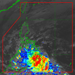
MANILA, Philippines – With Typhoon Betty (Mawar) still moving slowly over the waters east of Batanes, its enhancement of the southwest monsoon or habagat also continues.
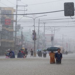
On Tuesday evening, May 30, rainfall warnings were raised for parts of Western Visayas and Mimaropa as the enhanced southwest monsoon dumped rain.
In Western Visayas, the provinces of Aklan, Antique, and Guimaras as well as the southern part of Iloilo were seeing heavy rain, while in Mimaropa, the province of Occidental Mindoro and some areas in Palawan were affected.
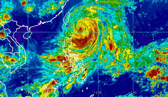
Betty was located 320 kilometers east northeast of Basco, Batanes, or 330 kilometers east of Itbayat, Batanes, as of 10 pm on Tuesday. It continues to slowly move north.
The 11 pm bulletin of the Philippine Atmospheric, Geophysical, and Astronomical Services Administration (PAGASA) also shows the typhoon weakened, with its maximum sustained winds decreasing from 150 kilometers per hour to 130 km/h. Its gustiness went down from 185 km/h to 160 km/h.
While Betty did not make landfall in the Philippines, it has been affecting Northern Luzon due to its size. The typhoon will still cause rain in the following areas within 24 hours:
Tuesday evening, May 30, to Wednesday evening, May 31
- 50-100 millimeters (mm): Ilocos Norte, Ilocos Sur, La Union, Abra, western part of Benguet
The enhanced southwest monsoon may also trigger more rain in the next two days.
Tuesday evening, May 30, to Wednesday evening, May 31
- 50-100 mm: Occidental Mindoro, Antique, northeastern part of Aklan
Wednesday evening, May 31, to Thursday evening, June 1
- 50-100 mm: Occidental Mindoro, Antique, Aklan, Cuyo Islands, Calamian Islands, northern part of mainland Palawan

Meanwhile, PAGASA maintained the list of areas under tropical cyclone wind signals as of 11 pm on Tuesday.
Signal No. 2
Gale-force winds (62 to 88 km/h), minor to moderate threat to life and property
- Batanes
Signal No. 1
Strong winds (39 to 61 km/h), minimal to minor threat to life and property
- Cagayan including Babuyan Islands
- northern and eastern parts of Isabela (Santo Tomas, Santa Maria, Quezon, San Mariano, Dinapigue, Delfin Albano, San Pablo, Ilagan City, Benito Soliven, Tumauini, Cabagan, Palanan, Quirino, Divilacan, Gamu, Maconacon, Naguilian, Mallig)
- eastern part of Ilocos Norte (Piddig, Bangui, Vintar, Marcos, Pagudpud, Banna, Adams, Carasi, Dingras, Solsona, Dumalneg, Nueva Era)
- Apayao
- northern part of Kalinga (Tabuk City, Balbalan, Pinukpuk, Rizal)
- northeastern part of Abra (Tineg, Lacub, Malibcong)
The weather bureau added that the enhanced southwest monsoon will bring occasional to frequent gusts to Western Visayas, Bicol, Aurora, Quezon, the northern part of mainland Palawan including Calamian and Cuyo islands, Occidental Mindoro, Oriental Mindoro, and Romblon, as well as the remaining areas of the Ilocos Region and the Cordillera Administrative Region that are not under wind signals.
The gale warning issued at 5 pm on Tuesday remains in place, covering the following seaboards:
- seaboards of Northern Luzon and eastern seaboard of Central Luzon – rough to high seas, with waves 3.1 to 6.5 meters high
- seaboards of Southern Luzon and eastern seaboard of Visayas – rough to very rough seas, with waves 2.8 to 4.5 meters high
PAGASA warned that rough to high seas are risky for all vessels. In areas with rough to very rough seas, small vessels should not sail while larger vessels must be on alert for big waves.
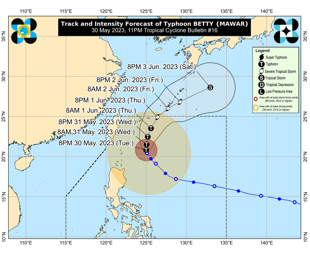
Betty is projected to keep moving north slowly until Wednesday, May 31, then speed up as it turns north northeast on Thursday, June 1, and northeast or east northeast on Friday, June 2, and Saturday, June 3.
Betty could leave the Philippine Area of Responsibility (PAR) on Thursday evening or early Friday morning.
Outside PAR, it may pass very close to or make landfall in the vicinity of Japan’s central Ryukyu Islands, possibly in Okinawa Island, according to PAGASA.
Betty is also seen to weaken into a severe tropical storm on Thursday and into a tropical storm on Friday.
PAGASA explained that the weakening would be caused by “cooler ocean waters, dry air intrusion, and increasing vertical wind shear.” The weather bureau is also not ruling out a “faster weakening rate” due to the dry air affecting the typhoon.
PAGASA added that Betty may start transitioning into a post-tropical cyclone on Saturday or Sunday, June 4, when it would already be outside PAR.
Betty entered PAR as a super typhoon early Saturday, May 27, and before its entry, had reached a peak intensity of 215 km/h. It is the country’s second tropical cyclone for 2023 and the first super typhoon of the year. – Rappler.com
Add a comment
How does this make you feel?


There are no comments yet. Add your comment to start the conversation.