SUMMARY
This is AI generated summarization, which may have errors. For context, always refer to the full article.
Frequent downpours hit areas affected by the enhanced southwest monsoon or hanging habagat on Thursday, July 22.
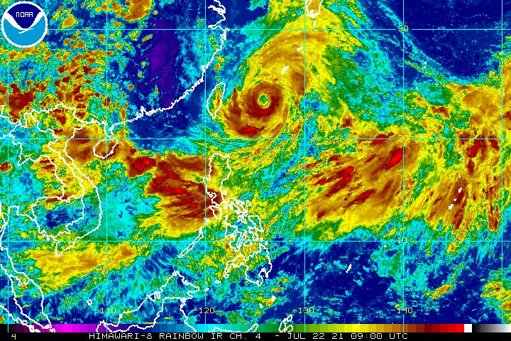
The southwest monsoon is still being enhanced by Typhoon Fabian (In-fa), which continues to move slowly over the Philippine Sea.
In a bulletin late Thursday afternoon, the Philippine Atmospheric, Geophysical, and Astronomical Services Administration (PAGASA) said Fabian was located 505 kilometers northeast of Itbayat, Batanes, heading west.
The typhoon maintained its strength, with maximum sustained winds of 150 kilometers per hour and gustiness of up to 185 km/h.
But PAGASA sees Fabian strengthening and reaching its peak intensity of 155 to 165 km/h on Thursday evening.
Batanes and Babuyan Islands remain under Signal No. 1 as of 5 pm, due to strong winds extending from Fabian’s center. (READ: Why is it now called tropical cyclone ‘wind’ – and not ‘warning’ – signals?)
Fabian will not hit land, but the southwest monsoon has been stronger all week because of the typhoon’s presence.
PAGASA warned on Thursday afternoon that monsoon rain will persist in these areas in the next 24 hours:
- Ilocos Region
- Abra
- Benguet
- Zambales
- Bataan
- Tarlac
- Pampanga
- Bulacan
- Metro Manila
- Calabarzon
- Occidental Mindoro
- Oriental Mindoro
- Marinduque
- Romblon
- northern part of Palawan including Calamian and Kalayaan Islands
Western Visayas and the rest of Luzon may have scattered rain and thunderstorms because of the southwest monsoon as well.
Affected areas must stay on alert for floods and landslides. (READ: FAST FACTS: Tropical cyclones, rainfall advisories)
Travel also remains risky for small vessels in the seaboards of Luzon and the Visayas, as Fabian and the enhanced southwest monsoon are causing rough to very rough seas.
PAGASA sees Fabian passing close to or making landfall in Japan’s Miyako, Yaeyama, and Senkaku Islands between Friday afternoon, July 23, and Saturday morning, July 24.
The typhoon could exit the Philippine Area of Responsibility (PAR) on Friday evening or Saturday morning, and move toward the East China Sea.
A second landfall is possible in the eastern part of China on Sunday morning, July 25. The typhoon could start to weaken after hitting China.
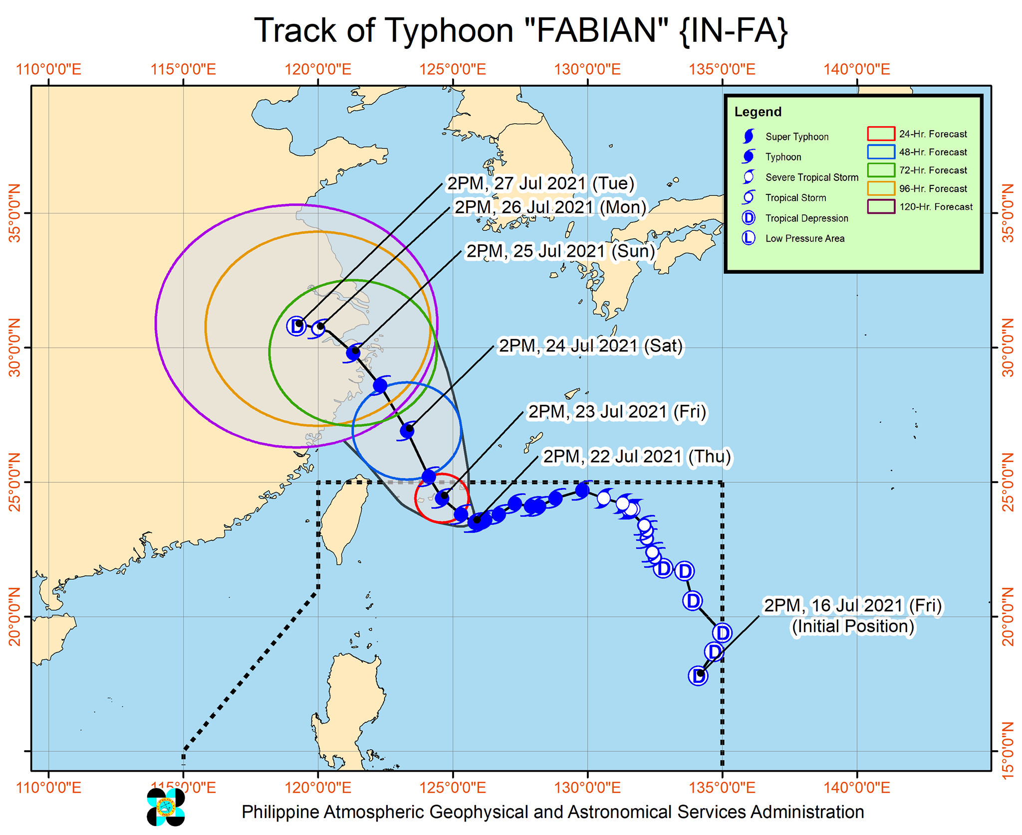
Fabian is the Philippines’ sixth tropical cyclone for 2021 and the second for July.
An average of 20 tropical cyclones form within or enter PAR each year. (READ: LIST: PAGASA’s names for tropical cyclones in 2021)
These are PAGASA’s latest available estimates per month:
2021
- July – 1 to 3
- August – 2 or 3
- September – 2 or 3
- October – 2 or 3
- November – 2 or 3
- December – 1 or 2
2022
- January – 0 or 1
The rainy season has been underway since early June. – Rappler.com
Add a comment
How does this make you feel?


There are no comments yet. Add your comment to start the conversation.