SUMMARY
This is AI generated summarization, which may have errors. For context, always refer to the full article.
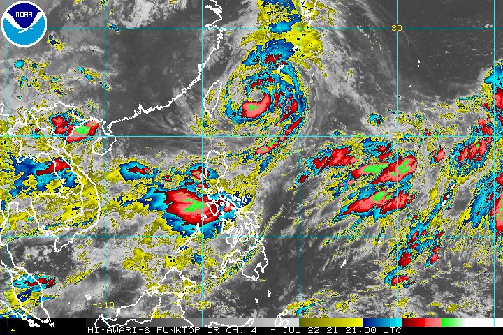
Heavy rain from the enhanced southwest monsoon or hanging habagat again poured in parts of Luzon early Friday, July 23, with more rainfall expected throughout the day.
The slow-moving Typhoon Fabian (In-fa) continues to boost the southwest monsoon.
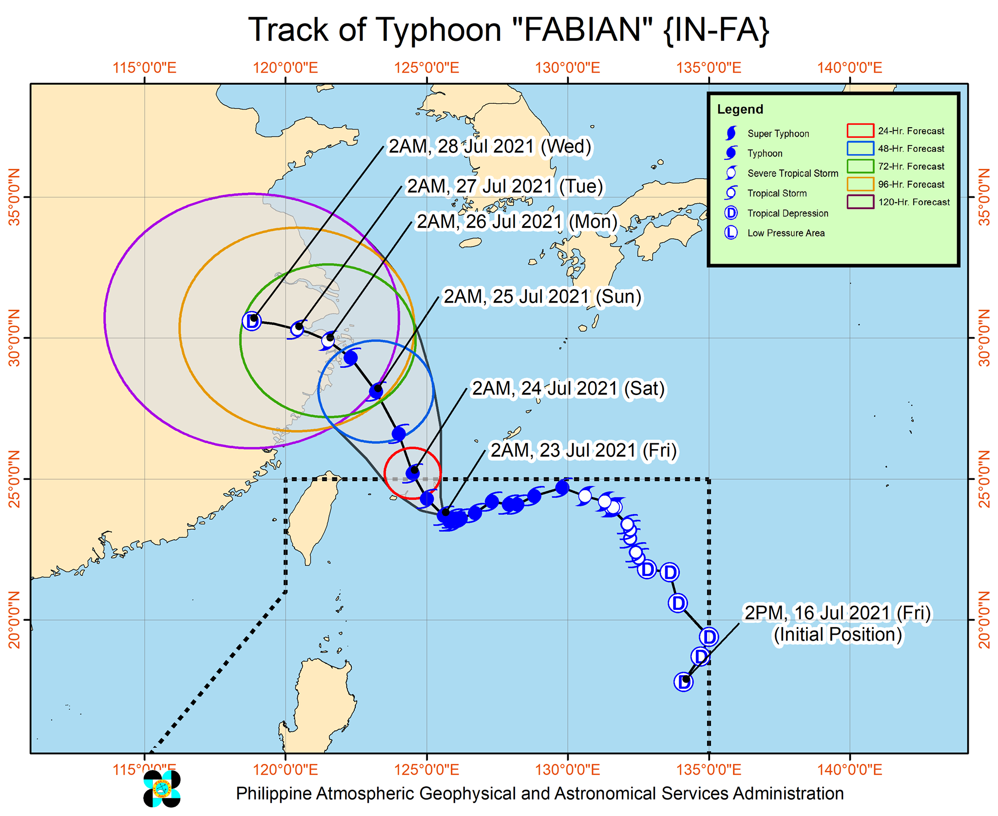
The Philippine Atmospheric, Geophysical, and Astronomical Services Administration (PAGASA) said in a briefing past 5 am on Friday that Fabian was located 510 kilometers northeast of Itbayat, Batanes, slowly moving west northwest.
The typhoon’s location was practically unchanged from six hours earlier, when it was 515 kilometers northeast of Itbayat.
With Fabian lingering, PAGASA warned that the enhanced southwest monsoon will again cause rain in much of Luzon on Friday. The affected areas include:
- Ilocos Region
- Cordillera Administrative Region
- Metro Manila
- most of Calabarzon
- most of Central Luzon
- parts of Mimaropa
Scattered rain and thunderstorms are also possible in the rest of Luzon as well as in Western Visayas. (READ: FAST FACTS: Tropical cyclones, rainfall advisories)
Before dawn on Friday, Fabian still had maximum sustained winds of 150 kilometers per hour and gustiness of up to 185 km/h.
Signal No. 1 remains raised in Batanes and Babuyan Islands, as strong winds extend up to 630 kilometers from the typhoon’s center. (READ: Why is it now called tropical cyclone ‘wind’ – and not ‘warning’ – signals?)
PAGASA also said there may be occasional gusty conditions in the Visayas and the rest of Luzon, especially in coastal and upland areas, due to the enhanced southwest monsoon.
Meanwhile, the southwest monsoon and Fabian are both affecting the Philippines’ coastal waters.
The state weather bureau warned of rough to very rough seas in the seaboards of Luzon and Western Visayas. Travel is risky for small vessels.
The remaining seaboards of the country have moderate to rough seas. PAGASA advised small vessels to take precautionary measures.
Based on PAGASA’s latest forecast, Fabian will move northwest in the next 72 hours toward the southern part of Japan’s Ryukyu Islands and the eastern part of China.
The typhoon is expected to gradually accelerate beginning Friday afternoon or evening. Also within the day, it may reach its peak intensity of 155 to 165 km/h.
On Friday evening, Fabian could pass close to or make landfall in Japan’s Miyako, Yaeyama, and Senkaku Islands.
The typhoon could finally leave the Philippine Area of Responsibility (PAR) between Friday evening and Saturday morning, July 24, then cross the East China Sea.
Fabian could start to weaken on Saturday.
Another landfall may occur in the eastern part of China on Sunday afternoon or evening, July 25.
By Tuesday afternoon, July 27, Fabian is projected to just be a tropical depression.
Fabian is the Philippines’ sixth tropical cyclone for 2021 and the second for July.
An average of 20 tropical cyclones form within or enter PAR each year. (READ: LIST: PAGASA’s names for tropical cyclones in 2021)
These are PAGASA’s latest available estimates per month:
2021
- July – 1 to 3
- August – 2 or 3
- September – 2 or 3
- October – 2 or 3
- November – 2 or 3
- December – 1 or 2
2022
- January – 0 or 1
The rainy season has been underway since early June. – Rappler.com
Add a comment
How does this make you feel?


There are no comments yet. Add your comment to start the conversation.