SUMMARY
This is AI generated summarization, which may have errors. For context, always refer to the full article.
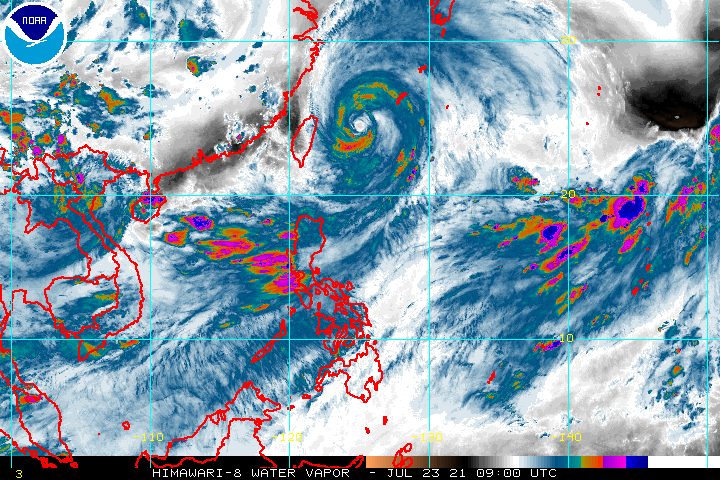
Typhoon Fabian (In-fa) crossed the Miyako Islands in the Japanese prefecture of Okinawa on Friday afternoon, July 23, still within the Philippine Area of Responsibility (PAR).
Fabian’s location was 540 kilometers northeast of Itbayat, Batanes, said the Philippine Atmospheric, Geophysical, and Astronomical Services Administration (PAGASA) in its 5 pm bulletin on Friday.
The typhoon is moving west northwest at the same slow pace of 10 kilometers per hour (km/h), poised to exit PAR on Friday evening.
It also maintained its strength, with maximum sustained winds of 150 km/h and gustiness of up to 185 km/h.
Batanes is the lone area left under Signal No. 1, as of 5 pm on Friday, following the lifting of this tropical cyclone wind signal for Babuyan Islands.
Batanes will still experience strong winds from Fabian. While the typhoon did not make landfall in the Philippines, its strong winds extend hundreds of kilometers from its center.
Fabian will also continue to pull the southwest monsoon or hanging habagat even after its exit from PAR.
Monsoon rain will persist in the next 24 hours in the following areas:
- Ilocos Region
- Abra
- Benguet
- Zambales
- Bataan
- Occidental Mindoro
- northern part of Palawan including Calamian Islands
Scattered rain and thunderstorms could also hit the rest of Luzon as well as Western Visayas. (READ: FAST FACTS: Tropical cyclones, rainfall advisories)
Meanwhile, travel in the seaboards of Luzon, Central Visayas, and Western Visayas will remain risky for small vessels in the next 24 hours, as both Fabian and the southwest monsoon trigger rough to very rough seas.
The remaining seaboards of the country have moderate to rough seas. PAGASA advised small vessels to take precautionary measures.
After Fabian’s expected exit from PAR on Friday evening, it is projected to make landfall in the eastern part of China on Sunday evening, July 25, or early Monday morning, July 26.
The typhoon may also reach its peak intensity of 155 km/h on Saturday afternoon, July 24.
It may start to weaken on Sunday morning ahead of its possible landfall in China.
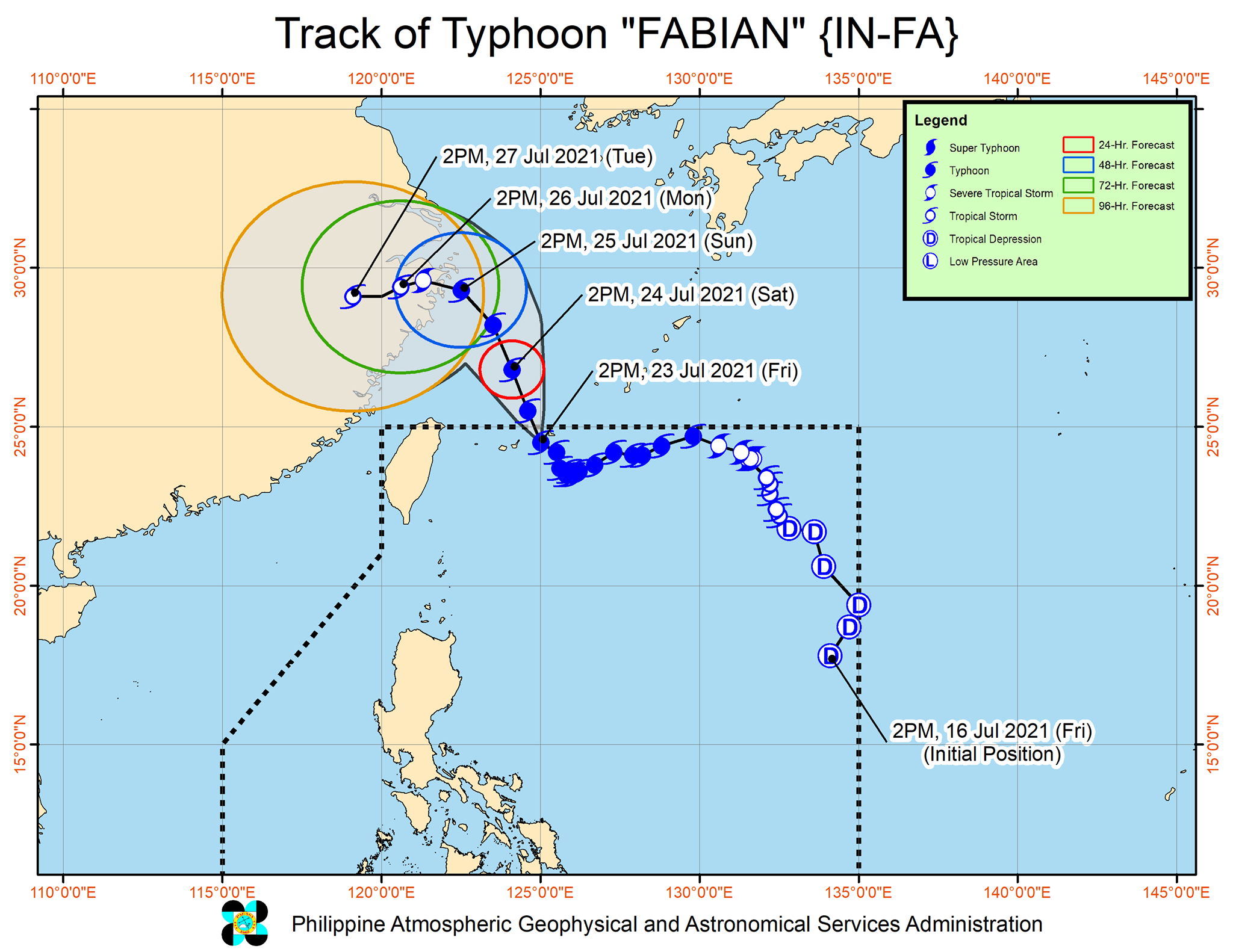
Fabian is the Philippines’ sixth tropical cyclone for 2021 and the second for July.
Aside from Fabian, PAGASA is also monitoring a tropical depression outside PAR.
As of Friday afternoon, this tropical depression was located 2,740 kilometers east of extreme Northern Luzon, moving north northeast at 20 km/h.
It continues to have maximum sustained winds of 45 km/h and gustiness of up to 55 km/h.
PAGASA said the tropical depression is heading for Japan and it is not expected to enter PAR.
An average of 20 tropical cyclones form within or enter PAR each year. (READ: LIST: PAGASA’s names for tropical cyclones in 2021)
These are PAGASA’s latest available estimates per month:
2021
- July – 1 to 3
- August – 2 or 3
- September – 2 or 3
- October – 2 or 3
- November – 2 or 3
- December – 1 or 2
2022
- January – 0 or 1
The rainy season has been underway since early June. – Rappler.com
Add a comment
How does this make you feel?


There are no comments yet. Add your comment to start the conversation.