SUMMARY
This is AI generated summarization, which may have errors. For context, always refer to the full article.
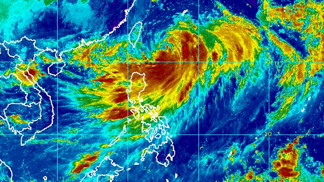
MANILA, Philippines – Signal No. 2 was raised for the province of Batanes on Friday morning, September 2, due to Typhoon Henry (Hinnamnor).
Henry was last spotted 365 kilometers east northeast of Itbayat, Batanes, slowly moving northwest after being almost stationary in the early hours of Friday.
As projected, the typhoon weakened further, with its maximum sustained winds decreasing from 175 kilometers per hour to 165 km/h. Its gustiness went down from 215 km/h to 205 km/h.
At its peak, Henry was a super typhoon with maximum sustained winds of 195 km/h.
Despite the weakening trend, however, Henry remains a strong tropical cyclone.
These are the areas under tropical cyclone wind signals as of 11 am on Friday:
Signal No. 2
Gale-force winds (62 to 88 km/h), minor to moderate threat to life and property
- Batanes
Signal No. 1
Strong winds (39 to 61 km/h), minimal to minor threat to life and property
- Babuyan Islands
- northeastern part of mainland Cagayan (Santa Ana)
The Philippine Atmospheric, Geophysical, and Astronomical Services Administration (PAGASA) also updated its rainfall forecast for Henry as of 11 am:
Friday, September 2
Moderate to heavy rain, with at times intense rain
- Ilocos Region
- Batanes
- Babuyan Islands
- Apayao
- Abra
Light to moderate rain, with at times heavy rain
- Cagayan
Saturday, September 3
Moderate to heavy rain
- Batanes
Light to moderate rain, with at times heavy rain
- Babuyan Islands
Isolated to scattered floods and landslides are possible in areas seeing rain from Henry.
PAGASA also issued a separate 11 am advisory for the southwest monsoon or hanging habagat, which is being enhanced by the typhoon.
Rain from the southwest monsoon may affect the following areas on Friday:
Moderate to heavy rain, with at times intense rain
- Kalinga
- Mountain Province
- Ifugao
- Benguet
- Zambales
Light to moderate rain, with at times heavy rain
- Isabela
- Quirino
- Nueva Vizcaya
- Bataan
- Occidental Mindoro
Scattered floods and landslides are possible in areas affected by the southwest monsoon.
Also at 11 am, PAGASA issued an updated gale warning, covering the following seaboards:
- northern and eastern seaboards of Northern Luzon (Batanes, Cagayan including Babuyan Islands, Isabela, and northern coast of Ilocos Norte) – rough to very rough seas, with waves 2.8 to 5 meters high
- eastern seaboard of Central Luzon (Aurora) – rough to very rough seas, with waves 2.8 to 4.5 meters high
PAGASA advised small vessels not to sail and large vessels to watch out for big waves.
Moderate to rough seas may also be seen in the eastern seaboard of Southern Luzon on Friday. Waves could be 1.2 to 3 meters high, making conditions risky for small vessels.
PAGASA expects Henry to continue moving slowly northwest on Friday before gradually accelerating northward. It could leave the Philippine Area of Responsibility (PAR) on Saturday evening, September 3, or Sunday morning, September 4.
Henry could also weaken further on Friday, then re-intensify on Saturday morning while heading north.

Henry is the Philippines’ eighth tropical cyclone for 2022. On Thursday, September 1, it absorbed the remnant low that used to be Tropical Depression Gardo, the country’s seventh tropical cyclone for the year.
PAGASA expects 7 to 11 tropical cyclones to enter or develop inside PAR from September 2022 to February 2023. Per month, these are the weather bureau’s estimates:
- September 2022 – 2 or 3
- October 2022 – 2 to 4
- November 2022 – 2 or 3
- December 2022 – 1 or 2
- January 2023 – 0 or 1
- February 2023 – 0 or 1
– Rappler.com
Add a comment
How does this make you feel?


There are no comments yet. Add your comment to start the conversation.