SUMMARY
This is AI generated summarization, which may have errors. For context, always refer to the full article.
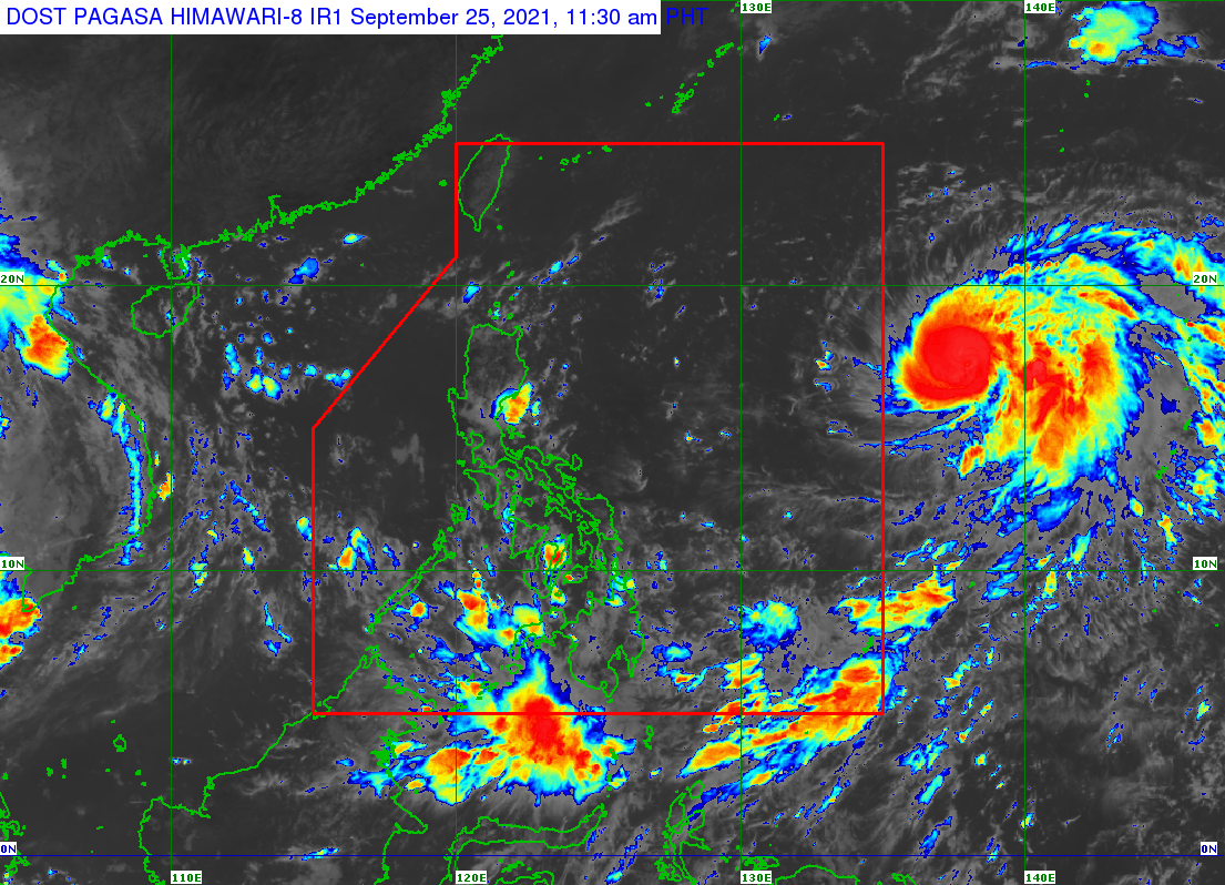
Mindulle strengthened from a severe tropical storm into a typhoon outside the Philippine Area of Responsibility (PAR) at 8 am on Saturday, September 25.
The Philippine Atmospheric, Geophysical, and Astronomical Services Administration (PAGASA) said in its 11 am advisory on Saturday that Mindulle now has maximum sustained winds of 120 kilometers per hour and gustiness of up to 150 km/h.
It could reach a peak intensity of around 205 km/h by Monday, September 27, still a typhoon. (READ: FAST FACTS: Tropical cyclones, rainfall advisories)
As of Saturday morning, Mindulle was located 1,720 kilometers east of Northern Luzon, moving northwest at a slower pace of only 10 km/h.
PAGASA now sees the typhoon moving northwest or north northwest until Wednesday, September 29, before turning north northeast by Thursday, September 30.
Mindulle is also seen to slow down further on Sunday, September 26, and on Monday.
Based on its latest forecast track, the typhoon is projected to enter PAR on Tuesday, September 28, or on Wednesday.
If the typhoon enters PAR, it would be given the local name Lannie. (READ: LIST: PAGASA’s names for tropical cyclones in 2021)
But it will remain far from Philippine landmass and it is unlikely to directly affect weather in the country. It may only cause moderate to rough waters in the northern and eastern seaboards of Luzon beginning Monday, making travel risky for small vessels.
PAGASA noted, however, that there is also an “increasing likelihood” of Mindulle not entering PAR at all. Updates will be given in succeeding advisories.
The Philippines has had 11 tropical cyclones in 2021. The yearly average is 20. – Rappler.com
Add a comment
How does this make you feel?
There are no comments yet. Add your comment to start the conversation.