SUMMARY
This is AI generated summarization, which may have errors. For context, always refer to the full article.
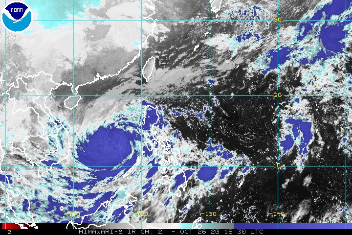
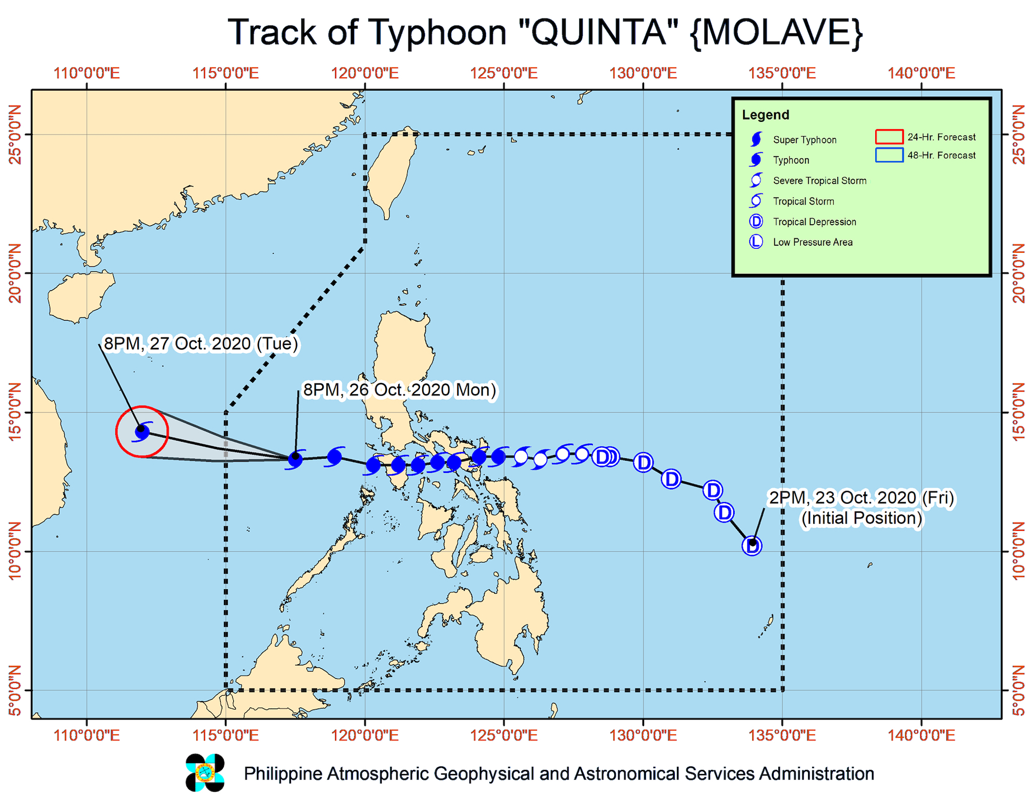
Typhoon Quinta (Molave) strengthened again over the West Philippine Sea on Monday evening, October 26, just hours before its exit from the Philippine Area of Responsibility (PAR).
The Philippine Atmospheric, Geophysical, and Astronomical Services Administration (PAGASA) said in its 11 pm bulletin on Monday that Quinta is now 420 kilometers west of Calapan City, Oriental Mindoro.
The typhoon is still moving west at 25 kilometers per hour (km/h), with its exit from PAR expected on Tuesday morning, October 27.
Quinta’s maximum sustained winds increased further from 130 km/h to 140 km/h, while its gustiness rose from 160 km/h to 170 km/h. PAGASA said the typhoon is likely to gain more strength and may reach its peak intensity within 24 hours. (READ: FAST FACTS: Tropical cyclones, rainfall advisories)
Ahead of Quinta’s exit, rain from the typhoon will continue hitting parts of the country until Tuesday morning, possibly causing more floods or landslides. Below is PAGASA’s latest rainfall forecast.
Moderate to heavy rain, with at times intense rain
- Occidental Mindoro
- Oriental Mindoro
- Palawan including Calamian, Cuyo, and Kalayaan Islands
- Quezon
- Aurora
- Isabela
- Cagayan
- Western Visayas
Light to moderate rain, with at times heavy rain
- rest of Luzon
- rest of Visayas
- Zamboanga Peninsula
- Bangsamoro Autonomous Region in Muslim Mindanao
- Northern Mindanao
- Caraga
Meanwhile, only 3 areas remain under Signal No. 1. Strong breeze to near gale conditions will persist here:
- Lubang Island
- Calamian Islands
- Kalayaan Islands
PAGASA added that Quinta’s outer circulation may cause occasional gusts in these areas:
- Mimaropa
- western part of Luzon
- Western Visayas
The northeasterlies will also trigger strong breeze to gale conditions in the following provinces:
- Batanes
- northern part of Cagayan including Babuyan Islands
- Apayao
- Ilocos Norte
Quinta earlier made landfall in the country 5 times.
- San Miguel Island, Tabaco City, Albay – 6:10 pm, Sunday, October 25
- Malinao, Albay – 6:50 pm, Sunday
- San Andres, Quezon – 10:30 pm, Sunday
- Torrijos, Marinduque – 1:20 am, Monday, October 26
- Pola, Oriental Mindoro – 3:30 am, Monday
As for coastal areas, PAGASA warned that “heavy swells of 2 to 4 meters due to Quinta can cause significant breaking waves that may bring potentially hazardous surf conditions” to the western coasts of:
- Pangasinan
- Central Luzon
- Occidental Mindoro
- Palawan including Calamian Islands
Travel remains risky, especially for small vessels, in several seaboards.
Rough to very rough seas (waves 2.5 to 6 meters high)
- seaboards of Northern Luzon, Central Luzon, and Palawan including Calamian, Cuyo, and Kalayaan Islands
- western seaboards of Western Visayas, Batangas, and Occidental Mindoro
Moderate to rough seas (waves 1.2 to 2.5 meters high)
- eastern seaboard of Southern Luzon
- western seaboards of Zamboanga Peninsula and Sulu
Meanwhile, the low pressure area (LPA) outside PAR is now 1,900 kilometers east of Southern Luzon.
The LPA is likely to enter PAR on Wednesday, October 28, or Thursday, October 29.
But the state weather bureau said it is “less likely” to develop into a tropical depression, at least in the next 48 hours.
Quinta is the Philippines’ 17th tropical cyclone for 2020, and the 4th for October.
An average of 20 tropical cyclones form within or enter PAR each year. (READ: LIST: PAGASA’s names for tropical cyclones in 2020)
These are PAGASA’s latest estimates for the number of tropical cyclones inside PAR in the next 6 months:
- November 2020 – 1 to 3
- December 2020 – 2 or 3
- January 2021 – 0 or 1
- February 2021 – 0 or 1
- March 2021 – 0 or 1
- April 2021 – 0 or 1
Last October 2, the state weather bureau warned Filipinos to expect more rain in the coming months due to the onset of La Niña. – Rappler.com
Add a comment
How does this make you feel?


There are no comments yet. Add your comment to start the conversation.