SUMMARY
This is AI generated summarization, which may have errors. For context, always refer to the full article.
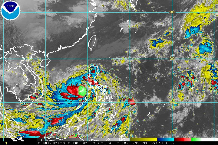
As expected, Typhoon Quinta (Molave) started to re-intensify over the West Philippine Sea on Monday afternoon, October 26, still causing rain though it is already beginning to move away.
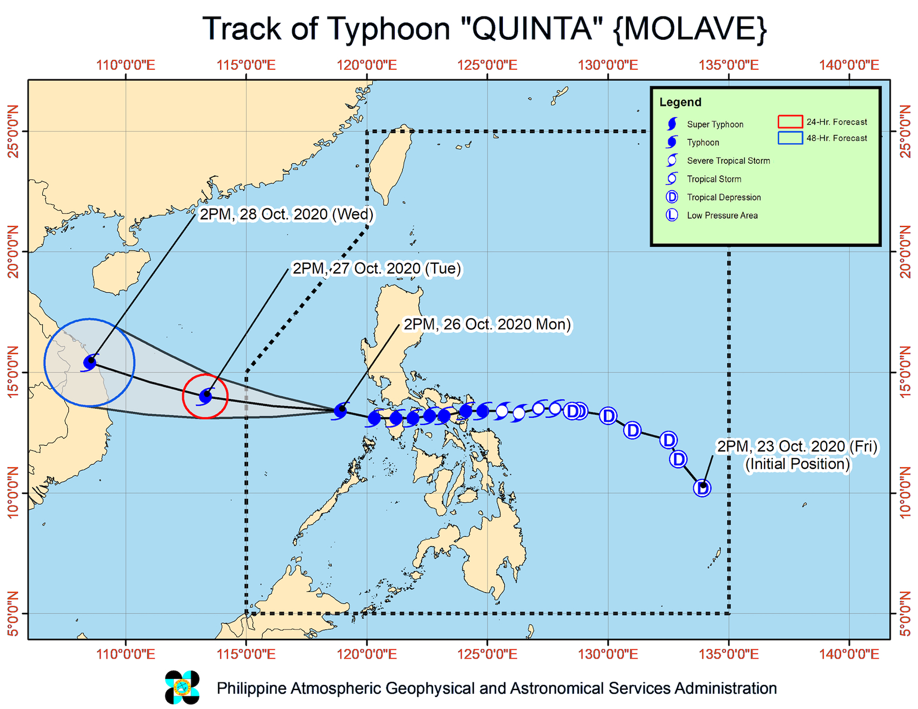
In a bulletin issued 5 pm on Monday, the Philippine Atmospheric, Geophysical, and Astronomical Services Administration (PAGASA) said Quinta is now 310 kilometers west of Calapan City, Oriental Mindoro.
The typhoon continues to move west at 25 kilometers per hour (km/h), heading for the western boundary of the Philippine Area of Responsibility (PAR), where it will exit on Tuesday morning, October 27.
Quinta now has maximum sustained winds of 130 km/h from the previous 125 km/h and gustiness of up to 160 km/h from the previous 150 km/h. PAGASA said the typhoon may reach its peak intensity within 24 hours. (READ: FAST FACTS: Tropical cyclones, rainfall advisories)
PAGASA cautioned that Quinta and the tail-end of a frontal system are still bringing rain on Monday evening until Tuesday morning.
Moderate to heavy rain, with at times intense rain (Quinta)
- Occidental Mindoro
- Oriental Mindoro
- northern part of Palawan including Calamian and Cuyo Islands
- Calabarzon
- Aurora
- Isabela
Moderate to heavy rain (tail-end of a frontal system)
- Cagayan
- Apayao
- Kalinga
- Abra
- Ilocos Norte
- Ilocos Sur
Light to moderate rain, with at times heavy rain (Quinta and tail-end of a frontal system)
- rest of Luzon
- Western Visayas
- Zamboanga Peninsula
- Bangsamoro Autonomous Region in Muslim Mindanao
But since Quinta is beginning to move away from the country, there are no more areas under Signal Nos. 2 and 3. Only the following remain under Signal No. 1, with strong breeze to near gale conditions:
- Batangas
- Occidental Mindoro including Lubang Island
- Oriental Mindoro
- Calamian Islands
- extreme northern part of Antique (Caluya)
Strong breeze to near gale conditions will persist due to the northeasterly surge in these areas, too:
- Ilocos Region
- Batanes
- Cagayan
- Apayao
- northern part of Zambales
Quinta earlier made landfall in the country 5 times.
- San Miguel Island, Tabaco City, Albay – 6:10 pm, Sunday, October 25
- Malinao, Albay – 6:50 pm, Sunday
- San Andres, Quezon – 10:30 pm, Sunday
- Torrijos, Marinduque – 1:20 am, Monday, October 26
- Pola, Oriental Mindoro – 3:30 am, Monday
Certain seaboards are still not safe for travel yet, for all types of vessels.
Rough to high seas (waves 2.5 to 7 meters high)
- areas under Signal No. 1
Rough to very rough seas (waves 2.5 to 5 meters high)
- remaining seaboards of Luzon
- western seaboard of Visayas
In some seaboards, small vessels must take precautionary measures.
Moderate to rough seas (waves 1.2 to 3.1 meters high)
- eastern seaboards of Visayas and Mindanao
- seaboards of Zamboanga Peninsula
Meanwhile, PAGASA continues to monitor a low pressure area (LPA) outside PAR, at 1,945 kilometers east of Southern Luzon.
The LPA could enter PAR on Wednesday, October 28, or Thursday morning, October 29.
But the state weather bureau said it is “less likely” to develop into a tropical depression, at least in the next 48 hours.
Quinta is the Philippines’ 17th tropical cyclone for 2020, and the 4th for October.
An average of 20 tropical cyclones form within or enter PAR each year. (READ: LIST: PAGASA’s names for tropical cyclones in 2020)
These are PAGASA’s latest estimates for the number of tropical cyclones inside PAR in the next 6 months:
- November 2020 – 1 to 3
- December 2020 – 2 or 3
- January 2021 – 0 or 1
- February 2021 – 0 or 1
- March 2021 – 0 or 1
- April 2021 – 0 or 1
Last October 2, the state weather bureau warned Filipinos to expect more rain in the coming months due to the onset of La Niña. – Rappler.com
Add a comment
How does this make you feel?


There are no comments yet. Add your comment to start the conversation.