SUMMARY
This is AI generated summarization, which may have errors. For context, always refer to the full article.
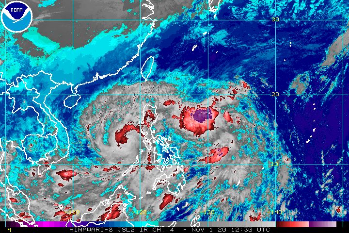
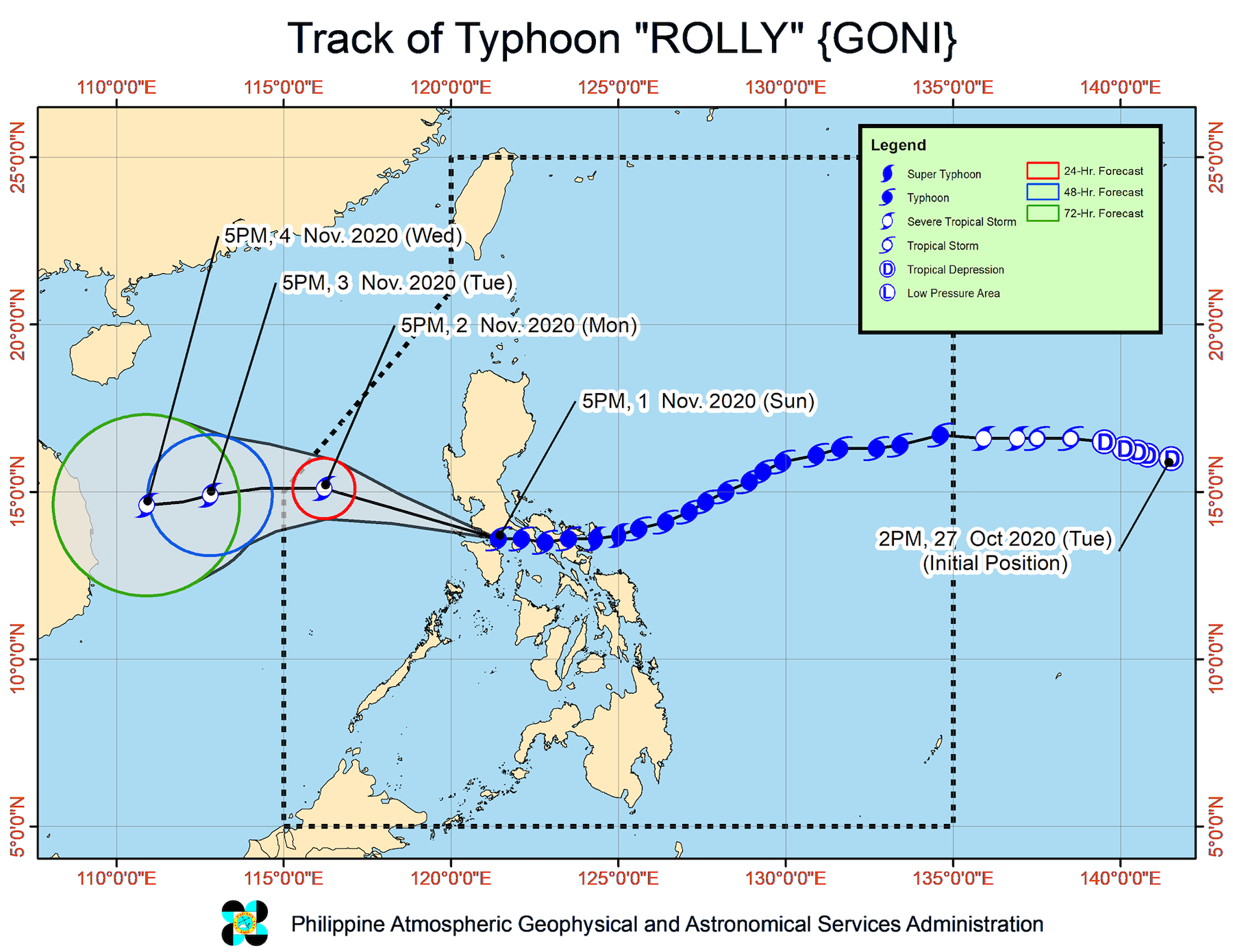
Typhoon Rolly (Goni) is now over the West Philippine Sea after making its 4th landfall in Lobo, Batangas, at 5:30 pm on Sunday, November 1.
Rolly earlier made landfall in these areas:
- Bato, Catanduanes – 4:50 am (super typhoon)
- Tiwi, Albay – 7:20 am (super typhoon)
- San Narciso, Quezon – 12 pm (typhoon)
With its previous status as a super typhoon, Rolly was declared the world’s strongest tropical cyclone for 2020, so far. Its intense rain triggered massive floods, while its violent winds destroyed homes. In Albay, at least 4 people were reported dead.
The Philippine Atmospheric, Geophysical, and Astronomical Services Administration (PAGASA) said in its 8 pm bulletin that Rolly is now 120 kilometers west of Calapan City, Oriental Mindoro, still moving west at 25 kilometers per hour (km/h).
Rolly weakened further, and now has maximum sustained winds of 125 km/h and gustiness of up to 170 km/h. Late Sunday afternoon, it had maximum sustained winds of 165 km/h and gustiness of up to 230 km/h.
PAGASA said Rolly is forecast to weaken into a severe tropical storm in the next 24 hours. (READ: FAST FACTS: Tropical cyclones, rainfall advisories)
Fewer areas remain under tropical cyclone wind signals as of 8 pm, with Rolly no longer over land.
Signal No. 3 (destructive typhoon-force winds)
- southwestern part of Batangas (Tingloy, Mabini, Bauan, San Luis, Taal, Santa Teresita, Alitagtag, San Nicolas, Talisay, Laurel, Agoncillo, Lemery, Calaca, Balayan, Tuy, Nasugbu, Lian, Calatagan)
- northwestern part of Occidental Mindoro (Abra de Ilog, Mamburao, Paluan)
Signal No. 2 (damaging gale- to storm-force winds)
- Cavite
- rest of Batangas
- northern part of Oriental Mindoro (Puerto Galera, San Teodoro, Baco, Calapan City, Naujan, Victoria, Pola)
- central part of Occidental Mindoro (Santa Cruz, Sablayan)
Signal No. 1 (strong breeze to near gale conditions)
- southern part of Zambales (San Marcelino, San Felipe, San Narciso, San Antonio, Castillejos, Subic, Olongapo City)
PAGASA added that strong breeze to near gale conditions due to the northeasterlies will be experienced in Northern Luzon.
Some areas will also continue to have rain from Rolly for the rest of Sunday evening.
Moderate to heavy rain, with at times intense rain
- Aurora
- eastern parts of mainland Cagayan and of Isabela
Light to moderate rain, with at times heavy rain
- rest of Central Luzon
- rest of mainland Cagayan Valley
- Metro Manila
- Calabarzon
- Cordillera Administrative Region
- Ilocos Region
- Mimaropa
- Western Visayas
- Zamboanga Peninsula
- Bangsamoro Autonomous Region in Muslim Mindanao
- Northern Mindanao
There is still a moderate to high risk of storm surges of up to 2 meters high in the areas below. Storm surges, “which may be accompanied by swells and breaking waves reaching the coast, can cause life-threatening and damaging coastal inundation.”
- coastal areas of Cavite, Bataan, Lubang Island
- southwestern coastal area of Batangas
- northern coastal area of Occidental Mindoro
Travel remains risky for all types of vessels in:
- seaboards of areas under tropical cyclone wind signals – rough to high seas, with waves 2.5 to 9 meters high
- remaining seaboards of Northern Luzon as well as eastern seaboards of Eastern Visayas that are not under a tropical cyclone wind signal and Caraga – rough to very rough seas, with waves 2.5 to 5 meters high
In the remaining seaboards of the country, there are moderate to rough seas, with waves 1.2 to 2.5 meters high. PAGASA advised those using small vessels to take precautionary measures, while “inexperienced mariners should avoid navigating in these conditions.”
Rolly might leave the Philippine Area of Responsibility (PAR) on Tuesday morning, November 3.
Aside from Rolly, Tropical Storm Siony (Atsani) is also inside PAR, though it is not affecting any part of the country yet.
The next PAGASA bulletin on Siony is expected to be released at 11 pm on Sunday.
Rolly is the Philippines’ 18th tropical cyclone for 2020, while Siony is the 19th.
An average of 20 tropical cyclones form within or enter PAR each year.
These are PAGASA’s latest estimates for the number of tropical cyclones inside PAR in the next 6 months:
- November 2020 – 1 to 3
- December 2020 – 2 or 3
- January 2021 – 0 or 1
- February 2021 – 0 or 1
- March 2021 – 0 or 1
- April 2021 – 0 or 1
Last October 2, the state weather bureau warned Filipinos to expect more rain in the coming months due to the onset of La Niña. – Rappler.com
Add a comment
How does this make you feel?


There are no comments yet. Add your comment to start the conversation.