SUMMARY
This is AI generated summarization, which may have errors. For context, always refer to the full article.
MANILA, Philippines – Landslides are not uncommon in the Philippines. In mountainous areas, heavy rainfall have often triggered landslides in the past.
How prone are we to landslides and what are their potential costs in lives and properties? What lessons can be learned from previous landslides?
Here are some major landslides in the country in the last two decades. Almost all of these happened in the midst of heavy rain that loosened the soil in landslide-prone areas.
1999 Cherry Hills landslide
On August 3, 1999, heavy rain induced by Typhoon Ising (Olga) spelled disaster for residents of Cherry Hills Subdivision in Antipolo City, when the ground beneath them broke apart and slid down the mountain. (READ: The ghost of Cherry Hills)
Houses went down along with the landslide, while those living down the slope were buried in mud and concrete. A total of 60 people died.
University of the Philippines geologists who looked into the disaster argued that while heavy rains may have set off the landslide, certain geological traits of the area where the subdivision stood made it vulnerable. Structural interventions could have averted the disaster, but that would have made the cost of the project prohibitive for the low-income sector.
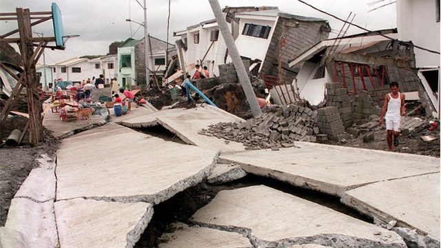
2003 Panaon Island (Southern Leyte) debris flow
A low pressure area brought nonstop rain to Panaon Island at the tip of Southern Leyte on December 19, 2003.
That evening, loose soil, boulders, and debris rolled down towards houses in Barangay Pinut-an in San Ricardo town, and in Sitio Lutao (Barangay Poblacion) and Barangay Punta in Liloan town. Authorities reported 154 people dead in Panaon Island due to the landslides.
2006 Guinsaugon landslide
Over 1,200 people died on February 11, 2006, when an earthquake triggered an avalanche of mud and boulders down a mountain slope towards Guinsaugon village in Saint Bernard, Southern Leyte.
The landslide caught residents by surprise that day, but it had been building up for quite some time, following intense rainfall in the days leading up to the disaster. In addition, geologists said that warning signs about the risk of landslides in the area went unheeded. (READ: Lessons from Guinsaugon: How do landslides happen?)
2006 Mayon Volcano lahar
Typhoon Reming (Durian) drenched the Bicol Region on November 30, 2006, after the storm made landfall there. The rains triggered the movement of volcanic ash on the slopes of the Mayon Volcano.
The resulting mudslide or lahar rushed down the villages located on the foot of the Mayon, killing over 1,200 residents, many of whom were missing or presumed dead.
2009 Cordillera landslides
Days after Tropical Storm Ondoy (Ketsana) left the country, Typhoon Pepeng (Parma) battered the mountainous Cordillera region with intense rain, causing multiple landslides in the region in early October 2009.
At least 120 people died in Benguet province, 25 in Baguio City, and 23 in Mountain Province, according to authorities.
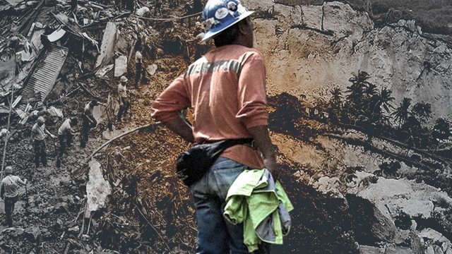
2012 Pantukan landslide
Five days into the new year of 2012, tragedy struck a small-scale mining site in Pantukan, Compostela Valley, where some miners have settled to pan for gold.
A landslide in the wee hours of the morning, caused by heavy rain and a mild earthquake near the province, buried the houses near the mining site. At least 42 people were killed.

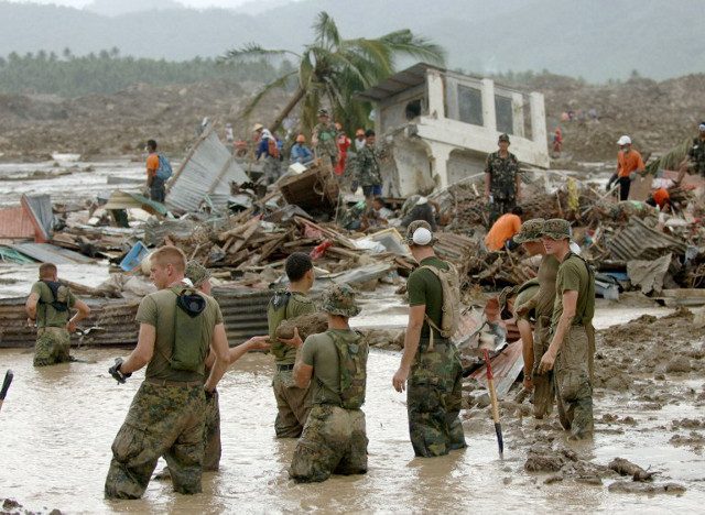
2012 New Bataan (Compostela Valley) debris flow
Rains brought by Typhoon Pablo (Bopha) caused a massive debris flow in Barangay Andap in New Bataan, Compostela Valley on December 4, 2012.
The flow of mud, boulders, and gravel rushed towards Barangay Andap, which was on the mouth of a steep mountain drainage network. At least 128 died and 450 went missing as the village was buried under the debris in the wake of the disaster.
2014 Catbalogan landslide
Around 19 people died on December 30, 2014, in Catbalogan City, Samar, after Tropical Storm Seniang (Jangmi) caused landslides in some areas, most notably in Barangay Mercedes.
Seniang also caused landslides in two towns in neighboring Leyte province, killing at least 9.
2017 Biliran landslides
On December 16, 2017, 4 towns in Biliran province were affected not only by rains brought by Tropical Storm Urduja (Kai-tak) but also by landslides. At least 42 people died in Naval, Caibiran, Biliran, and Almeria, while 14 others were missing.
The Mines and Geosciences Bureau said many factors – like the very high slope gradient in the affected areas and unstable grounds due to road development, farming, and poor drainage systems – mainly contributed to the landslides, not the supposed “open-pit mining” operations in the province.
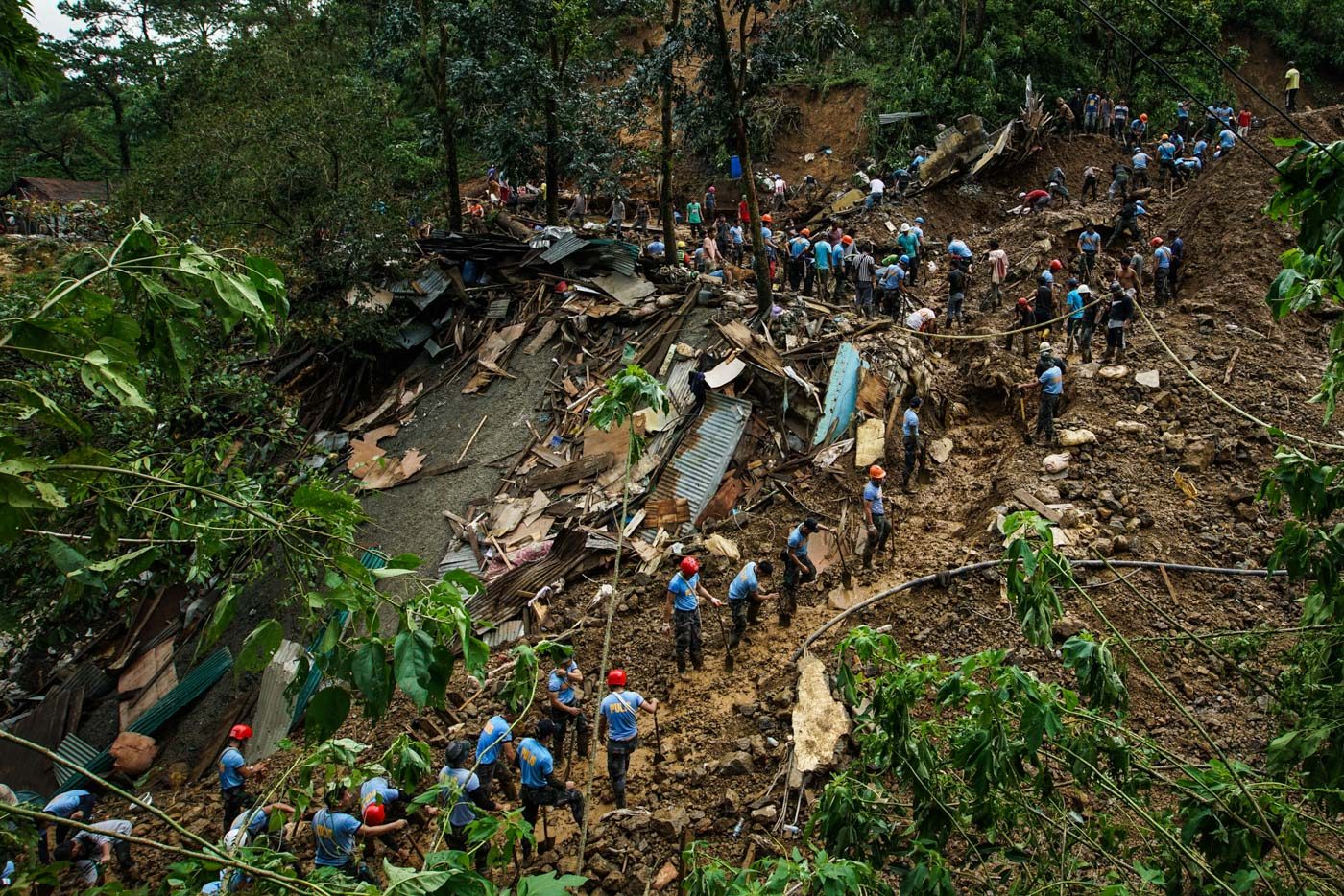
2018 Itogon, Benguet landslides
Typhoon Ompong (Mangkhut), so far the strongest tropical cyclone in 2018, brought heavy rains and strong winds in northern Luzon. Most of the fatalities were recorded in landslides that occurred at a mining town in Itogon, Benguet on September 15, 2018.
As of September 21, at least 58 people have been reported dead, 31 of whom lived in Barangay Ucab where the biggest landslide happened.
Despite the risks in the landslide-prone area, however, residents said they would rather stay put than lose their only source of livelihood. (READ: Why mine despite landslide scare? ‘Doon lang kami umaasa’)
The Department of Environment and Natural Resources (DENR) said the Itogon landslide was not caused by mining activities but mainly due to the texture of the soil and the mountain’s steep slope. The DENR later clarified that the deaths “were still a matter of mining” as it is the livelihood of many residents there.
After Ompong, Environment Secretary Roy Cimatu ordered a stop to small-scale mining operations in the Cordillera region.
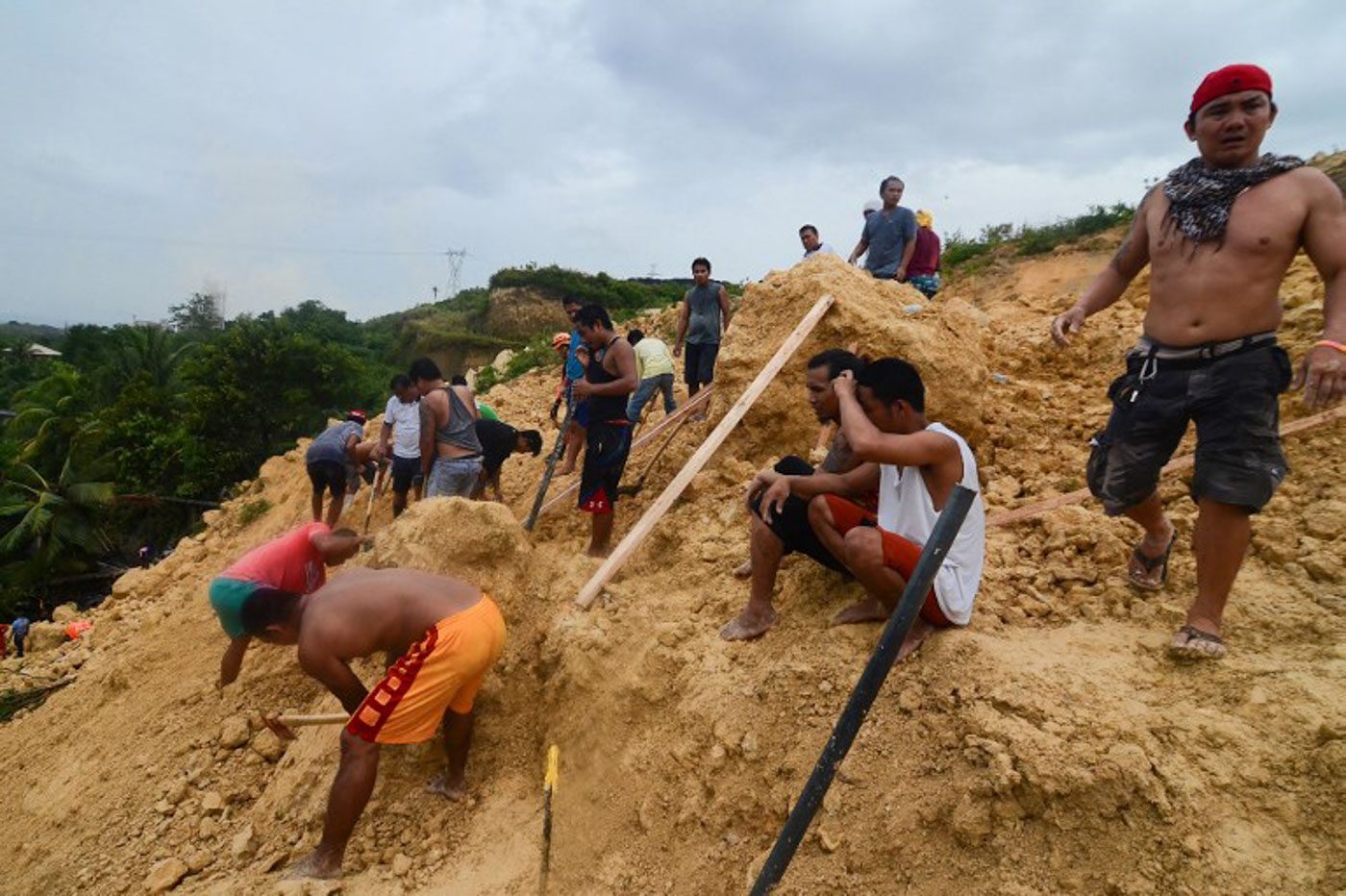
2018 Naga, Cebu landslide
Days of heavy monsoon rains caused a landslide in Naga City, Cebu on September 20, 2018, affecting at least two barangays. Limestone and soil on the mountainside softened due to the rain, and it collapsed on a number of homes that early morning, when many people would still have been in bed.
The death toll rose to 29 as of September 21. (IN PHOTOS: Rescuers dig for survivors in Naga, Cebu, landslide) – Rappler.com
Add a comment
How does this make you feel?
There are no comments yet. Add your comment to start the conversation.