SUMMARY
This is AI generated summarization, which may have errors. For context, always refer to the full article.

MANILA, Philippines – New Bataan and Legazpi City might be islands and hundreds of kilometers apart, but two barangays from these places now share the same fate.
The disaster brought about by typhoon Pablo (Bopha) in New Bataan’s Barangay Andap is similar to the flooding and rockslide that brought death and destruction to Legazpi City’s Barangay Padang in 2006 at the height of typhoon Reming (Durian).
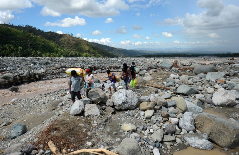
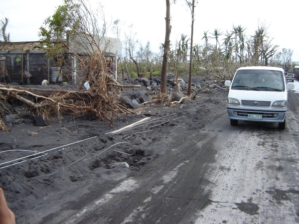
The cascade of rocks, debris, and boulders from the mountains, known as a debris flow, occurred in both villages, according to the initial assessment of the disaster in Compostela Valley, released by the National Institute of Geological Sciences (NIGS) on Saturday, December 8.
“[Barangay Andap]… was overwhelmed by a rapid downward moving mass of material that was fluid as wet cement and composed of boulders, gravel and sand,” the NIGS report said.
“In its wake, it left a pile of rubble called a debris flow deposit,” the report explained.
It is defined as a “rapid, downward mass movement” of particles larger or coarser than sand – from rocks to boulders – descending at a rate ranging from 2 to 40 km/h.
Deadly location
Barangay Andap – and New Bataan in general – is perched in a mountainside that is a natural channel for water to pass through on its way downstream during heavy rainfall events.
“Barangay Andap is situated at the mouth of a mountain drainage network at the base of steeply-sided slopes. It was nested on an alluvial fan, normally found at the base of mountains where water drains,” the report said.
The NIGS report also said that in Andap, heavy rain from Pablo created floods that carried eroded gravel, sand, and boulders from the mountains.
“Barangay Andap was situated along the path of a debris flow spawned by intense rainfall during the onslaught of typhoon Pablo,” it explained.
The debris flow field is estimated to be a kilometer wide, and 8 km long, all the way to the New Bataan town proper, according to MindaNews.
The disaster left over 300 dead in New Bataan, and many more still missing.
Other debris flows
On the other hand, back in November 2006 during typhoon Reming, Barangay Padang in Legazpi City experienced essentially the same phenomenon – debris flows were triggered by heavy rain, causing rocks and boulders to slide down the slopes of Mayon Volcano.
However, in the case of Padang, the flow is called a lahar flow, because it occurred on the slopes of a volcano.
“Within and on top of the deposit, there lay boulders strewn on top of the debris field,” the report recalled.
The debris flow cut through a wide swathe of the village, just north of Legazpi City proper, and caused the deaths of dozens of residents.

Debris flows are not uncommon, and numerous incidents have been recorded around the world.
The report cited the Cordillera de la Costa incident in Vargas, Venezuela, back in December 1999, in which heavy rains caused a major debris flow. It destroyed more than 1,500 houses and buildings, and killed 19,000 people.
Not the first time
Based on the geological characteristics of Andap, it is not the first time such event has occurred in the area, said Dr Alfredo Mahar Lagmay, one of the authors of the initial assessment report and the director of the government’s Project NOAH, or the National Operational Assessment of Hazards.
Lagmay told Rappler that the area already had flood deposits, indicating that it is not the first time such event happened there.
“Even before there were settlers there, meron nang mga flood deposits doon. It’s really not the first time that it happened. Siguro in our lifetime, in the past decades, were were not able to see such floods, flood events, but in the past there were,” he said.
He also said that deforestation in the area could be a factor, but with the amount of rain Pablo dumped in the area, flooding can still occur.
“[Logging] could have been a factor, but with such we all know that floods can still happen even with forested mountains,” he explained.
Lagmay said that in other areas hit by the typhoon, hazard maps have been of great help in preparing residents, but in the case of Andap, warnings could only do so much.
Project NOAH, he added, is still in the process of making more detailed, high-resolution topographic maps for areas such as Compostela Valley, which are currently served only by regional-scale maps that do not show details such as houses and bridges.
“The preparations, the warning that was given by PAGASA were accurate, only that the people did not know where to go,” he said.
If the terrain is really dangerous, people, local governments, and aid groups can only do so much, he said.
“You ask them to go down the mountain but when they are in the low-lying areas, there’s going to be flood,” Lagmay said.
“It’s not enough for people to know when the floods will come, to get advance warning of a coming flood. If they don’t know where to go, where the safe places are and where the dangerous places are, they won’t be safe,” he added. – Rappler.com
Add a comment
How does this make you feel?
There are no comments yet. Add your comment to start the conversation.