SUMMARY
This is AI generated summarization, which may have errors. For context, always refer to the full article.

PARIS, France – Removing mangroves, marshes, reefs, forests, dunes and other natural defenses doubles the risk for life and property from coastal floods, a US climate study said on Sunday, July 14.
In the most detailed analysis of the risks facing Americans from rising seas, researchers led by Katie Arkema at Stanford University in California built a computer model of coasts in the continental United States.
The huge program factored in population statistics, residential property values, natural defenses and flooding probability on a scale of one square kilometer (0.38 of a square mile).
“Today, 16 percent of the US coastline comprises ‘high hazard’ areas harboring 1.3 million people, (including) 250,000 elderly (and) 30,000 families below the poverty line, and $300 billion (230 billion euros) in residential property value,” the study said.
This estimate is for current sea levels and for the current state of natural buffers against floods.
Strip away this protection in order to build on the land, and the number of people and the value of property at high risk roughly doubles.
“At present habitats protect 67 percent of the coastline,” said the study, published in the journal Nature Climate Change.
“Habitat loss would double the extent of coastline highly exposed… and the number of poor families, elderly people and total property highly exposed to hazards would also double.”
In addition, rising seas caused by global warming will drive up the exposure, the study warned.
The team calculated what would happen under a common scenario for warming, known as A2, under which Earth’s average surface temperature would rise by 2.0-5.4°C (3.6-9.7°F) this century.
Around two million people, and property worth some $500 billion, would be in “high hazard” areas — a red line that stretches around most of the Gulf and Atlantic coasts and parts of San Francisco Bay.
That exposure would almost double if habitat defenses are removed, because more people inland are placed at risk.
Arkema says the new study can guide policymakers as to which areas are most exposed and which habitats are to be nurtured. Twenty-three of the United States’ 25 most populated counties lie on the coast.
“The traditional approach to protecting towns and cities has been to ‘harden’ shorelines,” the paper notes.
“Although engineered solutions are necessary and desirable in some contexts, they can be expensive to build and maintain, and construction may impair recreation, enhance erosion, degrade water quality and reduce the production of fisheries.”
Experts have long pointed out the folly of building homes and businesses on exposed coast and stripping away natural shields against seas.
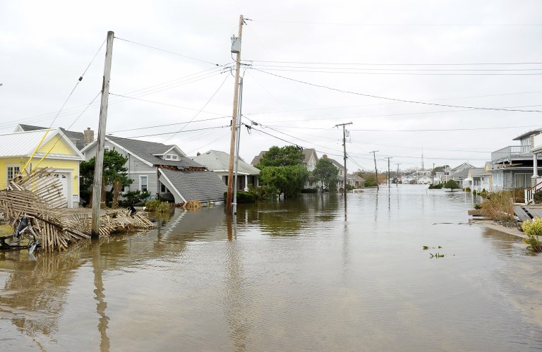
The message was given added weight after Superstorm Sandy swamped parts of New York and New Jersey in October 2012.
Last month New York Mayor Michael Bloomberg unveiled a $19-billion plan to build six-meter (20-feet) -high waterfront walls and dikes — and also reinforce or create dunes along vulnerable stretches of the city’s coast. – Rappler.com
Add a comment
How does this make you feel?
There are no comments yet. Add your comment to start the conversation.