SUMMARY
This is AI generated summarization, which may have errors. For context, always refer to the full article.
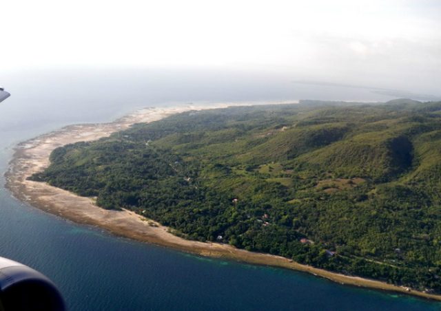
MANILA, Philippines – After being devastated by a strong earthquake two years ago, coastal areas in the municipalities of Loon and Maribojoc in Bohol were uplifted.
The 137-hectare of lifted areas cover 4 barangays of Loon – Tangnan, Cuasi, Tontonan and Song-on, and two barangays of Maribojoc – Punta Cruz and Guiwanon.
The Department of Environment and Natural Resources declared these areas as “geological monument,” under the DENR Administrative Order No. 2015-08, signed by Environment Secretary Ramon Paje.
“The Department order declaring the uplifted coastal area as a geological monument serves to provide a legal framework for the recognition, preservation and protection of the uplifted coast, as well as encourage further researches and studies on the monument for the advancement of geosciences in the country,” Paje said in a press statement on Tuesday, June 16.
Geological monuments are sites that show outstanding features or processes considered by geologists and other scientists as worthy of conservation, said the agency.
Two years ago, on October 15 , 2013, a magnitude 7.2 earthquake struck Visayas, destroying old-centuries churches and killing at least 28 people. (READ: Strong quake rocks Visayas; 28 dead)
The declaration was based on Mines and Geosciences Bureau (MGB)’s recommendation after finding out from its initial surveys that the earthquake caused the said areas to be lifted by up to 1.2 meters.
‘Geological heritage’
“The uplifted [area] ‘constitutes an irreplaceable segment of the earth’s history and geological heritage,” DENR said.
Under the administrative order, the areas, known as the “Loon-Maribojoc Geological Monument,” will undergo ground verification based on the survey map produced by MGB.
A marker containing the geological history, description and significance of the geological monument will then be installed.
To preserve the monument, MGB was tasked to come up with a management plan for the park, in cooperation with concerned government agencies and local governments.
“The plan will focus on enriching understanding and appreciation of the geological phenomenon, and the promotion and maintenance of the area as a potential ecotourism destination, as well as for scientific and educational purposes,” according to the press statement.
The DENR has earlier declared the following areas as national geological monuments:
-
Chocolate Hills in Bohol
-
Hundred Islands in Pangasinan
-
Sand Dunes in Ilocos Norte
-
St. Paul Limestone Formation in Puerto Princesa, Palawan
-
Taal Volcano in Batangas
-
Montalban Limestone Gorge in Rodriguez, Rizal
– Rappler.com
Add a comment
How does this make you feel?
There are no comments yet. Add your comment to start the conversation.