SUMMARY
This is AI generated summarization, which may have errors. For context, always refer to the full article.
MANILA, Philippines – Typhoon Nina (Nock-ten) hit the Philippines on Christmas Day, December 25, barrelling through Luzon from Bicol to Mimaropa.
More than 383,000 people have fled their homes while 300 domestic and international flights have been cancelled, as the unusually late typhoon marred Christmas celebrations in the largely Christian nation.
Nina previously cut off electricity to millions and forced government agencies to order evacuations of whole communities in Bicol which felt the brunt of the typhoon.
As Nina hit the country, various satellites as well as the International Space Station captured the typhoon from space. Here are some of their photos, thousands of kilometers above Earth.
The view from the ISS, December 23
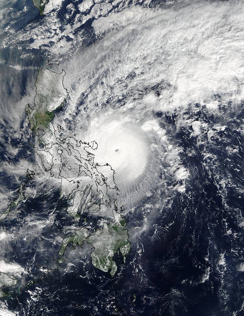
Satellite photo from the NASA Terra satellite, December 25
On December 25 at 0210 UTC the Moderate Resolution Imaging Spectroradiometer aboard NASA’s Terra satellite provided a visible-light image of Nina as it began to affect the eastern Philippines. The image provided a clear view of the typhoon.
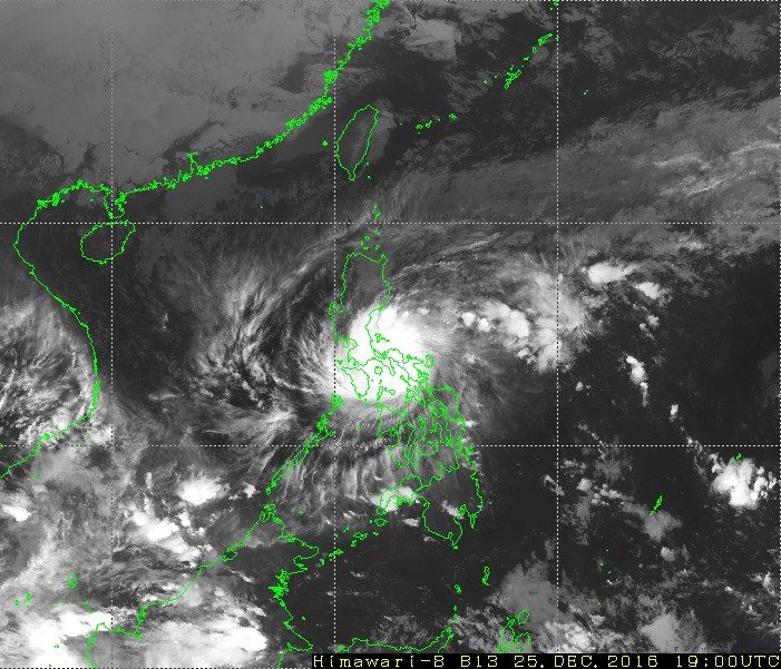
Captured by Japan’s Himawari satellite, December 25
Image of the typhoon as it crossed Southern Luzon on Christmas evening.
– Rappler.com
Add a comment
How does this make you feel?


There are no comments yet. Add your comment to start the conversation.