SUMMARY
This is AI generated summarization, which may have errors. For context, always refer to the full article.

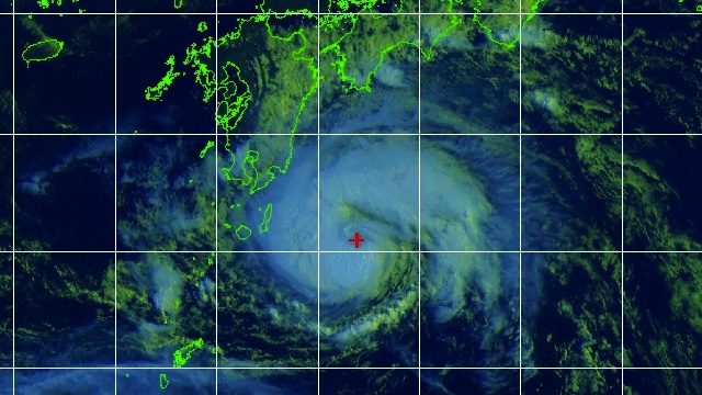
TOKYO, Japan – Typhoon Damrey was approaching southern Japan on Wednesday, August 1, triggering warnings of torrential rain and violent winds while scores of domestic flights were grounded.
Damrey, packing winds of up to 108 kilometers (67 miles) per hour, was churning in the Pacific ocean off the islet of Tanegashima near Japan’s main southern island of Kyushu on Wednesday afternoon.
The meteorological agency warned that Kyushu may see violent gusts and up to 80 millimeters (3.2 inches) of rain per hour.
The typhoon was expected to move over the Yellow Sea between the Korean peninsula and mainland China by midday Thursday.
Another typhoon, Saola (Philippine codename Gener), was also approaching Taiwan and Japan’s southernmost island chain of Okinawa on Wednesday, after lashing the Philippines Monday, where it left 12 people dead and millions without power.
Nearly 250 domestic flights in Japan have been grounded because of Damrey and Saola, according to public broadcaster NHK.
Two weeks ago, typhoon Khanun skimmed past southern Japan, dumping rain on an area already struggling to clean up after huge floods that left more than 30 people dead or missing. – Agence France-Presse
Add a comment
How does this make you feel?
There are no comments yet. Add your comment to start the conversation.