SUMMARY
This is AI generated summarization, which may have errors. For context, always refer to the full article.

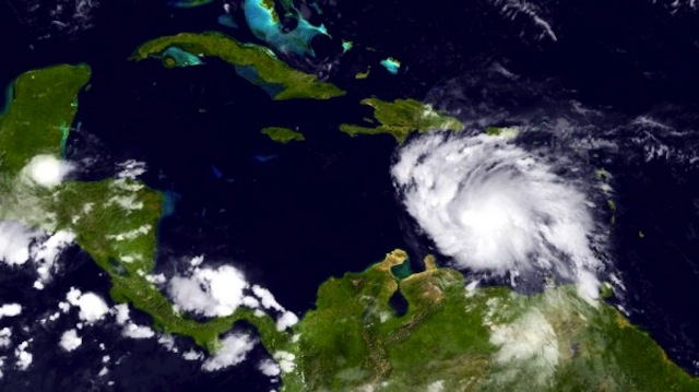
MIAMI, Florida, United States – Tropical Storm Ernesto in the Caribbean headed towards the Yucatan peninsula Saturday, August 4 (Sunday, August 5 in Manila), likely to reach hurricane strength and drench southeastern Mexico and Central America, US forecasters said.
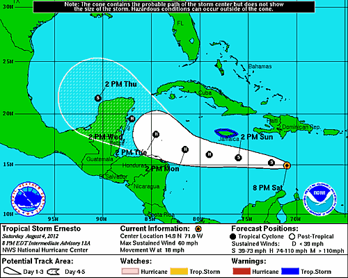
At 2100 GMT the center of Ernesto was located some 410 kilometers (255 miles) south of Santo Domingo, capital of the Dominican Republic, the Miami-based National Hurricane Center reported.
The storm had maximum sustained winds of 95 kilometers (60 miles) and hour, and was moving towards the west at 30 kilometers (18 miles) an hour.
“Some strengthening is possible during the next 48 hours, and Ernesto could become a hurricane during the next day or so,” the NHC warned.
On the forecast track Ernesto will move south of the island of Hispaniola — shared by the Dominican Republic and Haiti — late Saturday, and be south of Jamaica Sunday afternoon.

Rainfall accumulations of up to 15 centimeters (six inches) “with isolated higher amounts can be expected in Jamaica as Ernesto moves by the island.”
Showers and occasionally heavy thunderstorms “are possible in Aruba, Curacao and Bonaire,” the NHC said.
Jamaica has issued a tropical storm watch for the island, meaning tropical storm conditions are possible in the coastal area within the next 48 hours.
The current forecast model has Ernesto brushing the northern coast of Honduras and parts of Nicaragua, then making landfall in the Mexican state of of Quintana Roo, home to the busy beach resort city of Cancun, on Wednesday.
Further east, Tropical Storm Florence had top winds of 80 km/h (50 miles per hour) as it moved in a west-northwestward direction at 24 km/h (15 miles per hour). The sixth named storm of the Atlantic season was located west of the southernmost Cape Verde Islands and was not expected to reach hurricane status. – Agence France-Presse
Add a comment
How does this make you feel?
There are no comments yet. Add your comment to start the conversation.