SUMMARY
This is AI generated summarization, which may have errors. For context, always refer to the full article.
What’s the weather like in your area? Report the situation through Rappler’s Agos or tweet us at @rapplerdotcom.
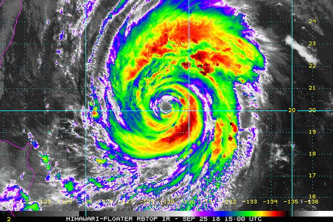
MANILA, Philippines – Typhoon Paeng (Trami) slightly weakened on Tuesday evening, September 25, while continuing its slow movement.
In a bulletin issued 11 pm on Tuesday, the Philippine Atmospheric, Geophysical, and Astronomical Services Administration (PAGASA) said Paeng now has maximum winds of 190 kilometers per hour (km/h) from the previous 200 km/h and gustiness of up to 235 km/h from the previous 245 km/h.
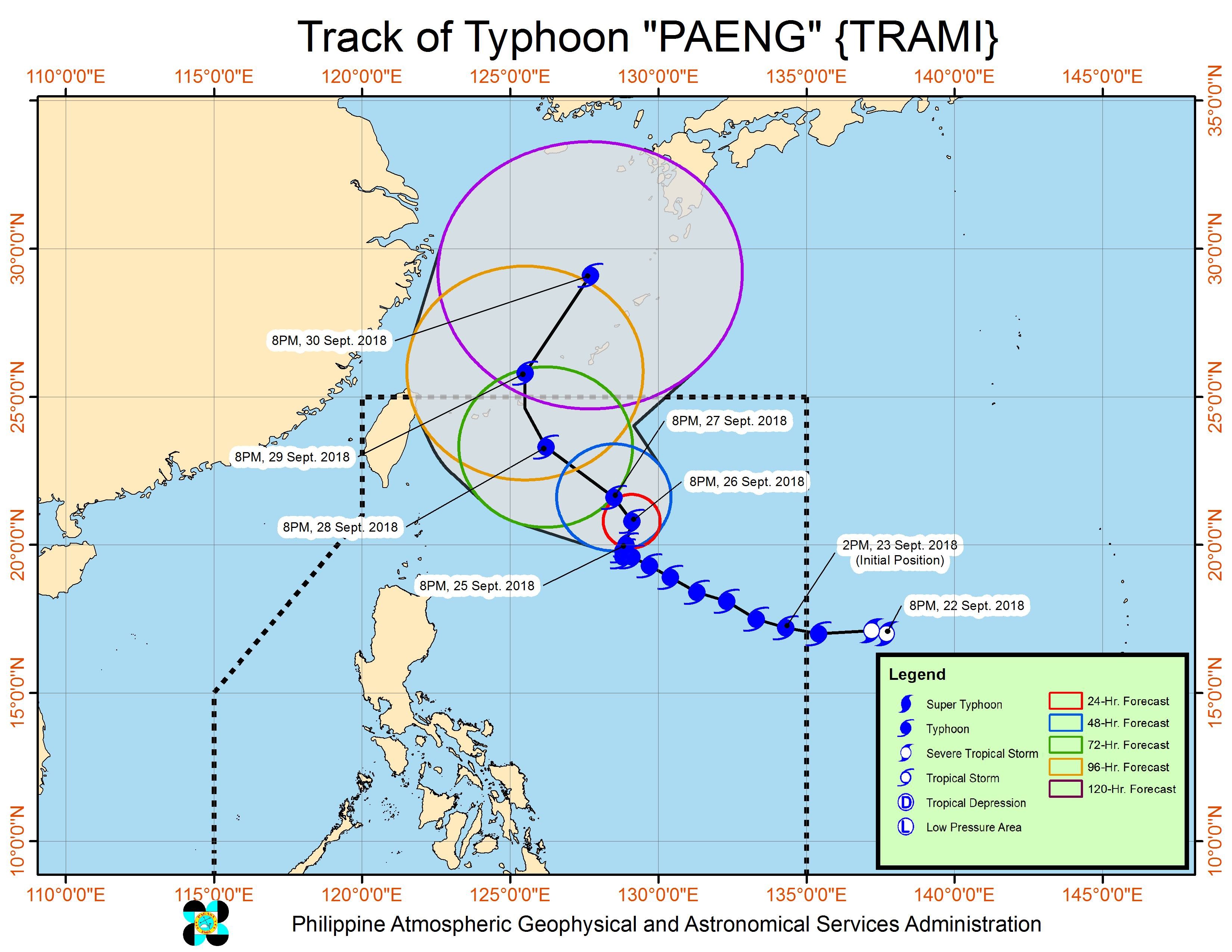
The typhoon is located 725 kilometers east of Basco, Batanes, slowly moving north northeast and veering away from land in the Philippines.
There are no areas under tropical cyclone warning signals, and signals are unlikely to be raised given Paeng’s path away from land.
But light to moderate rain could hit Northern Luzon on Friday, September 28. (READ: FAST FACTS: Tropical cyclones, rainfall advisories)
PAGASA also warned that sea travel remains risky in the northern and eastern seaboards of Luzon and in the eastern seaboard of the Visayas.
A gale warning was issued at 5 pm on Tuesday for Batanes, the Babuyan Group of Islands, Calayan, the northern coast of Cagayan, the northern coast of Ilocos Norte, Isabela, Aurora, the eastern coast of Cagayan, the eastern coast of Sorsogon, the eastern coast of Quezon including Polillo Island, Camarines Norte, Camarines Sur, Catanduanes, Northern Samar, and Eastern Samar.
Seas off those areas are rough to very rough, with wave heights reaching 2.8 meters to 4.5 meters.
PAGASA advised fishermen and others with small vessels not to set sail in areas covered by the gale warning. Larger vessels should watch out for big waves.
Based on its latest forecast track, Paeng could leave the Philippine Area of Responsibility on Saturday, September 29.
Paeng is the Philippines’ 16th tropical cyclone for 2018. The country usually gets an average of 20 tropical cyclones per year. (READ: LIST: PAGASA’s names for tropical cyclones in 2018)
Parts of Luzon are still reeling from the impact of Typhoon Ompong (Mangkhut), which left over a hundred people dead and caused destruction in provinces up north. Dozens of people remain missing. (READ: Areas under state of calamity due to Typhoon Ompong)
PAGASA declared the start of the rainy season last June 8. – Rappler.com
Add a comment
How does this make you feel?
There are no comments yet. Add your comment to start the conversation.