SUMMARY
This is AI generated summarization, which may have errors. For context, always refer to the full article.

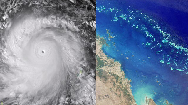
SYDNEY, Australia – Australia’s Barrier Reef coast was Saturday, April 12, taking a battering from a tropical cyclone which knocked out power and phones, but no deaths or major devastation had been reported.
Queensland state Premier Campbell Newman said the focus was now on assessing how quickly electricity and communications could be restored.
Heavy rain and gales from tropical cyclone Ita continued to lash the far north.
But the storm was downgraded from the strongest category 5 before it made landfall Friday night, April 11, to two Saturday morning.
Roofs were ripped off two homes and a pub in the coastal resort of Cooktown, where several trees were uprooted during the night, officials said.
Ita crossed the coast near Cape Flattery late Friday as a category 4 with winds up to 230 kilometres per hour (140 miles per hour) near the core and tracked south across the state.
Newman warned there remained a potential for some destruction on Saturday.
“There will be a lot of damage potentially to people’s property,” he told ABC radio.
Both the 1,000 strong Aboriginal community of Hope Vale and Cooktown, population 2,400, had lost power.
“We’ve really got to this morning assess how swiftly we can get the power and telecommunications back on in these communities,” Newman said.
Cyclone warnings remained in force for coastal areas from Cape Flattery to Cardwell, including Cooktown and the major Barrier Reef resorts of Port Douglas and Cairns, 1,700 kilometres (1,060 miles) north of Brisbane.
At 9:00 am (2300 GMT Friday) the Bureau of Meteorology said Ita was 120 kilometres northwest of Cairns and moving south at 11 kilometres an hour.
‘Still packing a fair punch’
Winds gusting up to 130 kilometres per hour were forecast to hit towards Port Douglas later Saturday morning, with gusts up to 110kph as far south as Cairns and surrounding inland areas.
Tropical storms are common in northeastern Australia. Before weakening offshore, Ita had threatened to be stronger but not as widespread as the monster Cyclone Yasi system that tore through the region just over 3 years ago, ripping homes from their foundations and devastating crops.
The Bureau of Meteorology also warned of heavy rainfall possibly leading to flash flooding and coastal inundation from a storm surge.
The possibility of dangerous surges prompted warnings for people to evacuate parts of Cairns, with the ABC reporting that 30,000 people had been advised to seek shelter elsewhere.
Cooktown Mayor Peter Scott told Australian Associated Press he felt relieved as he had feared waking to widespread devastation.
“There’s a lot of vegetation on the road and we’ve unfortunately seen some buildings damaged,” he said.
“But there hasn’t been a lot of structural damage.”
Local woman Diana Spiker spent the morning walking her dog and had also expected far worse.
“They were talking about a category 5 at one stage so I thought there would have been a lot more damage,” she said.
The bureau’s Ken Kato said Ita was likely to be downgraded to a category one system or tropical low later on Saturday.
He expected the cyclone to head out “into the Coral Sea somewhere off the north tropical coast” during the day.
“But it’s still packing a fair punch,” Mr Kato added. – Rappler.com
Add a comment
How does this make you feel?
There are no comments yet. Add your comment to start the conversation.