SUMMARY
This is AI generated summarization, which may have errors. For context, always refer to the full article.
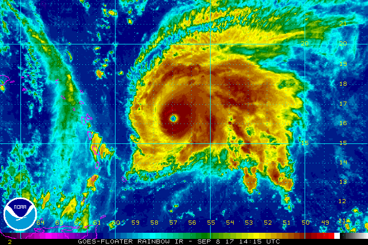
MIAMI, USA (UPDATED) – Hurricane Jose strengthened to a powerful Category 4 storm Friday, September 8, as it followed in the path of Hurricane Irma, US weather forecasters said.
The “extremely dangerous” storm was located in the Atlantic Ocean 415 miles (670 kilometers) east of the Leeward Islands, the National Hurricane Center said.
The storm was packing sustained winds of 150 miles (240 kilometers) per hour as it moved west-northwest at 18 miles (30 kilometers) per hour, the NHC said at 1500 GMT.
“On the forecast track, the center of Jose will pass near or east of the northeastern Leeward Islands on Saturday,” the NHC said.
Ocean swells “likely to cause life-threatening surf and rip current conditions” are expected to affect portions of the Leeward Islands later Friday, the NHC said.
Hurricane conditions are also possible on Caribbean islands including Antigua, Barbuda, and Anguilla on Saturday, September 9.
Jose follows Irma, a powerful Category 5 hurricane tearing across the Caribbean towards to Florida.
Further west, Hurricane Katia was also upgraded Friday to a Category Two storm as it churned towards the eastern coast of Mexico.
Mexico’s National Water Commission meteorological authority said Katia picked up strength as it swirled in the Gulf of Mexico 127 miles (205 kilometers) from the major port city of Veracruz. – Rappler.com
Add a comment
How does this make you feel?
There are no comments yet. Add your comment to start the conversation.