SUMMARY
This is AI generated summarization, which may have errors. For context, always refer to the full article.

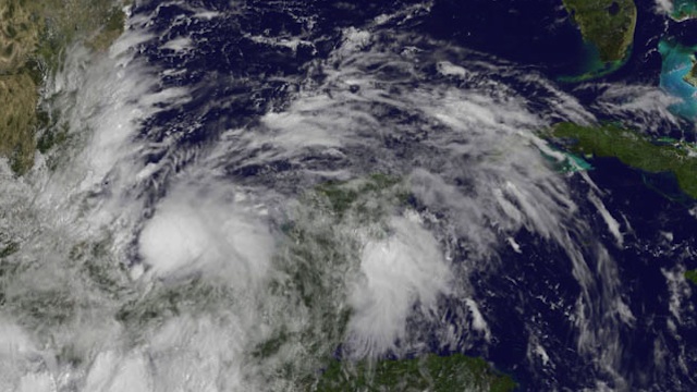
MIAMI, USA – Ingrid became the 2nd hurricane of the 2013 season on Saturday, September 15, US forecasters said, with authorities in Mexico making emergency plans ahead of likely life-threatening conditions when it makes landfall.
The Miami-based National Hurricane Center said in a 2100 GMT bulletin (5 am, Philippine time) that Ingrid was packing maximum sustained winds of 75 miles (125 km) per hour, and was headed northward at seven miles per hour.
The hurricane was located 195 miles (315 km) east of Tuxpan, off Mexico’s Gulf Coast, with the bulletin noting that the Mexican government had declared a hurricane watch from Cabo Rojo to La Pesca.
Ingrid was later expected to turn toward the northwest and then westward on Sunday with winds strengthening further before the hurricane is anticipated to reach the coast on Monday, the NHC said.
Forecasters said Ingrid would likely dump 10 to 15 inches (25-38 cm) of rain over a large part of eastern Mexico, though some mountainous areas could experience up to 25 inches of rainfall.
Such rains “are likely to result in life-threatening flash floods and mudslides,” the latest NHC bulletin said, with a dangerous storm surge capable of raising water levels as much as two- to 4-feet above normal, with large and destructive waves predicted along the coast within 48 hours.
Mexico’s state-owned oil company Pemex said late Thursday, September 12, that it had preemptively suspended “sea and air operations” in the area although rigs in the region continued to operate.
Heavy rain has lashed Veracruz this week, killing 14 people, including 13 of whom died when a landslide crushed their homes in a mountainous region of the Gulf Coast state.
Mexico’s National Weather Service said torrential rains were expected in the states of Chiapas, Guerrero, Tabasco, Veracruz and Oaxaca.
The NHC meanwhile said Tropical Storm Manuel, also carrying life-threatening flash floods, should be near the southwestern Mexican coast by early Sunday.
Manuel is moving northward at near 7 miles per hour, packing maximum winds of 50 miles (75 km) per hour, and is located 85 miles (135 km) south-southwest of Lazaro Cardenas, in Michoacan state. – Rappler.com
Add a comment
How does this make you feel?
There are no comments yet. Add your comment to start the conversation.