SUMMARY
This is AI generated summarization, which may have errors. For context, always refer to the full article.
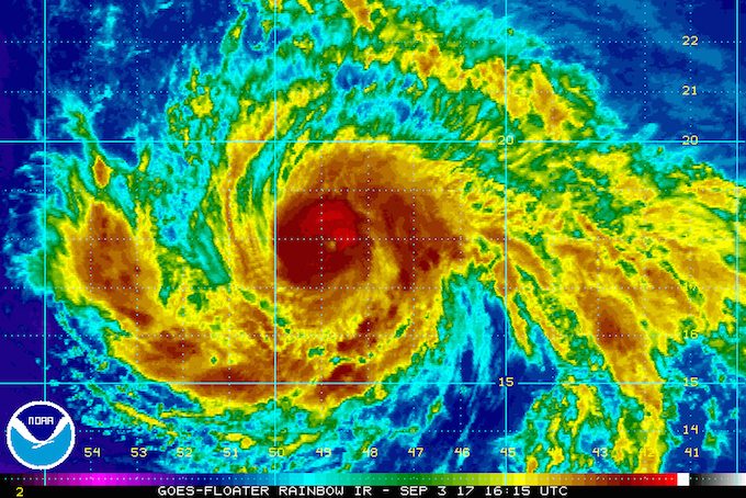
MIAMI, USA (UPDATED) – Hurricane Irma, already a major hurricane, churned Sunday, September 3, on course for the northern Caribbean and was due to strengthen before it nears landfall late Tuesday, September 5, weather forecasters said.
A hurricane watch is in effect for Antigua, Barbuda, Anguilla, Montserrat, St Kitts, and Nevis; Saba, St Eustatius, and Sint Maarten; Saint Martin and Saint Barthelemy.
At 0300 GMT Monday, September 4, the storm was packing top sustained winds near 115 mph (185 km/h), the National Hurricane Center in Miami said.
The storm, on the heels of Hurricane Harvey’s devastation in the United States, is moving toward the west-southwest near 14 mph (22 km/h).
“Some strengthening is forecast during the next 48 hours, as it continues moving into waters generally a bit warmer,” the center said.
On the forecast track, Irma’s eye is expected to approach the northern Leeward Islands late Tuesday, the NHC said.
“Swells generated by Irma will begin affecting the northern Leeward Islands on Monday. These swells are likely to cause life-threatening surf and rip current conditions,” it warned. – Rappler.com
Add a comment
How does this make you feel?


There are no comments yet. Add your comment to start the conversation.