SUMMARY
This is AI generated summarization, which may have errors. For context, always refer to the full article.
On Mahar Lagmay: It’s been a longtime advocacy of his to make weather data accessible to everyone.
What finally led to this project?
By working on disaster management for the past 8 years, we learn a lot from observing what happened.
The president instructed DOST to put in place a responsive program to address our problem with disasters. DOST accepted that and got the help of scientists from UP and they’re now implanting Project Noah.
What is Project Noah?
We have a website, it seeks to showcase what Noah can deliver but it’s not the only way to deliver information. We want to use other platforms like the DOST disaster channel, radio, SMS, social networking, Twitter, Facebook. The info that we want to deliver are reliable, accurate, timely information. Eventually it’s going to move on to also address other hazards like landslides, earthquakes. What we want to do is to use the best technology, the best science, to disseminate data and bring them to communities. We want to empower the LGUs and communities.
What specific type of information can people get?
Not just weather data, but flood maps, for every watershed. Noah has been around for about 2 months, we will complete everything by 2013. As of the moment we got the website up, we can start with an overview. If you want to look at weather conditions of the Philippines, you can zoom into the Philippines, the website gives an overview of satellite data. If you look at the Doppler, we have ground stations in Subic, Tagaytay, Cebu. All of this data come from PAGASA. This is a PAGASA Noah project.
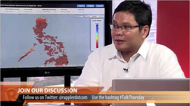
[Indicates map on screen] What you’re seeing is the map of the Philippines. Satellite data shows cloud pattern in and around the Philippines. Red areas (in the map show) rains. If you look at Doppler data, we have streaming online data from Subic. If we zoom in to Quezon City for example, you see clouds hovering above us. They’re not just images, they’re images with content. You see green parts and red parts which are areas that are going to experience rainfall. If you want to see if there’s going to be a thunderstorm, you have tools to see them.
The system delivers data every 10-15 minutes.
[indicates map on screen] You can also see land map of Marikina, creations of high resolution topographic maps. Red points on the map mean the flood level is above the head.
You can see information down to the street level.
We need high-resolution flood hazard maps because we want people to know flood hazards in their areas, so they can see their houses and other hazards in relation to their area.
If they’re aware, it’s the first step towards avoiding disaster. If they’re not aware, they may not be able to do something about it.
If people want to prepare and the government does not deliver, it will fail.
It’s an effort which should be participated in by everybody, not just the government, because no single group of agency can handle the disaster. We need the private sector, civiil society organization, government institutions, LGUs.
It’s highly important that we teach people how to use the Noah website. We instruct through DOST; last week I was in Cagayan de Oro to talk about Noah. If they don’t know how to use critical information, we’re just going to have a repeat of the disasters.
How will the system be used for decision making?
It’s a real time tool for critical information which people can use for critical decision making. It’s not only applicable to disasters. There are probability maps too. Ex, In San Jose del Monte, there’s a probability of rain in 6 hours. You can expect what weather conditions will be in those times.
Applications: knowing when best to plant rice, go out into see, wash clothes, etc.
On the accuracy of the information
Nothing is for sure, but we try our best to fix things. We know that from the lessons learned in past disasters, we need to use science and advanced technology. We put up sensors for the entire Philippines. We’re going to add another 1000 sensors. If you want an overview of weather conditions, you can see that. This kind of information are things that we saw were lacking before.
Usage on the barangay level
People can use the maps to know where there are possible floods. So if you know where the places are, you’d be able to know where to put your search and rescue teams, identify where the hospitals are, etc.
Flood maps are tools for development planning. Disasters are now treated as product of failure of planning.
It’s a developmental issue. It’s not just a one-off extreme event where you just act accordingly, we don’t want to treat disasters that way. We want to be smart, use our intelligence to be able to mitigate the high number of casualties during disasters.
[Question from social media] Are LGUs technically equipped? We just started, we have a new information campaign. Give us time, we’re just a little bit more than 2 1/2 months.
Our directive is to warn low-lying areas 6 hours in advance. We’re using rain gauge data, internet, other tools.
[Usage of SMS alerts] It can be a service for people to subscribe to. But he says some people may not mind SMS alerts, so interest is key. Awareness is key to mitigating disasters.
What happens if the telcos, internet, or electricity go down?
For the sensors, they have backups. They can update through SMS. If that fails, they can use radio. If that fails, there’s satellite.
Data/maps are hosted on Google servers.
If there’s no internet/power, is there a way to notify the LGUs?
Lagmay says they are experimenting with super wi-fi: the TV white space (the static part) is unused bandwidth. We have made the technology to get this unused bandwidth and convert it to internet bandwidth. We’re looking into that to deliver info to provinces with TV signal and that unused white space can be used.
Are we now moving to a culture of safety?
We’re trying. It’s a system of how a society treats disasters/natural hazards. We must be conscious of what happens. Remember that knowledge is power.
Final words
Expect us to work hard, the task at hand is very hard, we’re still trying to see how to deliver information in the best way possible. Government is trying to. We’re putting together the best minds that we can get. – Rappler.com
Add a comment
How does this make you feel?
There are no comments yet. Add your comment to start the conversation.