SUMMARY
This is AI generated summarization, which may have errors. For context, always refer to the full article.
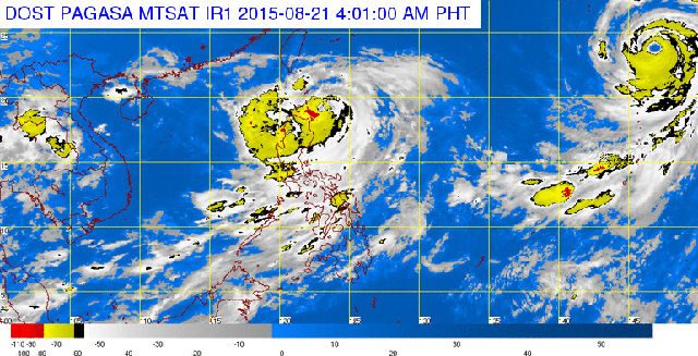
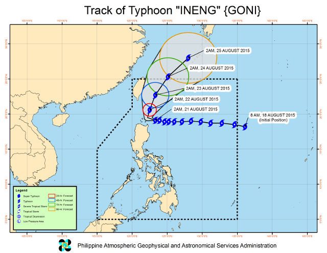
MANILA, Philippines – According to state weather service PAGASA, Typhoon Ineng (international codename Goni has slowed down further while maintaining its strength. The typhoon continues to pose a threat over the Batanes-Cagayan Area.
As of the latest updates, Typhoon Ineng was located 170 km east of Calayan, Cagayan, with maximum winds of 170 km/h, and gustiness of 205 km/h.
It is currently forecast to move west-northwest at a rate of 7 km/h, and is expected to be around 60 km east-northeast of Basco, Batanes within 24 hours.
The following public storm warning signals are in effect:
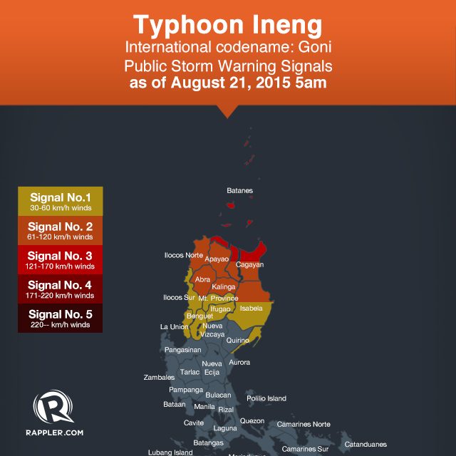
Signal No 3:
- Batanes Group of Islands
- Northern Cagayan including Babuyan and Calayan Group of Islands
Signal No 2:
- Rest of Cagayan
- Northern Isabela
- Kalinga
- Apayao
- Abra
- Ilocos Norte
Signal No 1:
- Rest of Isabela
- Ifugao
- Mt. Province
- Benguet
- La Union
- Ilocos Sur
The estimated rainfall amount will be moderate to heavy within the 600 km diameter of the typhoon, with enhanced “Habagat” bringing monsoon rains over Central Luzon and occasional rains over Metro Manila, CALABARZON, MIMAROPA, and Western Visayas.
Storm surges of up to two meters are possible over coastal areas with public storm warning signals 3 and 2. Fisherfolk are advised not to venture out over the eastern seaboards of Central Luzon, the seaboards of Southern Luzon, and the eastern seaboard of Visayas. – Rappler.com
Add a comment
How does this make you feel?
There are no comments yet. Add your comment to start the conversation.