SUMMARY
This is AI generated summarization, which may have errors. For context, always refer to the full article.
What’s the weather like in your area? Report the situation through Rappler’s Agos or tweet us at @rapplerdotcom.
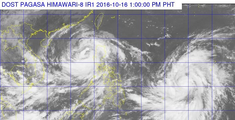
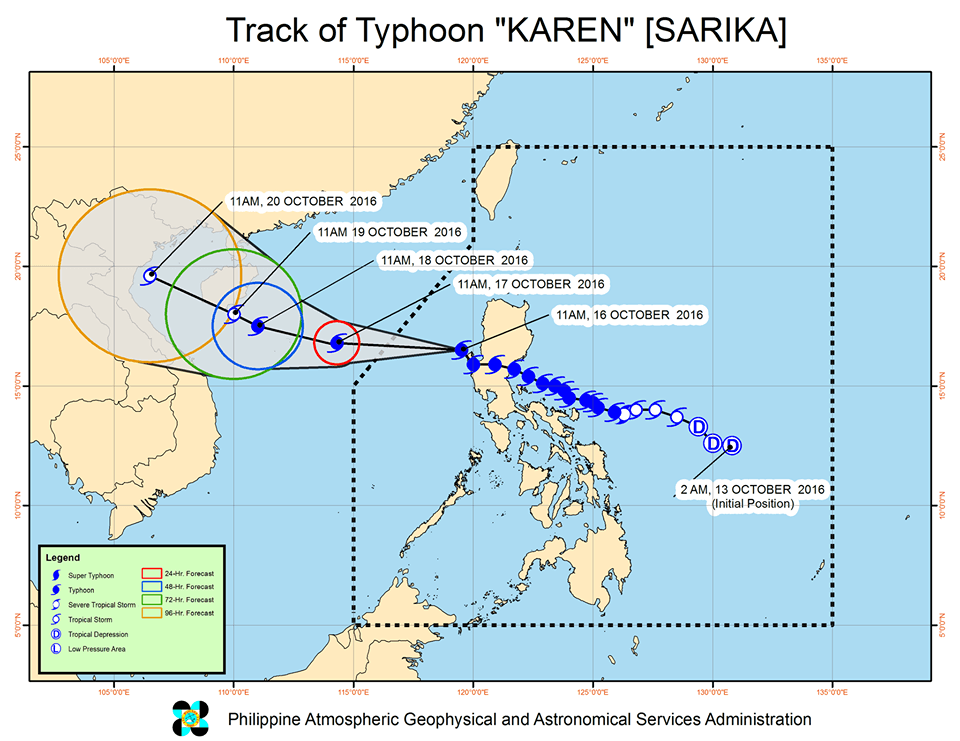
MANILA, Philippines – Typhoon Karen (Sarika) slightly accelerated early Sunday afternoon, October 16, and is now over the coastal waters of Pangasinan.
In its bulletin issued 2 pm on Saturday, state weather bureau PAGASA said Karen was already 175 kilometers west northwest of Dagupan City, Pangasinan. It is moving west northwest at 24 kilometers per hour (km/h) from the previous 22 km/h.
Karen maintained its strength, with maximum winds of up to 120 km/h and gustiness of up to 200 km/h.
It earlier made landfall in Baler, Aurora at 2:30 am on Sunday. (WATCH: VIDEO: Aftermath of Typhoon Karen in Baler, Aurora)
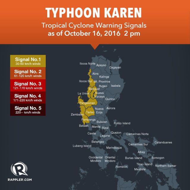
As of 2 pm, there are no more areas under signal numbers 2 and 3. The following provinces, meanwhile, are under signal number 1:
- Ilocos Sur
- Pangasinan
- Tarlac
- Zambales
- Benguet
- La Union
These provinces should continue to watch out for floods and landslides, as moderate to heavy rain is still expected within the 400-km diameter of the typhoon.
On Saturday, October 15, 199.5 millimeters (mm) of rain were recorded in Daet, Camarines Norte, the highest for the day.
Last Friday, October 14, Karen had dumped more than a month’s worth of rains in Catanduanes. PAGASA’s Virac Radar showed 406.55 mm of rain on Friday alone. The monthly average is just 393.5 mm.
The state weather bureau also warned that sea travel in the seaboards of Luzon remains risky.
Karen had caused the cancellation of domestic and international flights.
The typhoon is expected to leave the Philippine Area of Responsibility (PAR) on Monday, October 17, between 1 am and 3 am. (Read our live blog here.)
Severe Tropical Storm Haima
After Karen leaves, however, another tropical cyclone will enter PAR on Monday afternoon.
Severe Tropical Storm Haima is currently located 1,575 km east of the Visayas. It will be given the local name Lawin when it enters PAR.
PAGASA forecaster Benison Estareja earlier said that if Haima’s path stays the same, the severe tropical storm will likely target Luzon. The exact areas, however, cannot be pinpointed yet as Haima is still too far from the country. – Rappler.com
Add a comment
How does this make you feel?
There are no comments yet. Add your comment to start the conversation.