SUMMARY
This is AI generated summarization, which may have errors. For context, always refer to the full article.
What’s the weather like in your area? Report the situation through Rappler’s Agos or tweet us at @rapplerdotcom.
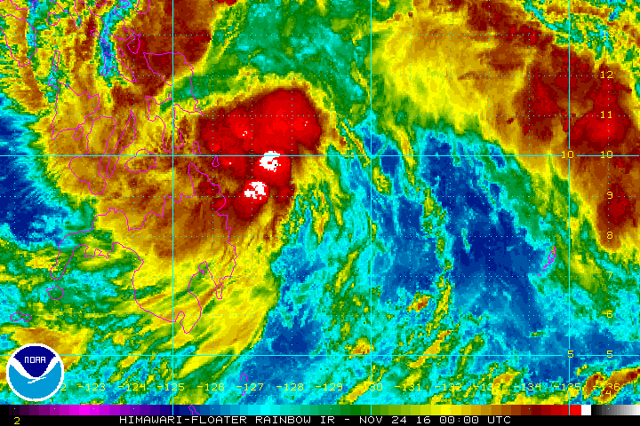
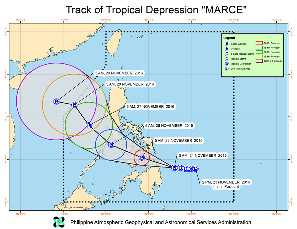
MANILA, Philippines – More areas were placed under signal number 1 as Tropical Depression Marce moved closer to the Surigao provinces, where it is expected to make landfall on Thursday, November 24.
In its bulletin issued 8 am on Thursday, state weather bureau PAGASA said Marce is 175 kilometers east northeast of Hinatuan, Surigao del Sur. It is still moving west northwest at 17 kilometers per hour (km/h).
Marce continues to have maximum winds of up to 45 km/h and gustiness of up to 55 km/h.
Signal number 1 is now raised in the following areas:
- Romblon
- Cuyo Island
- Leyte
- Southern Leyte
- Bohol
- Cebu including Bantayan and Camotes Islands
- Siquijor
- Negros Oriental
- Negros Occidental
- Iloilo
- Capiz
- Aklan
- Antique
- Guimaras
- Surigao del Norte including Siargao Island
- Surigao del Sur
- Dinagat Islands
- Agusan del Norte
- Agusan del Sur
- Misamis Oriental
- Camiguin
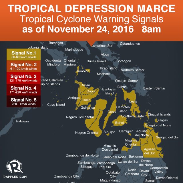
Moderate to heavy rainfall is expected within the 300-km diameter of the tropical depression. Floods and landslides are possible in areas under signal number 1.
PAGASA said Marce is expected to make landfall in the Surigao provinces on Thursday afternoon or early evening.
It is expected to leave the Philippine Area of Responsibility (PAR) on Monday morning, November 28.
With Marce affecting the country, sea travel is risky over the northern seaboard of Northern Luzon.
– Rappler.com
Add a comment
How does this make you feel?
There are no comments yet. Add your comment to start the conversation.