SUMMARY
This is AI generated summarization, which may have errors. For context, always refer to the full article.
What’s the weather like in your area? Report the situation through Rappler’s Agos or tweet us at @rapplerdotcom.
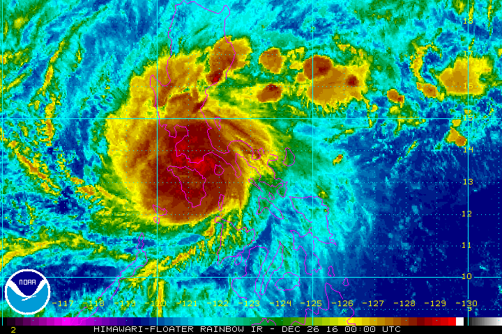
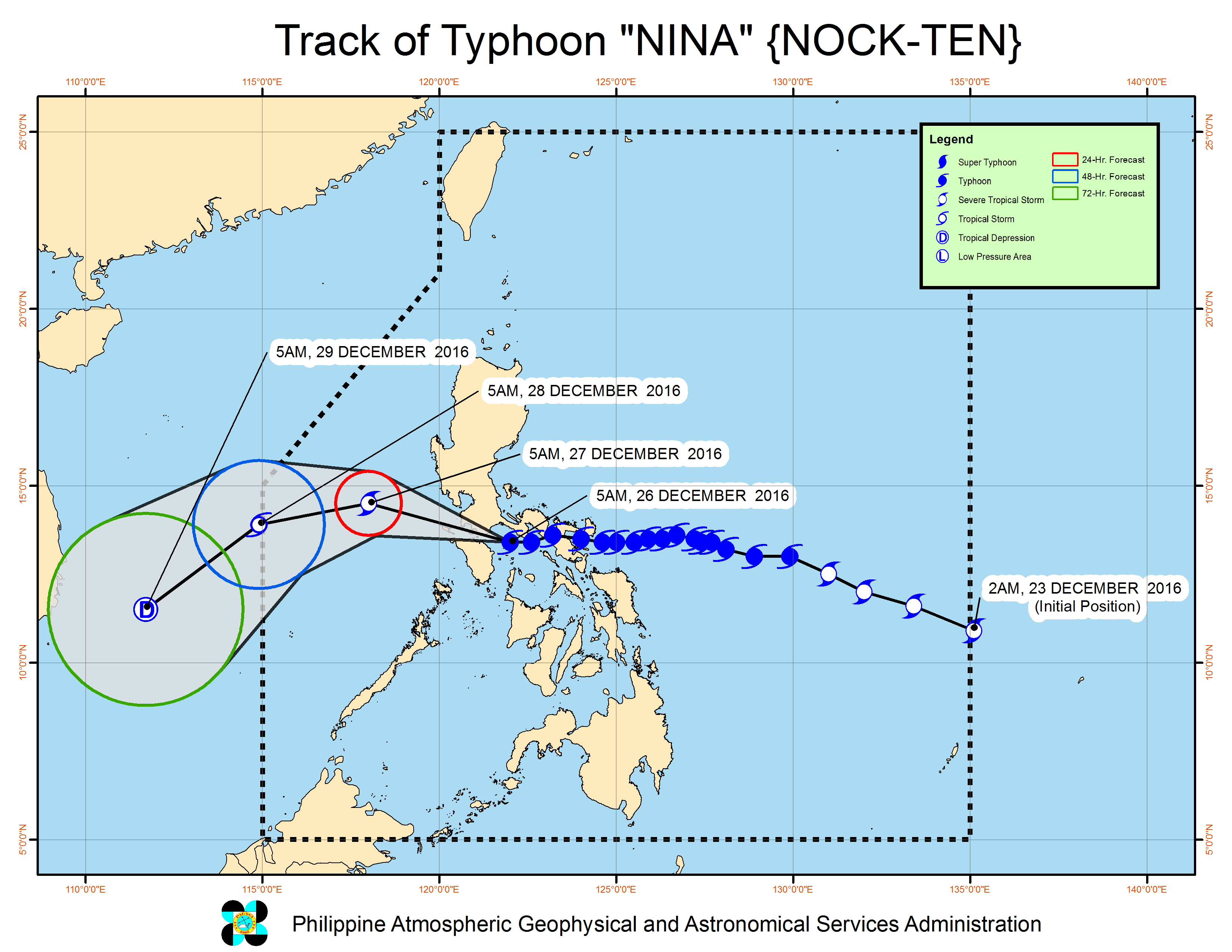
MANILA, Philippines – Typhoon Nina (Nock-ten) weakened further as it moved toward southern Batangas early Monday morning, December 26.
In a bulletin issued 8 am on Monday, state weather bureau PAGASA said Nina is already 60 kilometers south of Tayabas, Quezon. It maintained its speed, moving west northwest at 20 kilometers per hour (km/h).
The typhoon now has maximum winds of up to 140 km/h (from 150 km/h) and gustiness of up to 230 km/h (from 250 km/h).
Nina had made its 1st landfall in Bato, Catanduanes at 6:30 pm on Sunday, December 25. Catanduanes Governor Joseph Cua said his entire province lost electricity after the typhoon hit land.
Nina then made its 2nd landfall in Sagñay, Camarines Sur around 9:30 pm on Sunday; followed by its 3rd landfall in San Andres, Quezon at 2 am on Monday; and then its 4th landfall in Torrijos, Marinduque at 4:30 am.
Its 5th landfall will be in southern Batangas, and then it will head for Cavite.
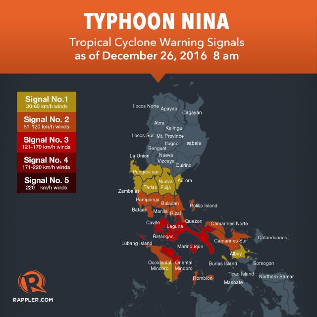
Below is the full list of areas under warning signals.
Signal number 3:
- southern Quezon
- Marinduque
- Batangas
- northern Oriental Mindoro
- Lubang Island
- Cavite
- Laguna
Signal number 2:
- Metro Manila
- Rizal
- northern Quezon including Polillo Island
- Bulacan
- Bataan
- Pampanga
- southern Zambales
- rest of Oriental Mindoro
- Romblon
- northern Occidental Mindoro
- Camarines Norte
- Camarines Sur
Signal number 1:
- rest of Occidental Mindoro
- rest of Zambales
- Tarlac
- Nueva Ecija
- southern Aurora
- Pangasinan
- Albay
- Burias Island
Moderate to heavy rain is being experienced within Nina’s 400-km diameter, which could bring floods and landslides. Strong winds may damage medium- to high-risk structures, uproot trees, and destroy crops, added PAGASA.
Metro Manila also started feeling the effects of Nina early Monday, with the typhoon bringing moderate to heavy rain.
Sea travel, meanwhile, remains risky in the seaboards of Luzon.
Nina is expected to leave the Philippine Area of Responsibility (PAR) on Wednesday, December 28.
– Rappler.com
Add a comment
How does this make you feel?
There are no comments yet. Add your comment to start the conversation.