SUMMARY
This is AI generated summarization, which may have errors. For context, always refer to the full article.
What’s the weather like in your area? Report the situation through Rappler’s Agos or tweet us at @rapplerdotcom.
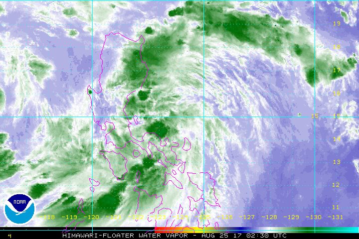
MANILA, Philippines (UPDATED) – Tropical Storm Jolina (Pakhar) intensified further late Friday morning, August 25, as it moved closer toward the Isabela-Aurora area.
In a bulletin issued 11 am on Friday, state weather bureau PAGASA said Jolina is already 210 kilometers southeast of Casiguran, Aurora, still moving west northwest at 19 kilometers per hour (km/h).
The tropical storm now has maximum winds of 80 km/h and gustiness of up to 95 km/h.
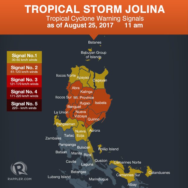
Signal number 2 is raised over the following areas:
- Isabela
- northern Aurora
- Quirino
- Kalinga
- Mountain Province
- Ifugao
- Ilocos Sur
- Benguet
- Abra
- La Union
- Nueva Vizcaya
Signal number 1, meanwhile, is up in:
- Cagayan including Babuyan Group of Islands
- Apayao
- rest of Aurora
- Ilocos Norte
- Nueva Ecija
- Pangasinan
- northern Quezon including Polillo Island
- Catanduanes
- Camarines Norte
- Camarines Sur
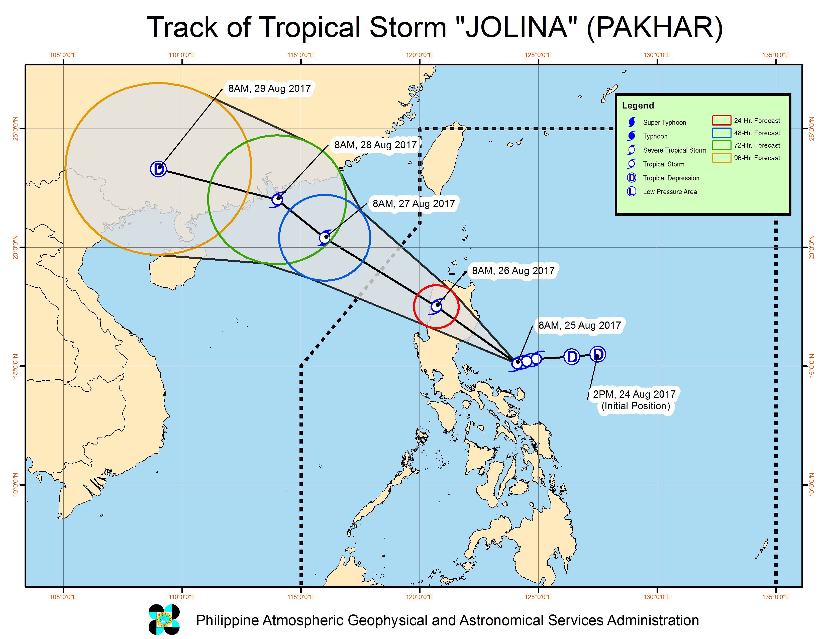
PAGASA said Jolina will strengthen again before making landfall in the Isabela-Aurora area on Friday evening, between 8 pm and 10 pm. (READ: Isabela prepares for Tropical Storm Jolina’s landfall)
PAGASA Deputy Administrator for Operations and Services Landrico Dalida Jr said in a news briefing late Friday morning that provincial officials have been informed of Jolina’s expected landfall.
After making landfall, the tropical storm will cross Northern Luzon, particularly Aurora, southern Isabela, Quirino, Nueva Vizcaya, Ifugao, Benguet, Mountain Province, La Union, and Ilocos Sur.
Jolina will then exit landmass on Saturday morning, August 26, then leave the Philippine Area of Responsibility (PAR) either Saturday evening or early Sunday morning, August 27.
“Hindi natin ine-expect na magiging typhoon ito sa Pilipinas,” PAGASA Weather Division chief Esperanza Cayanan said in the news briefing. (We don’t expect it to become a typhoon while here in the country.)
While Jolina is in PAR, it is also enhancing the southwest monsoon, which is affecting Luzon and the Visayas.
PAGASA warned Northern Luzon, Central Luzon, and Southern Luzon – including Metro Manila and Bicol – to brace for moderate to heavy rain from Friday evening to Saturday. There could be flash floods and landslides in these areas.
The Visayas would have light to occasionally heavy rain as well.
PAGASA also warned that sea travel is risky in the seaboard of Northern Luzon and in the eastern seaboards of Central Luzon and Southern Luzon.
Storm surges are “less probable, but big waves are expected offshore,” said the state weather bureau.
PAGASA recommended the cancellation of outdoor activities along the coasts of Isabela and Aurora.
11 am briefing from PAGASA (1/2)
11 am briefing from PAGASA (2/2)
– Rappler.com
Add a comment
How does this make you feel?
There are no comments yet. Add your comment to start the conversation.