SUMMARY
This is AI generated summarization, which may have errors. For context, always refer to the full article.

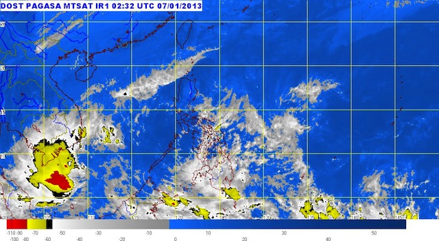
MANILA, Philippines (UPDATED) – Mindanao is bracing for more rain as the low pressure area east of the island moves closer Monday, January 7.
The LPA, embedded along the intertropical convergence zone, was last located 410 km southeast of Davao City (5.0°N, 129.0°E).
Moderate to heavy rain (5.0-15.0 mm/h) and thunderstorms are expected in Mindanao, especially in the Davao and SOCCSKSARGEN regions, due to the said weather systems, the PAGASA said.
On the other hand, the northeast monsoon, or ‘Amhian,’ continues to affect weather, particularly in northern Luzon.
Leyte and Mindanao will experience cloudy skies with moderate to heavy rain and thunderstorms, state weather bureau PAGASA said. The agency warned residents in these areas against possible landslides and flashfloods.
The rest of the Visayas and the Bicol Region, on the other hand, will have cloudy skies with light to moderate rain or thunderstorms.
Cagayan Valley will have cloudy skies with light rain, while the rest of Luzon will have partly cloudy skies with brief rain or thunderstorms.
Prevailing winds will primarily come from the northeast to north.
PAGASA 24-Hour Public Weather Forecast, 7 December 2012, 5am
– Rappler.com
Add a comment
How does this make you feel?
There are no comments yet. Add your comment to start the conversation.