SUMMARY
This is AI generated summarization, which may have errors. For context, always refer to the full article.
What’s the weather like in your area? Tweet us the situation: Use #weatheralert and tag @rapplerdotcom.
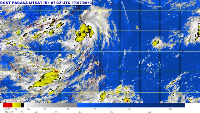
MANILA, Philippines – Isang has intensified into a tropical storm Wednesday afternoon, July 17, as it moves away from Luzon.
Isang was spotted 210 km northwest of Aparri, Cagayan (19.9°N, 120.2°E) as of 4 pm Wednesday, carrying maximum winds of 65 km/h near the center and gusts of up to 80 km/h, state weather bureau PAGASA said in its 5 pm update.
Ilocos Norte, the Calayan and Babuyan Islands, and Batanes remain under storm signal number 1. Storm warning signals elsewhere have been lowered.
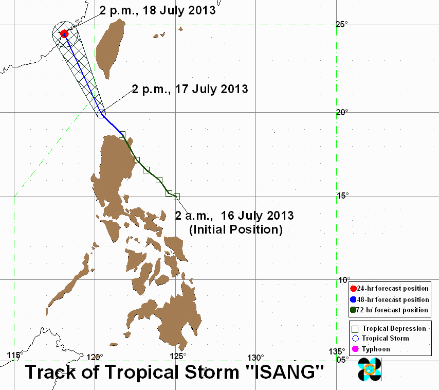
The storm continues to move away from Luzon, taking a path going northwest at 22 km/h. It is expected to be out of the Philippine Area of Responsibility (PAR) by tonight.
The southwest monsoon will continue to be enhanced by the storm, bringing light to moderate rain over the rest of Luzon and Western Visayas.
Moderate to heavy rainfall (5-15 mm/h) can be expected within the storm’s 300 km diameter.
The next bulletin on Isang will be released at 11 pm. – Rappler.com
Add a comment
How does this make you feel?
There are no comments yet. Add your comment to start the conversation.