SUMMARY
This is AI generated summarization, which may have errors. For context, always refer to the full article.
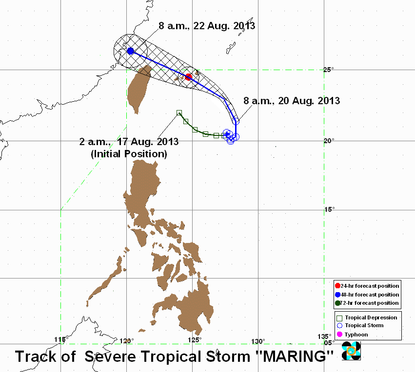
MANILA, Philippines – Tropical storm Maring (international codename Trami) will continue to enhance the southwest monsoon, even as it speeds up northward, the state weather bureau said Tuesday, August 20.
Maring was spotted 595 km east northeast of Itbayat, Batanes (21.6°N, 128.3°E) as of 10 am Tuesday, carrying maximum winds of 95 km/h near the center and gusts of up to 120 km/h, PAGASA said in its 11 am tropical cyclone alert.
After being “quasi-stationary” for the past few days, Maring is now moving north at a speed of 19 km/h, and is expected to be 460 km northeast of Itbayat by Wednesday morning.
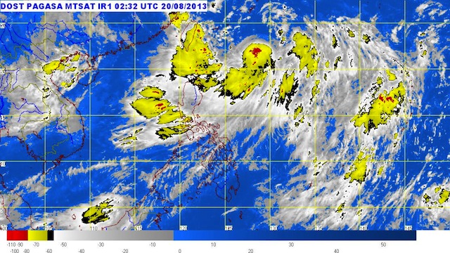
 showing its movement from 430-730 am August 20, 2013. Image courtesy of Weather Philippines")
The storm will continue to enhance the southwest monsoon, bringing moderate to heavy rain over Luzon and Western Visayas.
Within the storm’s 500 km diameter, rain is estimated to be heavy to torrential (10-40 mm/h).
Maring is expected to turn towards the direction of northern Taiwan in the next few hours. It is forecast to be 560 km northwest of Itbayat by Thursday morning, or outside the Philippine Area of Responsibility (PAR).
No public storm warning signal has been raised, the bureau added.
The next bulletin on Maring will be incorporated into the bureau’s 24-hour forecast at 5 pm, and another one at 11 pm. – Rappler.com
Add a comment
How does this make you feel?
There are no comments yet. Add your comment to start the conversation.