SUMMARY
This is AI generated summarization, which may have errors. For context, always refer to the full article.
What’s the weather like in your area? Tweet us the situation: Use #weatheralert and tag @rapplerdotcom
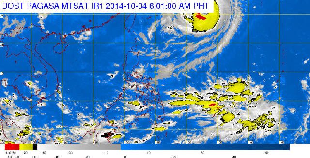
MANILA, Philippines – State weather service PAGASA announced Saturday morning, October 4, that the eye of Typhoon Neneng (International name Phanfone) was located some 1,240 kilometers Northeast of Itbayat Batanes, carrying maximum sustained winds of 175 km/h near the center and a gustiness of up to 210 km/h.
The typhoon is forecast to move Northwest at 20 km/h.
An Intertropical Convergence Zone (ITCZ) is also affecting Southern Mindanao.
As a result, Western Visayas, Zamboanga Peninsula and the province of Palawan will have cloudy skies, as well as light to moderate rainshowers and thunderstorms. Metro Manila and the rest of the country will have partly cloudy to cloudy skies, along with with isolated rainshowers or thunderstorms.
Seafarers should take note of moderate to strong winds blowing from the northeast to northwest over over the northern and eastern sections of Luzon, with strong winds also coming from the west and southwest over the eastern section of Visayas and of Mindanao.
The coastal waters along those determined areas will be moderate to rough as a result. Light to moderate winds coming from the northeast to northwest will prevail over the rest of Luzon, while light to moderate winds will also be coming from from the southwest over the rest of the country, bringing slight to moderate seas. – Rappler.com
Add a comment
How does this make you feel?
There are no comments yet. Add your comment to start the conversation.