SUMMARY
This is AI generated summarization, which may have errors. For context, always refer to the full article.
What’s the weather like in your area? Tweet us the situation: Use #weatheralert and tag @rapplerdotcom
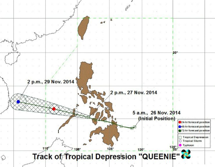
MANILA, Philippines – Tropical Depression Queenie has maintained strength as it moves over Sulu Sea and toward Palawan, state weather bureau PAGASA said.
At 4 pm Thursday, November 27, the center of the tropical depression was located at 90 km southeast of Cuyo, Palawan, with maximum winds of 55 km per hour near the center.
It will move west northwest in direction at 24 km per hour with an estimated rainfall amount of 7 to 15 mm per hour (moderate-heavy) within the 300 km diameter of the tropical depression.
Public storm warning signal number 1 is currently in effect over these areas:
- Palawan including the Calamian Group of Islands and Cuyo Islands
- Southern Negros Occidental
- Guimaras Island
- Iloilo
- Antique
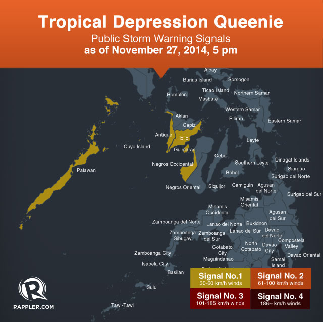
In these areas, as well as in Romblon and Mindoro, residents living in low lying and mountainous places are warned against possible flashfloods and landslides. Fisherfolks should avoid venturing out over the seaboards of Palawan and the western seaboard of Visayas.
PAGASA lowered the storm signals elsewhere.
Queenie will cross mainland Palawan on Thursday evening, and will be at 330 km west northwest of Puerto Princesa City by Friday afternoon, November 28.
It will exit the western border of the Philippine Area of Responsibility between 7 pm and 8 pm Friday, and will be at 930 km west northwest of Puerto Princesa by Saturday afternoon, November 29.
The next bulletin on Queenie will be issued at 11 pm Thursday. – Rappler.com
Add a comment
How does this make you feel?
There are no comments yet. Add your comment to start the conversation.