SUMMARY
This is AI generated summarization, which may have errors. For context, always refer to the full article.

MANILA, Philippines – Ride-hailing platform Grab and the World Bank have teamed up to launch a big data-based initiative to help decongest the country’s traffic.
The partnership produced the OpenTraffic Initiative, launched on Tuesday, April 5. It is designed to provide real-time data to traffic management agencies and city planners.
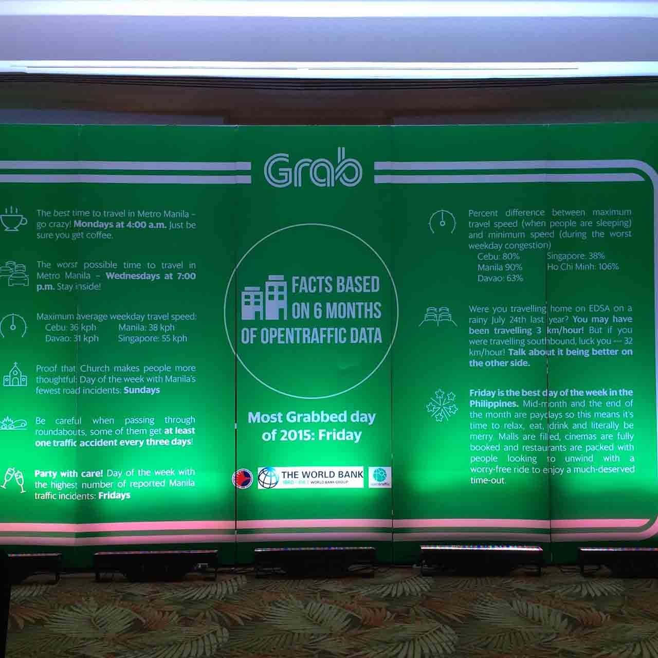
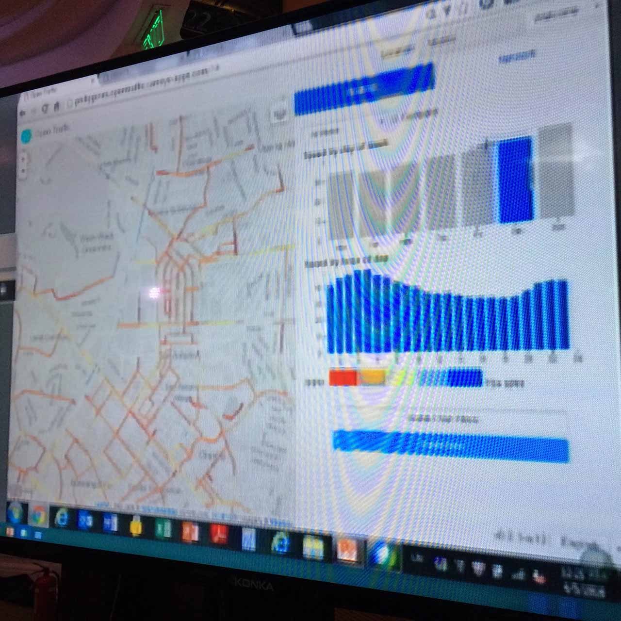
The open source platform uses GPS data taken from smartphones in Grab’s vehicles and translates it into traffic statistics which include speeds, flows, and delays at intersections.
This is done real-time with data transmitted every 6 seconds.
The data is then compiled in the OpenTraffic platform where information can be used by government agencies to study critical areas in traffic management.
These areas include peak hour analysis along key streets, travel time reliability, and street vulnerability to bad weather and traffic accidents.
“If governments can see precisely what traffic congestion looks like in the Philippines, it can alleviate its impact by optimizing traffic signals, revising the planning of public transportation routes and schedules, and making effective decisions for implementation of key infrastructure such as overpasses,” said Deevya Desai, Grab’s regional head of public affairs, at the platform’s launch.
In addition, Grab and the World Bank plan to integrate another open source tool called DRIVER, by late May, which will provide real-time notifications of traffic incidents to government agencies.
The application is designed to help governments identify and prioritize cash-prone areas and allow for faster response times.
While the Philippines was chosen as the initial country to pilot the project, Grab and the World Bank plan to eventually make it available to all governments throughout Southeast Asia.
“Through this initiative, the Philippines will leapfrog traditional approaches to road safety, traffic management, and planning,” said Holly Krambeck, senior transportation specialist at the World Bank.
From calculators to Excel sheets
The newly launched platform will be made available to the government at zero cost. The World Bank and the Department of Transportation and Communications (DOTC) have trained 200 government staff from different agencies to use it.
The initial agencies with personnel trained include the Metropolitan Manila Development Authority (MMDA), Philippine National Police (PNP), Department of Public Works and Highways (DPWH), and the Cebu City Transportation Office
“As they say whoever controls information controls decision-making. Once you have timely and reliable info, then decision-making and implementations become easy,” said DOTC Undersecretary for Planning Rene Limcaoco.
Limcaoco said the agencies will initially use the data to focus on travel patterns and durations so that they can get an accurate picture of where the demand for transportation is and to which specific destinations.
With that information, he added, “the government can then plan and implement through the Land Transportation Franchising and Regulatory Board (LTFRB), more responsive public transportation policies and/or new rules.”
The upgrade was needed because, until recently, the government’s major source of traffic data came from manual surveys. Limcaoco pointed out that these surveys ran the risk of being obsolete once completed due to the length of time needed to conduct them.
“It’s like moving from manual calculators to Excel,” he said.
Real-time data, however, is not a panacea to all of the country’s data collection woes, according to Ricardo Sigua, director of the UP Institute of Civil Engineering.
It is a good indication of the level of usage of roads but to fully understand traffic, other variables involved such as traffic law and density should also be considered, he explained.
“Most of the data for this platform will be gathering from Grab drivers which is a subset of road users. To have an overall assessment of what’s going on, on the road, we need to complement this project with other activities,” Sigua said. – Rappler.com
Add a comment
How does this make you feel?
There are no comments yet. Add your comment to start the conversation.