SUMMARY
This is AI generated summarization, which may have errors. For context, always refer to the full article.
What’s the weather like in your area? Report the situation through Rappler’s Agos or tweet us at @rapplerdotcom.
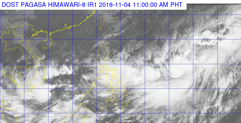
MANILA, Philippines – The tropical storm and tropical depression which are both outside the Philippine Area of Responsibility seem to be moving away from PAR, based on their latest forecast tracks.
In its latest bulletin issued 11 am on Friday, November 4, state weather bureau PAGASA said Tropical Storm Meari is now 1,780 kilometers east of Central Luzon, slowly moving northeast. Meari has maximum winds of up to 65 kilometers per hour (km/h) and gustiness of up to 80 km/h.
The tropical depression, meanwhile, is 2,225 kilometers east of extreme Northern Luzon, moving northeast at 20 km/h. It has maximum winds of up to 55 km/h and gustiness of up to 70 km/h.
Since both remain outside PAR, they have no direct effect on the Philippines.
The country continues to experience rain, however, still due to the low pressure area (LPA) embedded in the intertropical convergence zone (ITCZ). The LPA is now in the vicinity of Palapag, Northern Samar.
Because of the LPA and the ITCZ, there are moderate to heavy rain and thunderstorms in the regions of Calabarzon, Bicol, Western Visayas, and Eastern Visayas, as well as the provinces of Oriental Mindoro, Occidental Mindoro, Marinduque, and Romblon. The rain could bring floods and landslides to these areas.
Light to moderate rain and isolated thunderstorms are also being experienced in Metro Manila, Palawan, Mindanao, and the rest of the Visayas.
The rest of Luzon has light rain. – Rappler.com
Add a comment
How does this make you feel?
There are no comments yet. Add your comment to start the conversation.