SUMMARY
This is AI generated summarization, which may have errors. For context, always refer to the full article.

CLARK FREEPORT ZONE, Philippines – Disaster management is a difficult task made more so by a lack of more accurate data to allow for better preparations. While many Filipinos have seen firsthand what damage a bad flood can do, it takes a different view of the world to understand the nuances behind the trouble with flooding.
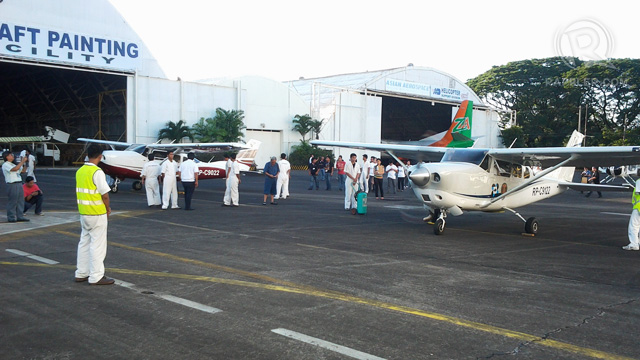
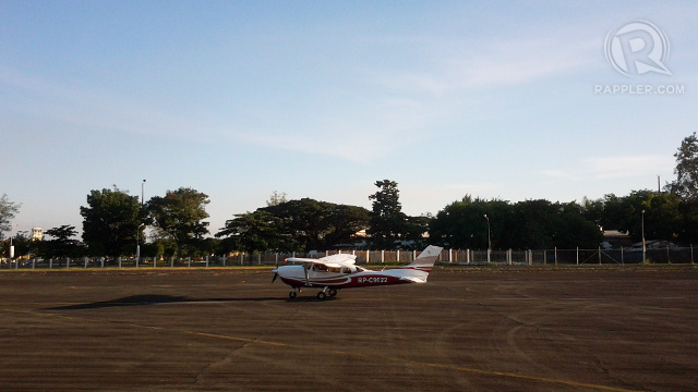
On Thursday, November 22, the Department of Science and Technology (DOST) celebrated the maiden flights of two Cessna 206 airplanes loaded with special equipment. These planes and the equipment they carry will play a part in creating 3-dimensional (3D) maps of the Philippines. The 3D maps generated will eventually provide government agencies with better data for risk management.
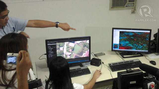
The equipment use Light Detection and Ranging (LiDAR) technology to generate detailed topographic maps of the Philippines. The technology used is not new, as LiDAR technology is approximately 30 years old, according to US LiDAR services provider Airborne1.
The ability to make the maps, however, has been in place for only 10 years. Combined, the LiDAR map generation system is seen as a cost-effective means of acquiring accurate data on elevation and depth, two things critical in determining the risks of flooding.
LiDAR mapping provides a significant increase to the scope of data given and the scale of data accuracy.
According to Dr. Enrico C. Paringit, Program Leader of the University of the Philippines’ (UP) Disaster Risk and Exposure Assessment for Mitigation (DREAM) program, Google Earth and Google Maps lack 3D coordinate. “It has a few 3D maps but only for select cities, like New York in the US,” he notes.

Dr. Paringit also mentions that Philippine base maps and 2D Google maps have an accuracy of “plus and minus 10 and 20 meters, respectively, and cannot be used for effective flood modeling.” On the other hand, LiDAR maps not only allow for flood modeling, but “also have vertical accuracy of plus and minus 20 centimeters,” a marked difference that he explains would allow flood models to be “greatly refined up to house level.”
Like a lot of different technologies, LiDAR can be helpful, but a search for information regarding data processing for LiDAR technologies reveals that there are some hurdles that need to be crossed as well.
Robert A. Fowler, responding to an inquiry in Earth Observation Magazine in October 2001, mentioned that LiDAR technology gathers a lot of data for its purpose, which only a few computer systems can handle. While software does exist for processing this data, it still requires enough time to process the data and trained analysts to ensure the mapping is accurate.
The DOST and UP prepared for that need. A project office on the third floor of the National Engineering Centre in UP was set up and inaugurated on Friday, November 23, for the purpose of processing the data from the LiDAR readings. An all-Filipino team will handle the data acquired by the LiDAR aircraft.

The process of gathering and processing the data will also take time. The DOST hopes to complete all flood models of the major river basins, which represent 33% of the Philippines’ total land area, over a two-year period.
As the data comes in, however, the overall purpose of the data and the LiDAR technology is clear. “The maps to be generated by DREAM will be very beneficial for government agencies,” says Dr. Paringit. “After the initial mapping and flood modeling program, we can always use the LiDAR instruments for other purposes including post disaster damage assessments.”
The DREAM flood models will ultimately be incorporated into the website for the Nationwide Operational Assessment of Hazards project (Project NOAH). Eventually, with more data on hand, it is hoped that the various government agencies will be able to work together to swiftly address potential issues and provide better early warning systems for communities that may be at risk of flooding. – Rappler.com
Add a comment
How does this make you feel?
There are no comments yet. Add your comment to start the conversation.