SUMMARY
This is AI generated summarization, which may have errors. For context, always refer to the full article.
What’s the weather like in your area? Tweet us at @rapplerdotcom.
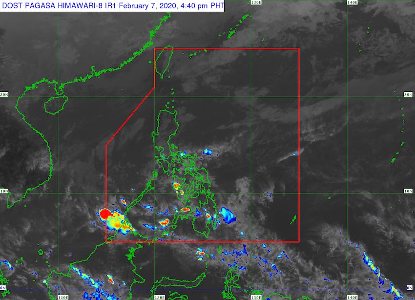
MANILA, Philippines – The trough or extension of the low pressure area (LPA) inside the Philippine Area of Responsibility will continue to bring rain to some areas in Mindanao and in the Visayas within the next 24 hours.
In a bulletin issued 4 pm on Friday, February 7, the Philippine Atmospheric, Geophysical, and Astronomical Services Administration (PAGASA) said the LPA is now 235 kilometers southwest of Zamboanga City, Zamboanga del Sur.
The LPA’s trough is causing scattered rainshowers and thunderstorms in these regions:
- Northern Mindanao
- Zamboanga Peninsula
- Caraga
- Davao Region
- Western Visayas
- Central Visayas
The rain may be moderate to heavy at times, so flash floods and landslides are possible.
The rest of the Visayas and of Mindanao will have generally good weather.
PAGASA Weather Specialist Ana Clauren said the LPA remains unlikely to develop into a tropical depression.
The Philippines gets an average of 20 tropical cyclones per year. There have been none, so far, in 2020. (READ: FAST FACTS: Tropical cyclones, rainfall advisories)
Meanwhile, the northeast monsoon or hanging amihan is triggering light rain in Luzon, particularly in:
- Metro Manila
- Cagayan Valley
- Calabarzon
- Bicol
- Aurora
- Nueva Ecija
- Bulacan
- Marinduque
- Romblon
- Occidental Mindoro
- Oriental Mindoro
The northeast monsoon is also causing lower temperatures in the country. (READ: ‘Ang lamig!’: Here’s why your nights and mornings are cold) – Rappler.com
Add a comment
How does this make you feel?
There are no comments yet. Add your comment to start the conversation.