SUMMARY
This is AI generated summarization, which may have errors. For context, always refer to the full article.
What’s the weather like in your area? Tweet us the situation: Use #weatheralert and tag @rapplerdotcom.
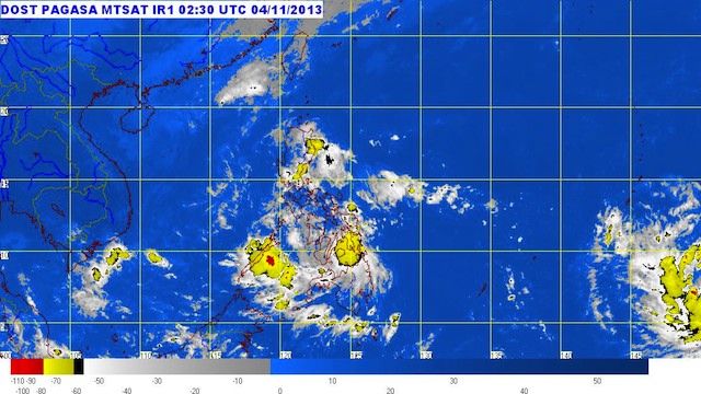
MANILA, Philippines (2nd UPDATE) – Tropical Depression Wilma has maintained its strength as it closes in on northeast Mindanao, state weather bureau PAGASA said Monday, November 4.
WIlma was located 75 km north-northeast of Hinatuan, Surigao del Sur, with maximum winds of 55 km/h near the center.
Signal number 1 has been raised over more areas:
- Southern parts of Negros Occidental and Negros Oriental
- Southern parts Cebu
- Siquijor
- Bohol
- Southern Leyte
- Dinagat Island
- Surigao del Norte
- Surigao del Sur
- Agusan del Norte
- Agusan del Sur
- Misamis Oriental
- Misamis Occidental
- Camiguin
- Northern parts of Zamboanga del Norte
These areas should be on alert for possible landslides and flash floods, the bureau warned.
The system is carrying heavy to intense rainfall (10.0-25.0 mm/h) within its 300 km diameter.
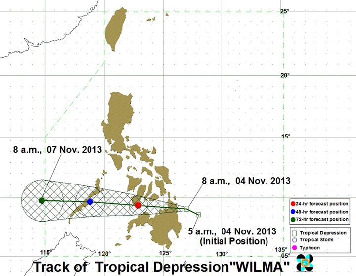
The storm is forecast to take a track crossing CARAGA, then over to Negros island, over to the Sulu Sea and then crossing Palawan towards the West Philippine Sea (South China Sea).
It will make landfall over Surigao del Sur Monday afternoon, and will cross the region. It will be 40 km west of Dumaguete City Tuesday morning, and 440 km west of Puerto Princesa City by Wednesday morning, or outside the Philippine Area of Responsibility (PAR).
The next bulletin will be released at 5 pm Monday.
New system near Guam
Meanwhile, another tropical depression, in this instance outside the PAR, is seen by meteorologists to intensify into a typhoon in the coming days, possibly hitting the Philippines by the end of the week.
The US Navy’s Joint Typhoon Warning Center labeled the system just south of Chuuk Island in the Pacific Ocean as Tropical Depression 31W, and was spotted near 6.4ºN, 152.7ºE as of Monday morning.
The US National Weather Service in Guam reported TD 31W as carrying maximum sustained winds of 35 miles per hour (56 km/h), and moving west at a speed of 17 mi/h (27 km/h).
As it is still over open water, it is forecast to intensify further in the coming days, while taking a track that will lead it to the Philippines, particularly in the Samar area.
The Japan Meteorological Agency (JMA) is also tracking the system.
The PAGASA has yet to issue a bulletin for the system. – Rappler.com
Add a comment
How does this make you feel?
There are no comments yet. Add your comment to start the conversation.