SUMMARY
This is AI generated summarization, which may have errors. For context, always refer to the full article.
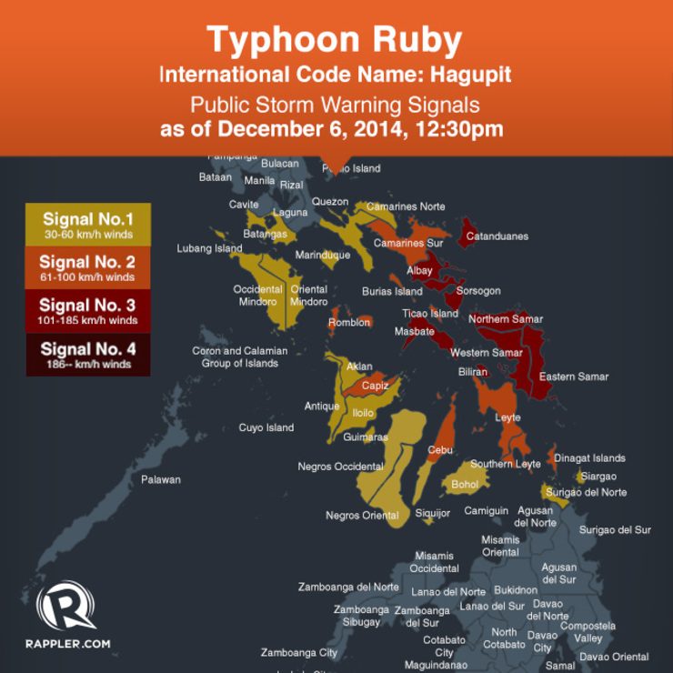
where winds between 100-185 km/h are expected within 18 hours, has been hoisted over these areas:
- Catanduanes
- Albay
- Sorsogon
- Masbate including Ticao Island
- Northern Samar
- Eastern Samar
- Samar
- Biliran
- Camarines Sur
- Burias Island
- Romblon
- Capiz
- Northern Cebu including Cebu City
- Bantayan Island
- Camotes Island
- Leyte
- Southern Leyte
- Dinagat Province
Storm signal number 1 is in effect over these areas:
- Southern Quezon
- Camarines Norte
- Marinduque
- Batangas
- Occidental Mindoro
- Oriental Mindoro
- Antique
- Iloilo
- Guimaras
- Aklan
- Northern Negros
- Rest of Cebu
- Bohol
- Surigao del Norte including Siargao Island
The typhoon is currently moving at a speed of 13 km/h to the west.
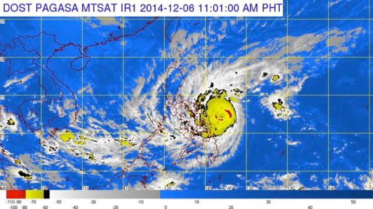
PAGASA forecasts the storm to be located 50 km west of Catarman, Northern Samar or at 60 km east of Masbate City, Masbate on Sunday morning.
It is expected to cross over Romblon and then Oriental Mindoro before exiting the Philippine area of responsibility on Wednesday evening.
PAGASA also warned residents in low-lying areas against possible flashfloods and landslides.
Those living along coastlines are also warned against the possibility of storm surges which may reach up to 4.5 meters.
“Ruby and the Northeast Monsoon will bring rough to very rough sea conditions over the seaboards of Northern Luzon, eastern seaboard of Central and Southern Luzon, seaboards of Visayas and over northern and eastern seaboards of Mindanao. Fisherfolks and those using small seacraft are advised not to venture out over the said seaboards,” the bureau added. – Rappler.com
Add a comment
How does this make you feel?
There are no comments yet. Add your comment to start the conversation.