SUMMARY
This is AI generated summarization, which may have errors. For context, always refer to the full article.

MANILA, Philippines (UPDATED) – A wrong forecast, late warnings, and a lack of hazard awareness worsened the death toll due to Tropical Depression Usman in Bicol, said disaster scientist Mahar Lagmay on Saturday, January 5.
“The forecast on December 28 to 29, 2018, was moderate (light blue) to heavy (dark blue) rainfall in Bicol. But the actual rainfall was intense (yellow) to torrential (red), the latter being the highest amount of rainfall,” according to a note Lagmay posted on Facebook.
Lagmay is director of Project Nationwide Operational Assessment of Hazards (NOAH), a University of the Philippines-based research center that aims to lessen the impact of hazards.
“There is a big difference, especially since moderate rainfall measures 2.5 to 7.5 mm/hr; heavy rainfall 7.5 to 15mm/hour; intense 15-30mm/hour; and torrential >30mm/hour. In Bicol, the intense and torrential rainfalls lasted for several hours,” Lagmay added.

The warnings from National Disaster Risk Reduction and Management Council (NDRRMC) on December 28 and 29 also came late, according to Lagmay.
That is so “because intense to torrential rainfall (not moderate or heavy as forecasted) was already happening in the morning of December 28,” he said.
The NDRRMC sent text messages of an orange alert rainfall at 8 pm on December 28, then a red alert at 11 pm, and another red alert at 5 am on December 29 for possible landslides and flooding.
Lagmay said people can better act if a rainfall warning is available at least one day in advance with the amount of mm/day predicted. (READ: How Tropical Depression Usman affected schools)
Measures done before to avert disaster
Lagmay said measures had been done before to avert disasters.
In the study “Lessons from tropical storms Urduja and Vinta disasters in the Philippines,” Project NOAH underscored the execution of Pre-Disaster Risk Assessment (PDRA) from 2014 to early 2017 by the NDRRMC. These assessments helped avert mass loss of lives in many severely-impacted areas because of hazard-specific, area-focused, and time-bound warnings.
The study also suggested that the PDRA must reinstate specific calls, where mayors of communities are informed by phone hours in advance of imminent danger, to prompt and ensure immediate action.
The NDRRMC institutionalized PDRA in June 2014 to provide risk analysis and constant monitoring of hydrometeorological hazards. These actions are supported by scientific information from Pagasa, Project NOAH, and the MGB.
Project NOAH was taken out of NDRRMC in mid-2017 before the 6 recent disasters happened, said Lagmay.
As a result, advisories have become too general, where Project NOAH used to complement NDRRMC’s forecasts on floods and landslides. This held true during tropical storms Urduja, Vinta, and Usman.
“These broad and general warnings (e.g. province-wide) not only add to disaster stress from an emergency perspective, it also tends to desensitize people and may result to the cry-wolf effect because the actual hazards do not impact entire provinces,” according to the study.
Typhoon signal
Lagmay also pointed out that people had probably thought Usman would be low-impact. This was after the state weather bureau raised storm signal number one.
“Unfortunately, typhoon signal has nothing to do with rainfall amount because the signal numbers of Philippine Atmospheric, Geophysical, and Astronomical Services Administration (PAGASA) are based on wind strength,” he said.
Meanwhile, Lagmay emphasized that the real objective of hazard map is to show the safe places in a community using science, not only to show the hazard areas.
“People and the LGU (local government unit) find it hard to use or interpret a hazard map without the identified safe places,” he said.
With identified safe places, LGUs and people can make the right decisions – from planning evacuation sites, to people knowing where to go in times of severe weather. This is what is missing in the map of Mines and Geosciences Bureau, but is covered by Project NOAH.
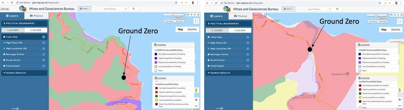
Lagmay believes it should also show hazards beyond those previously experienced in the community. (READ: #ReliefPH: Help victims of Tropical Depression Usman)
“Science must complement local knowledge to anticipate bigger events than what the community has experienced,” he said.
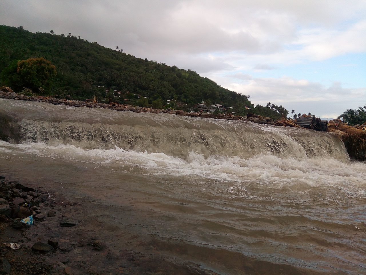
This and the abovementioned factors make people in Barangays Sogod in Tiwi, Albay and Patitinan in Sangay, Camarines Sur – areas of steep mountains, thus prone to landslides when triggered by heavy rains – unaware of the hazards in their areas at that time.
“Why didn’t they know that they shouldn’t be there during Usman?” he asked.
“Because people need the right warnings so they can respond right,” he said.
Warnings, after all, are not just for forecasting typhoon landfalls but also for knowing hazardous places, Lagmay concluded. – Rappler.com
Add a comment
How does this make you feel?
There are no comments yet. Add your comment to start the conversation.