SUMMARY
This is AI generated summarization, which may have errors. For context, always refer to the full article.

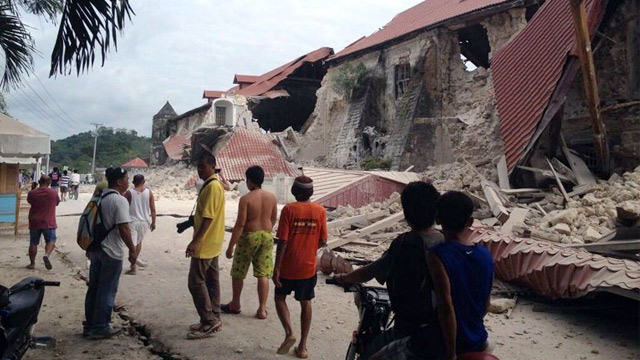
MANILA, Philippines – A magnitude 7.2 earthquake shook large parts of the Visayas and Mindanao on Tuesday, October 15, bringing widespread damage in the region.
The quake struck at 8:12 am, and was centered 2 kilometers southeast of Carmen, Bohol (09.80°N, 124.20°E). The quake’s depth of focus was 33 kilometers, and was of tectonic origin, the Philippine Institute of Volcanology and Seismology (Phivolcs) said in its initial report.
Bohol lies across the Cebu Strait from Cebu City, the country’s fifth most populous city, about 60 kilometers (37 miles) away.
In the immediate aftermath of the quake, authorities were struggling to reach or contact damaged areas, with power lines as well as phone networks down, and a clear picture of the disaster had yet to emerge.
Cebu and surrounding areas impacted by the quake are among the country’s most popular tourist destinations, largely due to the region’s many beautiful beaches. Bohol also is famous for its Chocolate Hills, and its centuries-old churches.
Here are some of the photos from the quake zone, crowdsourced by Rappler.
– Rappler.com
Add a comment
How does this make you feel?
There are no comments yet. Add your comment to start the conversation.