SUMMARY
This is AI generated summarization, which may have errors. For context, always refer to the full article.

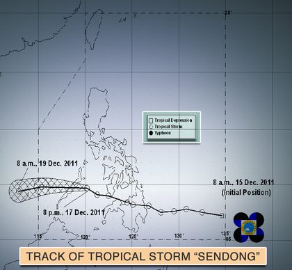
At 10:00 pm Saturday, Dec. 17, the center of Tropical Storm “Sendong” was estimated (based on satellite and surface data) at 110 km East of Puerto Princesa City. It has maximum sustained winds of 65 kph near the center and gustiness of up to 80 kph.
Movement: Forecast to move West at 22 kph.
Forecast Positions: Sendong is expected to cross Palawan early Sunday (Dec. 18) morning and be at 370 km West of Puerto Princesa City by Sunday evening.
It is expected to be at 630 km west southwest of Puerto Princesa City by Monday morning and out of the Philippine Area of Responsibility.
Signal No. 2 is raised in Palawan where winds of 61-100 kph are expected in at least 24 hours. Signal No. 1 is raised in Cuyo and the Coron Group of Islands.
Add a comment
How does this make you feel?
There are no comments yet. Add your comment to start the conversation.