SUMMARY
This is AI generated summarization, which may have errors. For context, always refer to the full article.

MANILA, Philippines – If an overflowing Bicol River Basin were to cause extreme flooding, Naga City would become an island.
This was one of the findings of a new study that assessed how prepared Philippine cities are to the effects of climate change. Climate change can lead to stronger storms, more rainfall, sea level rise, extreme droughts, and intensified flooding and landslides.
From a range of 1 to 10 – 10 being the most vulnerable – Naga City got a score of 6.10. It is second to Tacloban City (6.74) in being the city most vulnerable to climate change among 4 assessed by the study.
Conducted by Worldwide Fund for Nature (WWF) Philippines and BPI Foundation, the study gave this score based on 3 factors: climate or environmental exposure, socio-economic sensitivity, and capacity to adapt.
Climate or environmental exposure
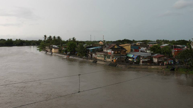
Naga City sits beside a major source of flooding in the southern part of Luzon: the Bicol River Basin.
No wonder, geohazard maps show a high susceptibility of flooding in the city. Climate change can bring more rain, causing the river basin to overflow more often. In the past, the city experienced extended periods of isolation because of flooding. Naga City can become Naga Island again.
The city also has a high exposure to tropical cyclones. Records show that it is hit by an average of 2.7 typhoons a year.
Socio-economic sensitivity
Naga City’s population is on the rise, increasing by 52% from 1990 to 2010. The number of houses also increased by 60%, while school enrollment increased by 71%. A bigger population increases the vulnerability of a city to climate change impacts.
Tourism has become Naga City’s number one economic driver. Tourist arrivals in 2012 was almost 11 times that of 2004. This booming tourism is heavily dependent on roads. Most tourists arrive and leave Naga via land transportation because it is more reliable than air flights, which are often cancelled due to bad weather.
Even residents prefer the road. In 20 years, the number of registered motor vehicles more than tripled from 1991 to 2012. This means that per square kilometer, there are 477 vehicles.
Adaptive capacity
The ability of Naga City to achieve normalcy after a major climate change-related event like a storm is quite high.
Families have more resources to get back on their feet. Average family savings rose by 44% from 1994 to 2000. The same can be said of the city government. Its savings increased 150% from around P62,000 2003 to more than P156,000 in 2012.
There are now more people with bank accounts. The number increased by 37% from 2007 to 2012.
Recommendations
The late Jesse Robredo, a 6-term mayor of Naga City, definitely left his mark on the city.
Good governance and greater accountability have given the city more resources and capability in adapting to changes in the climate.
Unfortunately, it’s geographic position still makes it highly vulnerable to disaster. To protect its economy, Naga City must make sure its roads are passable in any weather.
The national highway that connects it to other parts of the region passes right through flood-prone sections of the Bicol River Basin. If nothing is done, the city will again be isolated during extreme flooding, effectively crippling its tourism industry.
The design of the road should be improved, and effective drainage should be put in place. The local and national governments should also consider making alternative routes.
Districts inside Naga City proper are also well within the catchment area of the Bicol River Basin. This includes Naga’s old business district which also sits barely above sea level.
Temporary shelters and relocation zones in less flood-prone areas is another way of reducing damage caused by flooding. Commercial and agricultural activities can also be transferred to areas which will remain safe in any weather.
The city is also straddled by Mount Isarog, which, due to the rain-producing clouds always crowning its peak, has become a watershed.
With increasing rainfall due to climate change, the management of this watershed must be improved. The city should consider harvesting rain water and channel it to household, commercial, and agricultural uses.
This new source of fresh water can then allow the city to veer away from extracting water from the ground (through wells), which causes land to sink. Land subsidence is irreversible and can make Naga City even more susceptible to flooding.
***
Naga City is one of 4 cities assessed by the study. The others are Tacloban City in Leyte, Batangas City in Batangas, and Angeles City in Pampanga. Previous phases assessed 8 other cities. Download the studies for all 12 cities from this site. – Rappler.com
Add a comment
How does this make you feel?
There are no comments yet. Add your comment to start the conversation.