SUMMARY
This is AI generated summarization, which may have errors. For context, always refer to the full article.
MANILA, Philippines (UPDATED) – Continuous heavy rain is now pounding northern Luzon provinces, as tropical storm Dindo (international codename Doksuri) moves closer to the area Thursday, June 28.
Dindo was last spotted at 150 kilometers Northeast of Casiguran, Aurora, carrying maximum sustained winds of 75 km per hour near the center and gustiness of up to 90 kph, according to PAGASA’s 11 am bulletin.
The heaviest rains brought by the weather disturbance were observed in provinces in Northern Luzon, and could continue until Friday afternoon or evening, PAGASA forecaster Nikos Peñaranda said in an interview on ANC, the ABS-CBN News Channel.
Dindo is forecast to move west northwest at 19kph, and is forecast to be at 190 km north northwest of Aparri, Cagayan by Friday morning and at 530 km northwest of Basco, Batanes by Saturday morning.
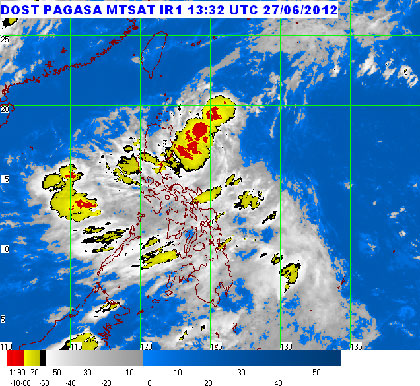
The PAGASA estimated the rainfall brought by Dindo to be heavy to intense, around 15-25 millimeters per hour, within the 400 km diameter of the tropical storm.
The following storm signals are raised over these parts of Northern Luzon:
Signal #2:
- Cagayan including Calayan and Babuyan Group of Islands
- Isabela
- Batanes Group of Islands
- Apayao
- Kalinga
- Ilocos Norte
- Abra
- Mt. Province
Signal #1
- La Union
- Ilocos Sur
- Aurora
- Ifugao
- Nueva Vizcaya
- Quirino
- Benguet
- Pangasinan
- Nueva Ecija
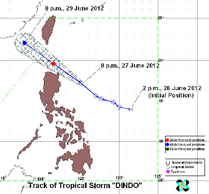
The closest approach to land will be near Santa Ana, Cagayan by early afternoon Thursday, PAGASA said in a press briefing. It is forecast to exit the PAR by Friday morning.
Despite this, the weather bureau said it expects another weather disturbance to enter the PAR by Sunday.
Dindo is also expected to enhance the southwest monsoon, bringing rain over southern Luzon and Visayas. Landslides, flashfloods, and storm surges could be possible in areas under signal number 2.
Stormy weather is expected in Isabela, Apayao, Kalinga, Mountain Province, and Cagayan, while the rest of northern Luzon and the province of Aurora will have occasional rains with gusty winds, the bureau said.
Sea travel is risky in Luzon and Visayas due to the monsoon surge, the bureau added. Fishermen are advised not to venture out to sea in these areas.
The rest of Luzon and Visayas, meanwhile, will have occasional to frequent rains, particularly over the western seaboard. Mindanao will be partly cloudy to cloudy with isolated rains or thunderstorms.
The next bulletin for Dindo will be at 5 pm. – Rappler.com
For the latest on tropical storm Dindo, click on the links below.
Add a comment
How does this make you feel?
There are no comments yet. Add your comment to start the conversation.