SUMMARY
This is AI generated summarization, which may have errors. For context, always refer to the full article.

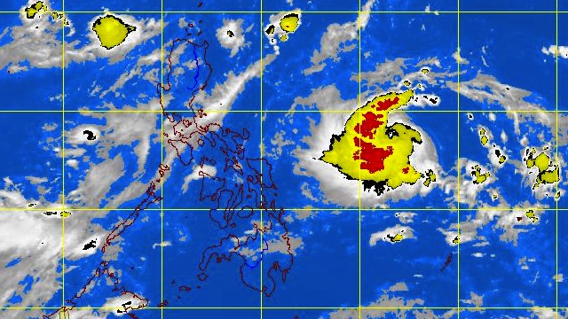
MANILA, Philippines – Tropical depression “Lawin” has gained speed and continues to move West towards southern Luzon, weather bureau PAGASA said on Thursday, September 20.
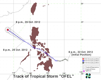
In its 11 pm tropical cyclone update, PAGASA said that as of 10 pm Lawin is 810 km East of Virac, Catanduanes (13.6°N, 132.5°E) with maximum sustained winds of 55 km/h near the center.
The tropical depression is moving West at 11 km/h and is expected to be 570 km East of Virac on Friday afternoon.

No public storm warning signals have been raised yet, as ‘Lawin’ is still too far to affect any part of the country, according to the weather bureau.
PAGASA added that the estimated rainfall amount within the 300 km diameter of the tropical storm is now 5-15 mm per hour (moderate-heavy).
The weather bureau advised the public and disaster coordinating councils to monitor the storm and wait for the next bulletin, to be issued at 11 am on Friday.
Here is PAGASA’s latest tropical cyclone warning for Lawin on Thursday, September 20:
Tropical Cyclone Warning #2 for Lawin
– Rappler.com
Add a comment
How does this make you feel?
There are no comments yet. Add your comment to start the conversation.