SUMMARY
This is AI generated summarization, which may have errors. For context, always refer to the full article.
What’s the weather like in your area? Report the situation through Rappler’s Agos or tweet us at @rapplerdotcom.
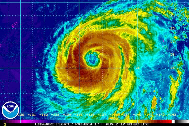
MANILA, Philippines – State weather bureau PAGASA continues to monitor Typhoon Noru, which is outside the Philippine Area of Responsibility (PAR) but is enhancing the southwest monsoon.
In a bulletin issued past 11 am on Wednesday, August 2, PAGASA said Noru is already 1,575 kilometers east northeast of extreme Northern Luzon, moving northwest at a slow 10 kilometers per hour (km/h).
The typhoon has maximum winds of up to 165 km/h and gustiness of up to 205 km/h.
While it has no direct effect on the Philippines since it is outside PAR, it is triggering heavier monsoon rain.
The southwest monsoon is bringing light to moderate rain and thunderstorms to Metro Manila, Southern Luzon, and the Visayas.
The monsoon rain is expected to last until Friday, August 4.
Classes in several parts of Metro Manila and Calabarzon were suspended on Wednesday. – Rappler.com
Add a comment
How does this make you feel?
There are no comments yet. Add your comment to start the conversation.