SUMMARY
This is AI generated summarization, which may have errors. For context, always refer to the full article.
What’s the weather like in your area? Report the situation through Rappler’s Agos or tweet us at @rapplerdotcom.
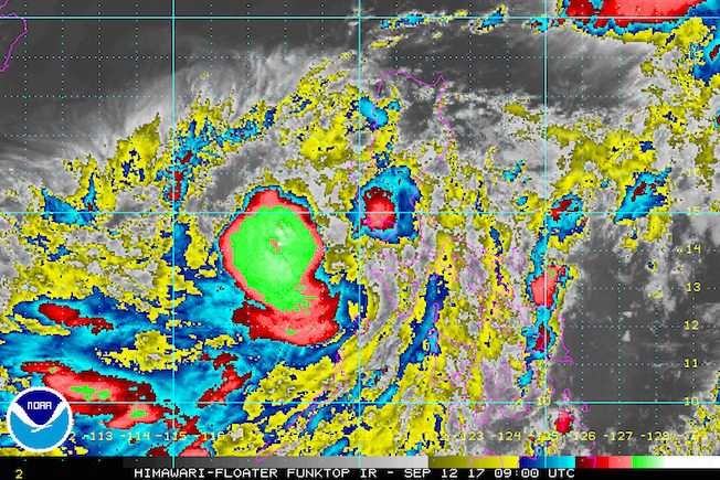
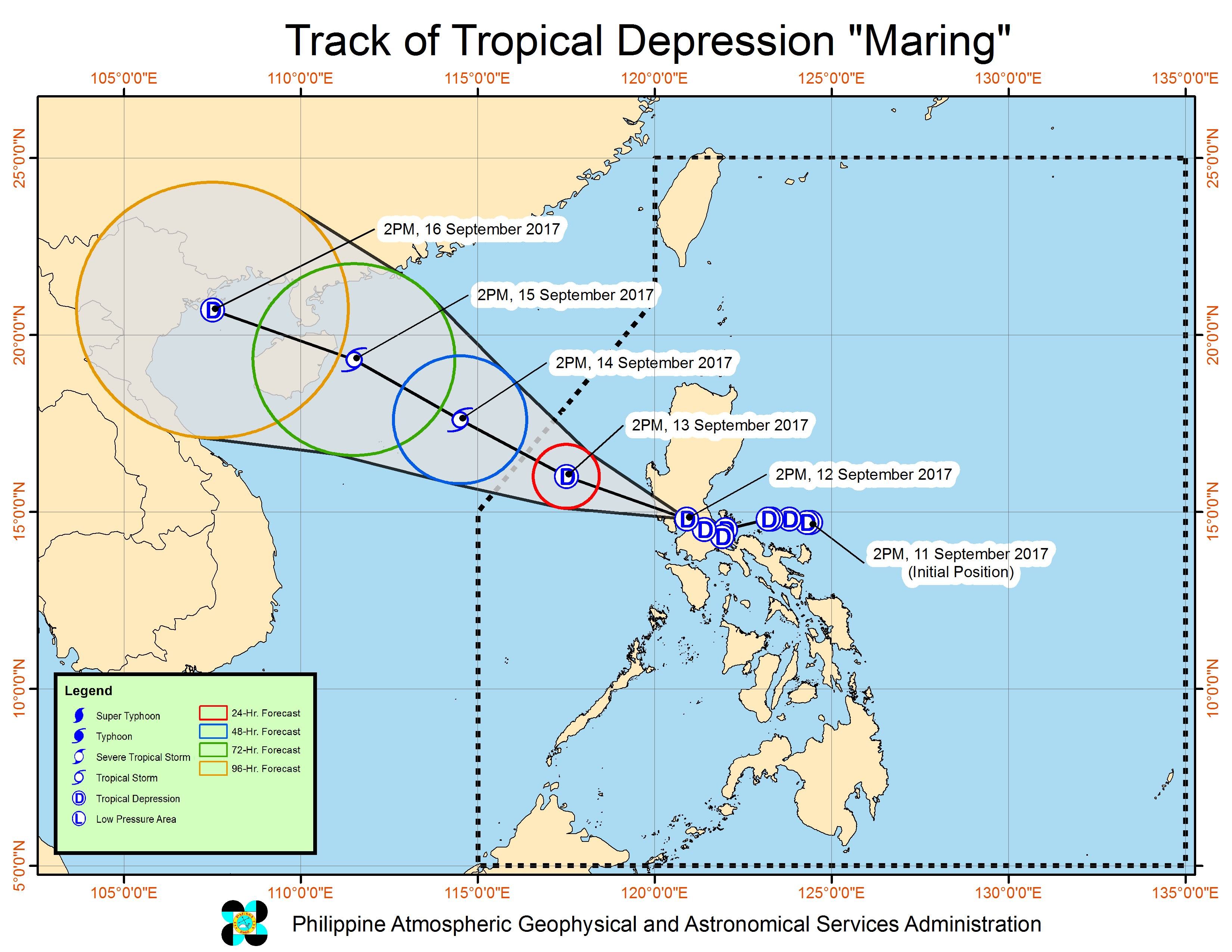
MANILA, Philippines – Tropical Depression Maring is set to leave the landmass of Luzon via the Zambales-Bataan area on Tuesday evening, September 12, after hitting Quezon in the morning.
In a bulletin issued past 5 pm on Tuesday, state weather bureau PAGASA said Maring was already in the vicinity of Pampanga, still moving west northwest at 15 kilometers per hour (km/h).
It maintained its strength, with maximum winds of 60 km/h and gustiness of up to 100 km/h.
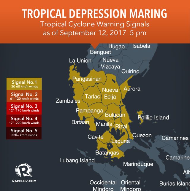
Signal number 1 is still up over the following areas due to Maring:
- Metro Manila
- Cavite
- Laguna
- Batangas
- Rizal
- northern Quezon including Polillo Island
- southern Aurora
- Bulacan
- Pampanga
- Nueva Ecija
- Tarlac
- Zambales
- Bataan
- Pangasinan
The tropical depression will continue to bring moderate to heavy rain to Pampanga, Bulacan, Tarlac, Zambales, Bataan, and Pangasinan. There will also be light to moderate rain in Metro Manila, the rest of Central Luzon, Calabarzon, and Mimaropa.
There could still be more floods and landslides due to Maring even though the rain is expected to begin easing as the tropical depression exits land. Heavy rain had triggered a landslide in Taytay, Rizal early Tuesday morning, leaving two teenaged brothers dead. Several areas have been flooded.
Earlier, Tuesday classes were suspended in the entire Metro Manila as well as various provinces. Malacañang also suspended work in government offices in Metro Manila, Calabarzon, and Central Luzon. The Supreme Court suspended work in courts in the same 3 regions as well, while there was no trading at the Philippine Stock Exchange.
Some cities have decided to also suspend classes for Wednesday, September 13.
PAGASA warned that sea travel remains risky in the seaboards of Central Luzon, Calabarzon, and Mindoro.
Typhoon Lannie
PAGASA also continues to monitor Typhoon Lannie (Talim), which is not directly affecting the country.
Lannie continues to move toward Taiwan, with maximum winds of 120 km/h and gustiness of up to 145 km/h.
There are no areas under tropical cyclone warning signals due to Lannie.
Lannie is expected to leave the Philippine Area of Responsibility (PAR) on Wednesday afternoon, while Maring will leave PAR either Wednesday evening or early Thursday morning, September 14. – Rappler.com
Add a comment
How does this make you feel?
There are no comments yet. Add your comment to start the conversation.