SUMMARY
This is AI generated summarization, which may have errors. For context, always refer to the full article.
What’s the weather like in your area? Report the situation through Rappler’s Agos or tweet us at @rapplerdotcom.
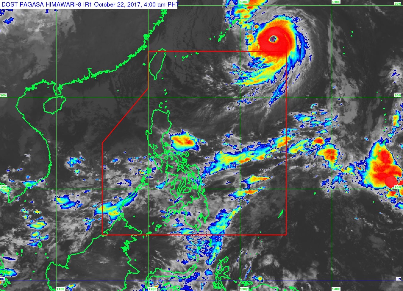
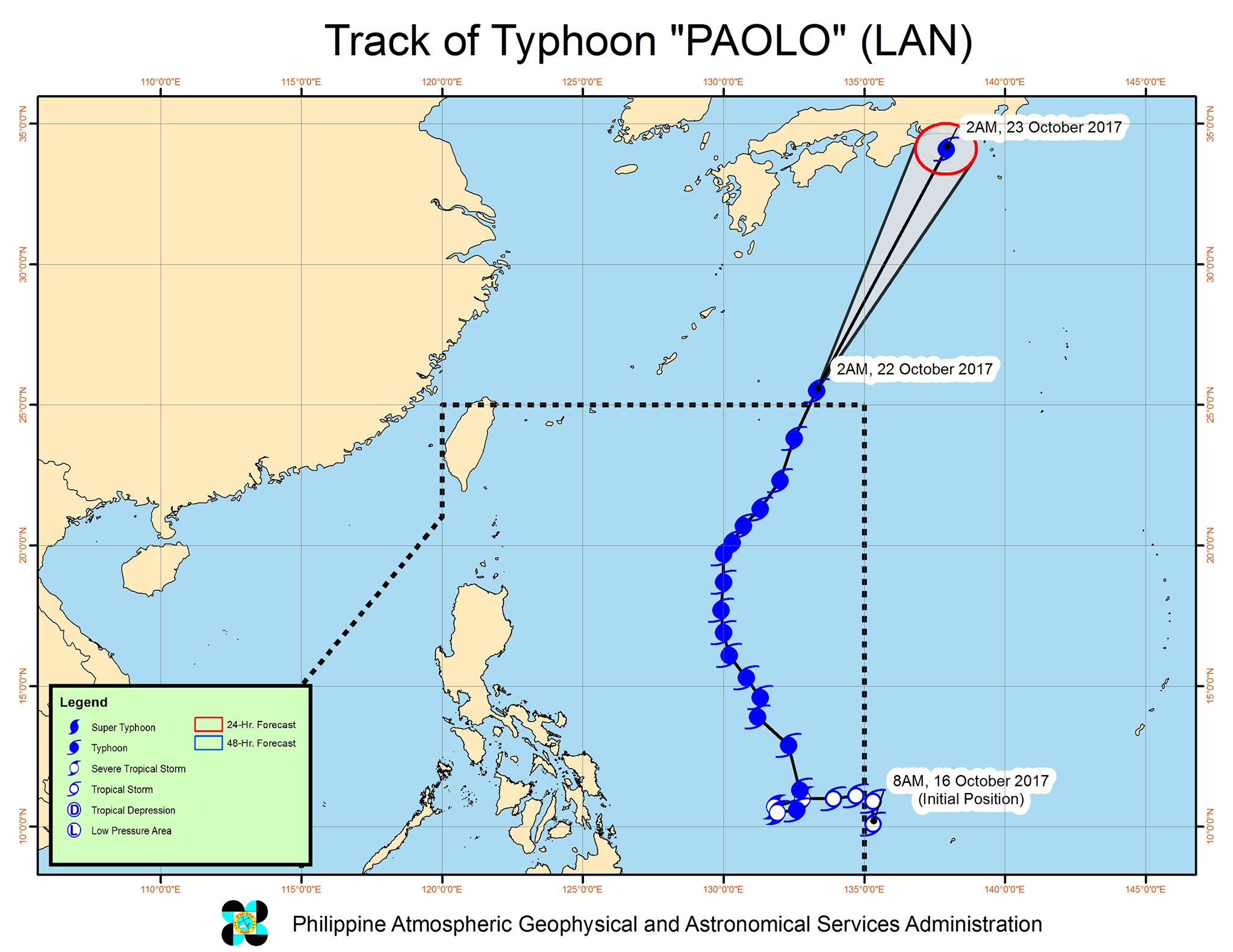
MANILA, Philippines – Typhoon Paolo (Lan) left the Philippine Area of Responsibility (PAR) early Sunday, October 22.
In a bulletin issued 5 am, state weather bureau PAGASA said Paolo is already 1,345 kilometers east northeast of Basco, Batanes, moving north northeast toward Japan at a fast 30 kilometers per hour (km/h).
The typhoon maintained its strength as it left PAR, with maximum winds of 185 km/h and gustiness of up to 225 km/h.
Paolo did not make landfall in the Philippines, but still triggered heavy rain across the country the past week. It had such a wide diameter that its outer rainbands affected much of Luzon, the Visayas, and Mindanao. (READ: FAST FACTS: Tropical cyclones, rainfall advisories)
PAGASA warned, however, that sea travel remains risky in the seaboards of Northern Luzon and in the eastern seaboards of Central Luzon, Southern Luzon, and the Visayas.
The intertropical convergence zone (ITCZ) will also bring light to heavy rain to Bicol, Palawan, and Eastern Visayas. These areas should watch out for flash floods and landslides.
The ITCZ is a belt near the equator where the trade winds of the Northern Hemisphere and Southern Hemisphere meet, usually causing low pressure areas or thunderstorms.
The rest of the country, including Metro Manila, will only have isolated rainshowers or thunderstorms. – Rappler.com
Add a comment
How does this make you feel?
There are no comments yet. Add your comment to start the conversation.