SUMMARY
This is AI generated summarization, which may have errors. For context, always refer to the full article.
What’s the weather like in your area? Report the situation through Rappler’s Agos or tweet us at @rapplerdotcom.
MANILA, Philippines – Brace for even more rain in Luzon on Monday, August 13, after a weekend that saw many areas already soaked.
In a bulletin issued 4 pm on Sunday, August 12, the Philippine Atmospheric, Geophysical, and Astronomical Services Administration (PAGASA) warned that the southwest monsoon or hanging habagat will continue to affect Luzon on Monday.
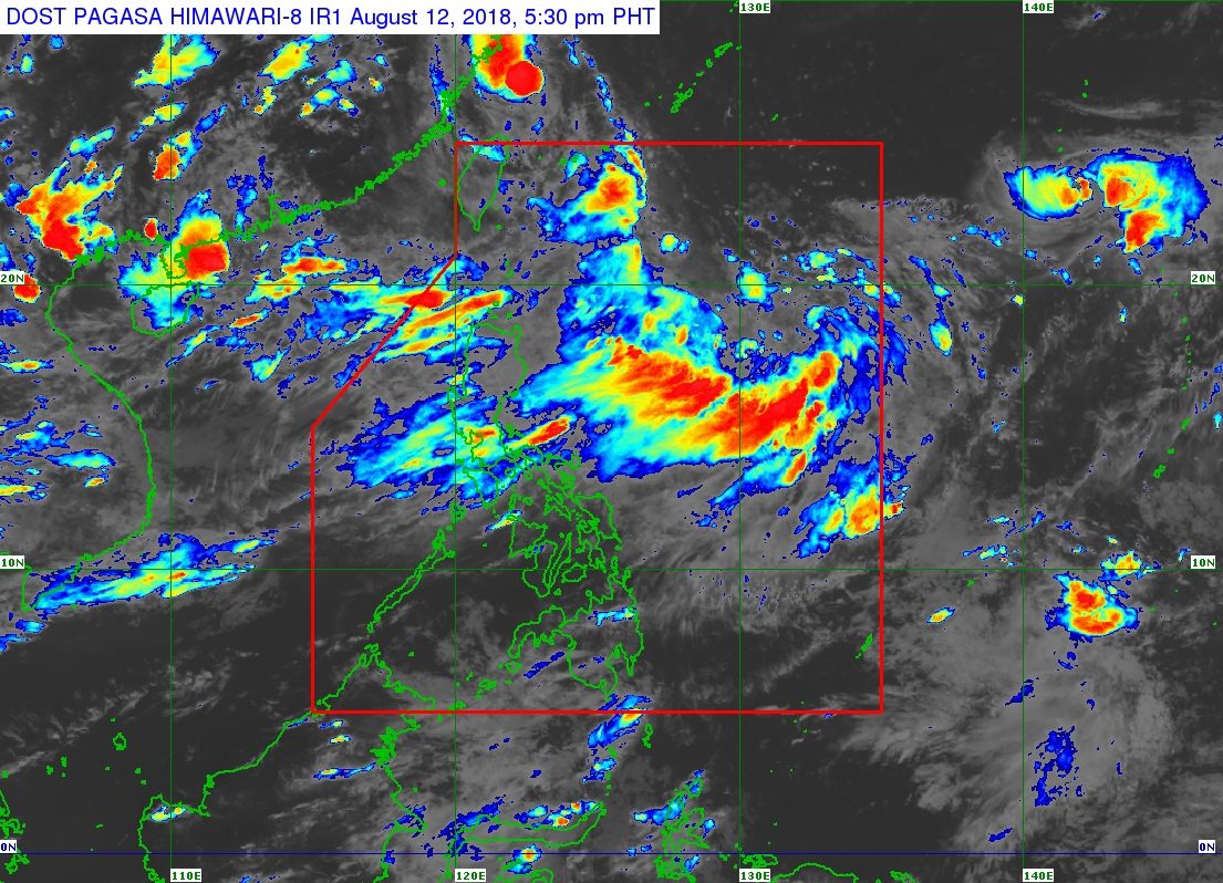
The southwest monsoon is still being enhanced by Tropical Storm Karding (Yagi), which already left the Philippine Area of Responsibility (PAR) on Saturday morning, August 11.
Karding is located 665 kilometers north northeast of extreme Northern Luzon, moving northwest at 20 kilometers per hour (km/h). It still has maximum winds of 75 km/h and gustiness of up to 90 km/h.
On Monday, moderate to heavy monsoon rain will again hit Metro Manila, the Ilocos Region, the Cordillera Administrative Region, Central Luzon, Calabarzon, Oriental Mindoro, and Occidental Mindoro.
The rest of Luzon will also have scattered rainshowers and thunderstorms. (READ: FAST FACTS: Tropical cyclones, rainfall advisories)
Residents of areas affected by the southwest monsoon should watch out for flash floods and landslides. Massive floods already hit parts of Metro Manila and Rizal over the weekend. (READ: #FloodPH: Things to do when you’re trapped, in need of rescue)
Classes have already been suspended in parts of Luzon for Monday. (READ: #WalangPasok: Class suspensions, Monday, August 13)
The Visayas and Mindanao – not affected by the southwest monsoon – will only have localized thunderstorms on Monday. But flash floods and landslides are possible, too, if the rains become moderate or heavy.
Meanwhile, a gale warning was issued for Ilocos Norte, Ilocos Sur, La Union, Pangasinan, Zambales, Bataan, Metro Manila, Cavite, the western coast of Batangas, Occidental Mindoro, Palawan, Batanes, the Calayan Group of Islands, the Babuyan Group of Islands, Cagayan, Isabela, Aurora, Camarines Sur, Camarines Norte, Catanduanes, Albay, Sorsogon, Quezon, Oriental Mindoro, Marinduque, Romblon, Masbate, Burias Island, and the southern coast of Batangas.
Seas off those areas are rough to very rough, with wave heights reaching 2.6 meters to 4.5 meters.
PAGASA advised fishermen and others with small vessels not to set sail in areas covered by the gale warning. Larger vessels should watch out for big waves.
PAGASA is also monitoring Tropical Storm Leepi outside PAR. It is 2,065 kilometers east of extreme Northern Luzon, moving northwest at 20 km/h with maximum winds of 80 km/h and gustiness of up to 95 km/h.
The good news – Leepi is unlikely to enter PAR based on its forecast track.
Karding was the Philippines’ 11th tropical cyclone for 2018. The country usually gets an average of 20 tropical cyclones per year. (READ: LIST: PAGASA’s names for tropical cyclones in 2018)
PAGASA declared the start of the rainy season last June 8. – Rappler.com
Add a comment
How does this make you feel?
There are no comments yet. Add your comment to start the conversation.