SUMMARY
This is AI generated summarization, which may have errors. For context, always refer to the full article.
What’s the weather like in your area? Report the situation through Rappler’s Agos or tweet us at @rapplerdotcom.
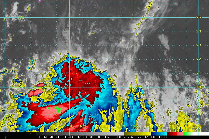
MANILA, Philippines – Tropical Depression Luis slightly weakened as it continued to enhance the southwest monsoon or hanging habagat on Friday morning, August 24.
In a bulletin released past 11 am on Friday, the Philippine Atmospheric, Geophysical, and Astronomical Services Administration (PAGASA) said Luis now has maximum winds of 45 kilometers per hour (km/h) from the previous 55 km/h and gustiness of up to 65 km/h from the previous 90 km/h.
The tropical depression is now 435 kilometers north northwest of Basco, Batanes, moving west southwest at an even slower 7 km/h from the previous 10 km/h.
Luis earlier made landfall in Taiwan on Thursday, August 23. Taiwan, given its proximity to the Philippines, is inside the Philippine Area of Responsibility (PAR) – the area set by the World Meteorological Organization for PAGASA to monitor. Weather disturbances inside PAR directly or indirectly affect the Philippines.
In the case of Luis, it is not expected to directly affect any part of the country, so there are no areas under tropical cyclone warning signals. But as PAGASA said, Luis is enhancing the southwest monsoon.
The southwest monsoon is bringing moderate to heavy rain to the Ilocos Region, the Cordillera Administrative Region, Batanes, and the Babuyan Group of Islands. Classes in some areas have been suspended for Friday due to the rain. (READ: #WalangPasok: Class suspensions, Friday, August 24)
PAGASA also warned that the rain is expected to continue until the weekend. Residents of the affected areas should stay on alert for possible flash floods and landslides. (READ: FAST FACTS: Tropical cyclones, rainfall advisories)
PAGASA also warned that travel remains risky in the seaboards of Northern Luzon and Central Luzon.
Based on its latest forecast track, Luis will leave PAR on Friday night.
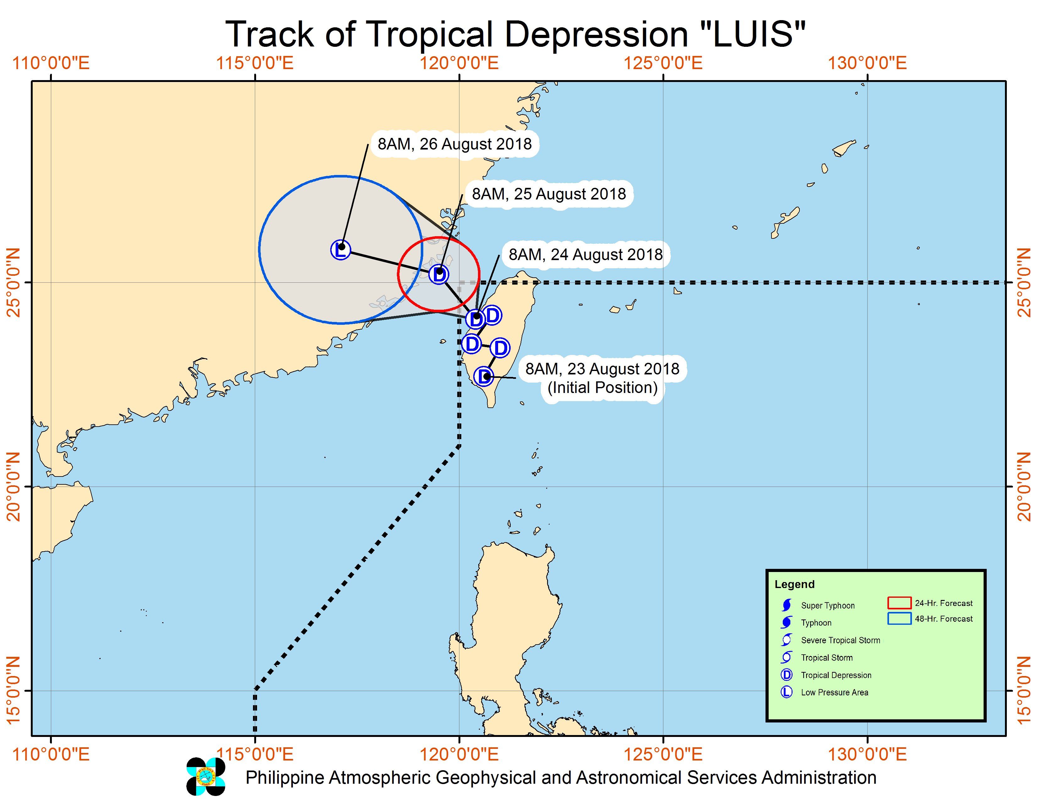
Meanwhile, PAGASA continues to monitor a low pressure area (LPA) located 1,070 kilometers east of Basco, Batanes.
This LPA could develop into a tropical depression within the next 24 to 48 hours. If it becomes a tropical depression, it would be named Maymay. (READ: LIST: PAGASA’s names for tropical cyclones in 2018)
Luis is the Philippines’ 12th tropical cyclone for 2018. The Philippines usually gets an average of 20 tropical cyclones per year.
PAGASA declared the start of the rainy season last June 8. – Rappler.com
Add a comment
How does this make you feel?
There are no comments yet. Add your comment to start the conversation.