SUMMARY
This is AI generated summarization, which may have errors. For context, always refer to the full article.
What’s the weather like in your area? Report the situation through Rappler’s Agos or tweet us at @rapplerdotcom.
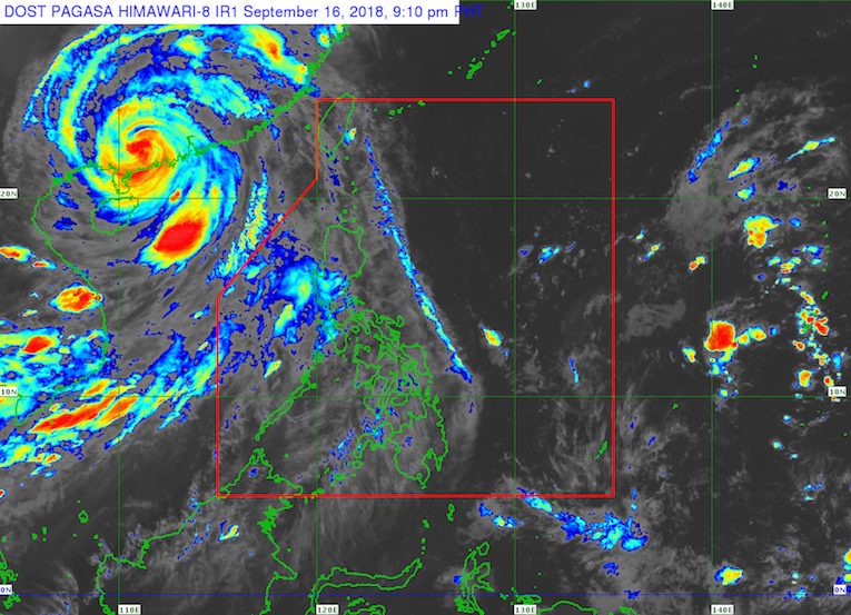
MANILA, Philippines – The southwest monsoon or hanging habagat is expected to affect Luzon on Monday, September 17.
In a bulletin issued 4 pm on Sunday, September 16, the Philippine Atmospheric, Geophysical, and Astronomical Services Administration (PAGASA) warned there would be light to heavy rain in Zambales and Pangasinan.
Scattered rainshowers and thunderstorms will also hit the rest of the country.
The public should be on alert for flash floods and landslides, especially if the rain becomes heavy. (READ: FAST FACTS: Tropical cyclones, rainfall advisories)
Parts of Luzon are still reeling from the impact of Typhoon Ompong (Mangkhut), which left dozens of people dead and caused destruction in provinces up north. (READ: Areas under state of calamity due to Typhoon Ompong)
Classes in some areas remain suspended for Monday. (READ: #WalangPasok: Class suspensions, Monday, September 17)
A gale warning was also issued at 5 pm for the seaboards of Northern Luzon, the western seaboard of Central Luzon, and the western seaboard of Southern Luzon. These include Batanes, the Babuyan Group of Islands, Calayan, Cagayan, Ilocos Norte, Ilocos Sur, La Union, Pangasinan, Zambales, Bataan, Occidental Mindoro, and the western coast of Palawan.
Seas off those areas are rough to very rough, with wave heights reaching 2.6 meters to 4.5 meters.
PAGASA advised fishermen and others with small vessels not to set sail in areas covered by the gale warning. Larger vessels should watch out for big waves.
PAGASA is also monitoring a low pressure area (LPA) outside the Philippine Area of Responsibility (PAR).
This LPA is located 1,980 kilometers east southeast of southern Mindanao. PAGASA Weather Specialist Ariel Rojas said it has a very slim chance of developing into a tropical depression. It could enter PAR, and then eventually just dissipate.
So far, the Philippines has had 15 tropical cyclones in 2018. The country usually gets an average of 20 tropical cyclones per year. (READ: LIST: PAGASA’s names for tropical cyclones in 2018)
PAGASA declared the start of the rainy season last June 8. – Rappler.com
Add a comment
How does this make you feel?
There are no comments yet. Add your comment to start the conversation.